


 Francais
 Deutsch
 Italiano
Refine Your Search
+"Atlantic Ocean" +1974 stock footage and images
- Showing 1 to 2 of 2 results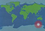
Scientists and technicians at work aboard The Glomar Challenger during oceanographic research project.
World oceans map with red dots marking areas of scientific interest for Glomar Challenger Expeditions. Scientists study ocean chart and mark a line on it. Offices on board the ship. Teletype is received and logged. Crew member monitors instruments on board. Crew lowers large circular device on which is painted: "Built for Scripps Institute of Oceanography, La Jolla, California, by Research Equipment, Inc., Plymouth, Massachusetts." Animated diagram shows the ship monitoring acoustics in a circular area above the generating device. A large antenna-like frame is lowered into the ocean. Inside the ship, several expedition members monitor a sonar screen as it paints acoustic returns.

Map of oceans showing "rings of fire" where tectonic plates are active. Arctic operations on Glomar Challenger
Animated map of worlds oceans, showing "rings of fire" where tectonic plates are in various states of relative motion. Scene shifts to drilling rig on the research vessel, Glomar Challenger. Scene of arctic conditions, with heavy coatings of ice seen on the vessel. Drilling crew continues work on the Glomar Challenger, in spite of the weather. Crew member's feet sliding across the deck. Crew continues "roughneck" work of drilling and use Acetylene Torch and hammer to keep equipment free and moving. Crew with core sections, retrieved from deep ocean floor. they cut them with hacksaw and bind them. Views of deck in harsh weather. Radar antenna in motion.