


 Francais
 Deutsch
 Italiano
Refine Your Search
+"Black Sea" +1943 stock footage and images
- Showing 1 to 4 of 4 results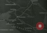
German and Romanian ships lay naval mines in the Black Sea.
A map shows countries bordering the Black Sea. German and Romanian ships lay naval mines in the Black Sea. Battleship at sea. Deck guns on a chip. LIfe boats by the ship side. Naval mines lines on the ship deck. Sailors arm the mines and roll them off the deck into the sea. An officer supervises the exercise and observes through binoculars.
A brief description of Russia (Soviet Union or USSR)
Animated map on globe of world shows extent of the USSR from East to west and North to South (9 million Square miles). Miners extracting her natural resource minerals. 110 million acres of forests and timber being felled. Coal on a conveyer belt. A "forest" of oil derricks in a Soviet field. Oil tank cars moving on a railroad. Iron and steel mills. 370 million acres of farmland. Farms being worked. Tea, tobacco, and cotton crops. Herds of ranch animals. Corn,oats,hops,rye and wheat being harvested by machinery. Huge parades of people parading in Red Square, Moscow, Russia. Dancers on floats in the parade. Cossacks from the Don River Valley demonstrate horsemanship. Map showing Ukraine, Russia,Hungary, Romania,and other adjoining areas. Musicians playing balalaikas accompany dancers. Ukranians,Moldovians and Beserabians in local costume. Map of the Caucasuses between the Caspian and Black Seas. People from that region dancing and playing instruments. Armenians,and people riding on horseback from tribes of the Caucasian mountains. Uzbeks blowing long horns. Turkmen with horses. Mongols playing stringed instruments. Views of people from further East and North approaching Siberia. Some hunting with rifles. Views of Moscow. Moscovites walking on a summer day. Man riding in a horse-drawn carriage. Cars driving on a street. All kinds of vehicular traffic in Moscow city, including trams. Outside views of Soviet factories. Soviet soldiers. Soviet bricklayer, traffic cop, and sailor are shown. A riveter at work. Soviet school children. An old fireman.Nurse in a hospital. Civil engineer with transit. A window washer. A sales girl. Housewives. A Postal clerk. A radio announcer. A stewardess on an airliner. A chemist in a laboratory. A typist at work. A harpist playing and a ballerina dancing as an orchestra plays. Soviet citizens walking across a field. Narrator refers to their love for the soil. Animated map sums up Russia's size and characteristics. (World War II period).
German commando operations in the Kuban Lakes region, Northwest Caucasus, World War Two
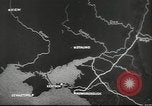
German commando troops attack Russian positions in the Kuban Lakes area near Russian Black Sea Port of Novorossiysk, Northwest Caucasus, during World War II. Map depicts the area of operations. German commando units in motor launches raid Russian positions. View of a bay from mountain. The commandos load in motor boats and move through marshes and lakes . The troops wade through water and move on land to attack Russian targets. They fire machine guns. Commandos returning to their base, where several are seen at a pier with their boat, as other boats arrive.
Germany invades Hungary, Romania and Bulgaria during World War II.
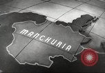
German invasion of Eastern European countries during World War II. Maps of Manchuria and Ethiopia. Newspaper headlines. Maps of various European countries conquered by Nazi Germany including Poland. Newspaper printing press running. Newspaper headlines declaring war against Germany. Herald newspaper headline reads, WAR. Animated map of Germany shows the Nazi symbol spreading across Europe with fire. German Chancellor Adolf Hitler and officers at a map as they confer. Maps of Hungary, Romania and Bulgaria. Hungarian pheasant farmers gather grain in Hungary. Ore car heaped with bauxite in Hungary. Aluminum sheet rolling down conveyor belt. German aircraft parked in line with propellers spinning. Hungarian soldiers marching in parade with crowd giving Nazi salute. Grain pouring into holding bin. Oil derricks in Romania. Romanian soldiers marching in parade. Animated map depicts the importance of cities of Varna and Burgas in Bulgaria for their submarine bases in the Black Sea. Admiral Miklos von Nagybanya Horthy of Hungary, Prime Minister of Romania General Ion Antonescu, King Michael of Romania and King Boris of Bulgaria. Newspaper headlines include 'Bulgarian King Joins Axis', "Bulgarian Revolts Bring 1200 Arrests', 'Riots Sweep Romania', and 'Hungarian Revolt Brewing' German motorcycles with sidecars driving into Hungary. German artillery being towed into Hungary. German soldiers driving halftracks drive into Romania and Bulgaria. Animated map depicts the plan for invasion of Greece.