


 Francais
 Deutsch
 Italiano
Refine Your Search
+"China" +1941 stock footage and images
- Showing 31 to 36 of 70 results more
more Hide
Hide
U.S. supply trucks move along the Burma Road near Paoshan in Yunnan, China during World War II.
A film shows the Burma Road near Paoshan in Yunnan, China during World War II. Animated map shows the Burma Road and highlights Paoshan and Huitung Bridge. U.S. supply trucks moves along the road. Water of the Salween River flows over rocks. Chinese laborers stand along the Burma Road. A supply truck moves along the Burma Road on the side of a mountain.
Activities of Shan tribe people near Paoshan in Yunnan, China.
A film shows Shan tribe people near Paoshan in Yunnan, China. Shan tribe women carry poles on shoulders with load on both the ends. Tribesmen carry hut structures. Buddhist monks walk out of a building carrying clay pots. The brother and the chief aide of the local head gets into a car.
Japanese troops advance through rural areas and capture Shao-chow, China during World War II.
Japanese army captures Shao-chow, China during World War II. Animated map depicts Guilin in Guangxi, some towns in Hunan, and Guangdong provinces. Japanese troops march across rural areas. A damaged bridge. Japanese troops on barges. Japanese troops fire artillery guns on field. Japanese troops advance into the city and on streets. Troops capture the city.
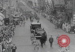
Funeral of Shinzo Akagi in Shanghai, China (WW2)
Japanese women and children mourn and follow behind a hearse during a funeral procession of Mr. Shinzo Akagi, special deputy general director of the Shanghai Industrial Bureau, who was shot dead by a Chinese nationalist group in World War II. Japanese soldiers lead the procession on the street. Crowds of civilians watch the procession in Shanghai, China. The Shanghai Municipal Council and Japanese consulate general attend the funeral. The procession crosses a bridge.
Allied officials in a conference in China, and Chinese Premier's wife Soong May-ling with allied officer in China during WWII.
A promotional propaganda documentary justifying Japanese involvement in World War II. An aircraft overhead. An Allied officer walks out of a building with Soong May-ling, wife of Chinese Premier Chiang Kai-Shek. Newsmen in an office sending dispatches overseas. Transmission towers for message transmissions. Allied officials in a conference. Western soldiers in bunkers.

Animated illustration of the Burma Road as vital link between Lashio, Burma and Kunming, China during World War II.
A film titled 'Under Heaven all is one Family' illustrates the importance of the Burma Road during World War II. A globe spins. Animated map of China depicts the distance of Singapore from the U.S. and highlights Rangoon. The map further highlights Burma, China, Indo-China and Thailand. The Burma Road is presented as a vital link between Lashio, Burma, and Kunming, China during World War II.