


 Francais
 Deutsch
 Italiano
Refine Your Search
+"Marianas Islands" +1944 stock footage and images
- Showing 265 to 270 of 370 results more
more Hide
Hide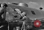
Examples of aircraft art on B-29s stationed at Saipan, Marianas Islands, during World War 2
U.S.Soldier artist painting image of a bull dog wearing boxing gloves, on the fuselage of a B-29. Names painted on B-29s read: "Dumbo, King of the Show; "Miss Behavin;" "Special Delivery;"and "Waddy's Wagon;" B-29s landing on the airfield.
U.S. troops establishing a beachhead on Guam, Mariana Islands, during World War II
U.S. troops wading ashore on Guam, during Marianas campaign, in World War 2. Transport ships in far background. One soldier directing vehicular traffic in the surf, motions to a DUKW amphibious vehicle, carrying a load of troops, that drives past the camera. Troops carrying packs and weapons as they slog through shallow surf. Battle scarred shoreline of sand and palm trees. Vehicles moving through area as troops set up camp. More views of troops wading ashore, through deeper water (tide coming in). Line of amphibious vehicles (DUKWs) coming ashore. Contingent of U.S. troops wading in knee deep water. Some weapons covered in plastic for protection.
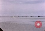
U.S. Marines examine damaged structures and Knocked out tanks on Saipan, Mariana Islands during World War II.
A line of landing craft silhouetted on the horizon. An explosion on the shore behind them. Camera pans from beach, across a bay to a beached landing craft, and then back past some damaged huts, to a destroyed Japanese motorcycle that an American marine examines. A marine climbs through a damaged Japanese wooden structure. A marine examines a knocked out Japanese 1st Yokosuka SNLF Type 2 Ka Mi Amphibious tank
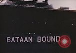
A damaged hangar and other buildings in Saipan, Mariana Islands during World War II.
Damaged buildings on Saipan Islands during World War II. A Japanese tank on fire. A sign on a tank reads 'Bataan Bound'. Smoke rises from an area. A damaged Japanese aircraft in revetment. Wrecked hangar with a steel frame structure. A damaged building. Debris spread outside the building. Piled up crates and bundles of paper. Captured Japanese books and documents. Books in a cupboard.
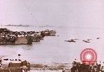
U.S. soldiers unload supplies from LCM and load it onto a LVT in Saipan, Mariana Islands during World War II.
Unloading supplies in Saipan Islands during World War II. Jeeps and trucks on the beach. Smoke rises from the background. Men unload supplies from a LCM (Landing Craft Mechanized). A sling in a hoist being lowered in a truck. A man operates a crane as it picks up a wooden plank. Shells on ground. Wrecked equipment lying on ground. Soldiers load supply boxes onto a LVT (Landing Vehicle Tracked).
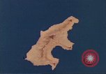
Animated map shows a mountainous ridge and a road network in Saipan, Mariana Islands.
Animated map gives geographical details of Saipan, Marian Islands. A mountainous ridge across the island shows Mount Topatchau, Mt. Marpi, Mt. Kagman and Mt. Nafutan. The map shows the Charan-Kanoa Marsh. Animation shows sugarcane plantations across the island. A road network shows Karaberra Pass, Flores Point, Charan Kanoa. Pictures of Japanese civilians in Kanoa.