


 Francais
 Deutsch
 Italiano
Refine Your Search
+"Marshall Islands" +1944 stock footage and images
- Showing 31 to 36 of 83 results more
more Hide
Hide
United States Task Force off the coast of Enewetak, Marshall Islands after its capture during World War II.
The U.S. Army secures Enewetak Island in the Marshall Islands during World War II. U.S. Task Force off shores. Bursts along the shore. Landing crafts underway.
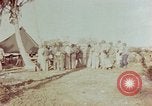
Admiral Nimitz and his party inspect island and move around on Kwajalein Island, Marshall Islands.
U.S. Navy Fleet Admiral Chester William Nimitz on inspection of Kwajalein Island, Marshall Islands. Admiral Nimitz and his party on Kwajalein Island. Tent and palm trees in the background. The party in jeep. Admiral Nimitz and his party move around and inspect the island. They inspect debris and damaged flag. Views of sea, U.S. Navy PB2YCoronado taxis on water surface.
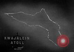
Code names of islands and operations of United States forces on Kwajalein Atoll in the Marshall Islands during World War II.
A training film on operations of United States forces on Kwajalein Atoll in the Marshall Islands during World War II. Animated map locates Kwajalein Atoll. Islands, atolls and operations are given code names. The code name for Kwajalein Atoll is Carillon atoll. The operation's name is Flintlock Operation. The Arnold pass and the Cohen Island. The code names are given alphabetically and begin with Abraham and end with Jasper. The areas of Roi Island and Namur Island are called Burlesque and Camouflage respectively. The 4th Marine Division is active in the northern area and is called Task Force 53. The southern attack force is the 7th Division and is called Task Force 52. Burlesque and the Camouflage islands are located. The two islands are connected with a concrete causeway. Average annual rainfall in the area is about 80 inches. Average annual temperature is about 81 degrees Fahrenheit. Out of the 25 navigable passes into the lagoon, only 6 are considered good. These are Jacob Pass, Ivan Pass, Bennett Pass, Chester Pass, Conrad Pass and Elton Pass. Flow of wind and current in the area is shown.
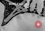
Animation locates areas of Burlesque and Camouflage Islands under northern attack forces in Kwajalein Atoll, Marshall Islands.
A training film on operations of U.S. forces on Kwajalein Atoll in the Marshall Islands during World War II. A map locates places which are under northern attack forces. Burlesque Island is located. Camouflage Island. Areas captured on the islands. A large concentration of Japanese buildings on Camouflage Island. Radio and radar stations are installed by the Japanese in these areas.
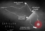
Information about arms, ammunition and equipment used to fortify various islands of the Marshall Islands is given.
A training film on operations of U.S. forces on Kwajalein Atoll in the Marshall Islands during World War II. Animated map of Kwajalein Atoll locates Cohen Island, Porcelain, Arnold Pass and Burlesque Island. Major air facilities are on Burlesque Island and Porcelain. Guns, machine guns, defense installations, artillery, trenches, anti tank ditches, barricades and embankments are used to fortify Burlesque Island. Burlesque and Camouflage Islands are located. Camouflage Island is the most strongly defended island. Abraham, Allen, Andrew and Anton Islands also had gun emplacements. On Allen Island are three tower radio station. On Jacob Island is a radar installation.
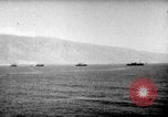
U.S. northern attack forces leave San Diego, U.S. for their operations on Kwajalein Atoll in the Marshall Islands.
A training film on operations of U.S. forces on Kwajalein Atoll in the Marshall Islands during World War II. Northern attack force departs from San Diego, United States for the Hawaiian area. A convoy of ships underway at sea. Aircraft in flight over the target area. High altitude view of the area. Smoke rises from bombardment by the aircraft. Several enemy airplanes are damaged. Enemy ships are also bombed. The ships explode.