


 Francais
 Deutsch
 Italiano

Refine Your Search
+"New Guinea" +1944 stock footage and images
- Showing 85 to 90 of 130 results more
 Hide
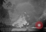
Brief wartime scenes from Pacific Theater during World War II
First scene shows a raging fire on an island in the Pacific during World War 2. Next, the dense smoke cloud is seen from a boat offshore as it covers all of the sky. A landing ship Tank nearby is silhouetted against the light sky. U.S. medics are seen bending a wounded soldier lying on the ground, as they administer first aid to him. Change if scene shows natives preparing to dig a dead soldier out of mud. U.S. Marines push wounded away from a shore on an inflated raft. Natives help a blinded Australian soldier wade through water and mud in jungles of Papua New Guinea. Australian soldiers, in rain gear, stand in a battlefield graveyard containing several rustic crosses. One of them reads from a document, as the others stand with heads bowed. Closeups from camera panning around the group of soldiers. Next, one is seen reading from a small prayer book. More closeups from various views of the mourning soldiers.
Preparations for allied invasion of Normandy France during World War II.
'Normandy: Air borne invasion of fortress Europe ' Allied invasion of Normandy. Lieutenant General William S Knudsen introduces the film to be presented, expressing thanks to makers of the glider aircraft used in the invasion, who are the intended audience of the film. Field Order no1, 9th Troop commander Carrier. A man puts a Top Secret seal on the order. The Captain of United States 82nd Air Borne Division briefs men about the terrain with the help of a mosaic. A map of Europe shows principle cities of the continent. Map and narrator describe German Atlantic Wall coastal defenses on European continent. A giant concrete coastal gun emplacement. A large German railroad coastal gun moved out of a concrete shelter. Various concrete structures, sandbag structures of coastal guns. A concrete base gun turret revolves. Huge coastal guns protrude from concrete gun emplacements. Huge steel and concrete tank barriers stretched across. Large concrete and steel structures built along the coast to prevent assault craft from landing. Combined Chiefs of staff of the United Nations at a meeting. George Marshall and Henry Arnold at the head of the table during the meeting. A map shows invasion area near Le Harve. Troop Carrier units departing for Allied invasion on Sicily, Africa on 10 July, 1943. The United States C-47 aircraft take off towing gliders from an airfield in Africa. Troops transported from British 1st Air Borne division and United States 82nd Air Borne division. Dust rises as aircraft take off from a desert field. Demolished gliders on field and beside water. Multiple views of demolished gliders. C-47 in flight and paratroopers jump from the plane in New Guinea. Instructor trains paratroopers in United States. Discussion and demonstration of improvements in glider equipment and usage after Sicily Invasion and prior to D-Day Normandy invasion. Two men attach link nose chain to glider. Parachute extended and held open by men. Pilot of a glider talks to the pilot of the plane towing the glider over intercom.
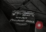
An American flying boat PBY Catalina carrying soldiers and correspondents in flight to Mindanao,Philippines.
The soldiers and war correspondents being transferred aboard the U.S. Navy PBY Catalina of the 2d Emergency Rescue Squadron from Motorai Island in New Guinea to Mindanao in Philippines during World War II. The PBY Catalina in flight. The coastline of an island in view. Inhabited areas in the island and rocky terrain in the island. The aircraft in flight in the sky. Two aircraft in flight. A vessel in the ocean. Few vessels in the ocean water.
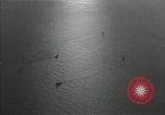
Soldiers and correspondents move from the American flying boat PBY Catalina to a small boat in the Pacific Theater.
The soldiers and war correspondents aboard PBY Catalina of the 2d Emergency Rescue Squadron being transferred from Motorai Island in New Guinea to Mindanao in Philippines during World War II. Few vessels in the ocean. The PBY Catalina carrying the soldiers and war correspondents prepares to land on water. Several vessels in the ocean. A small boat carrying men approaches the flying boat after it has landed on water. Men with belongings transfer from the PBY Catalina to the small boat. The boat moves away.
U.S. Army Air Corps strike on Langoan, Samate and Boela, during Philippines Campaign in Philippines Island during World War II.
Philippines Campaign in Philippines during World War II. A pictorial map showing the location of Langoan in Philippines. The bombs strike on Langoan on Celebes Island. A map showing the location of Samate. Bombs being dropped on Samate in New Guinea. A map showing the location of Boela. Bombs being dropped on Boela on Ceram Island. Smoke rise from explosions.
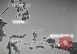
U.S. heavy bomber B-24 Liberator drops bombs over target areas in Buayan in Philippines Island during World War II.
Philippines Campaign in Philippines during World War II. A pictorial map showing distance of 650 MI from Middleburg in New Guinea to Buayan in Philippines Island. U.S. Army men at work. Two U.S. officers on ground below an aircraft during inspection. A U.S. heavy bomber B-24 Liberator taxis and takes off. The B-24 in flight. The nose section of the aircraft. Other aircraft in flight. Bombs being dropped on target areas in Buayan in the Philippines Island. Smoke rises from explosions. Aerial views of inhabited areas in the Philippines Island. A wooded region in view. Paved ways in view on ground. A column of smoke rises from the bombarded areas