


 Francais
 Deutsch
 Italiano
Refine Your Search
+"Pacific Ocean" +1934 stock footage and images
- Showing 1 to 3 of 3 results
The Philippines gains independence from the United States on July 4, 1946; also scenes from 1941 Japanese invasion WW2
The Philippines are established as an independent nation. Crowds of Filipinos gathered at Rizal Park (Luneta Park) in Manila on the July 4, 1946. View of Independence Grandstand (a temporary structure built in front of the Rizal Monument) with American flag and Philippine flags on tall flag poles.. View looking down on General Douglas MacArthur at a podium, speaking into microphones. Camera pans over various segments of the audience. A map shows the Philippine Islands in context of its neighbors in the Pacific Ocean. Camera pans closeup across faces of many Filipinos gathered at the independence event. View of the Jones Bridge over the Pasig River in downtown Manila. Heacock’s Department Store on the Escolta. The Legislative Building. (later the National Museum of the Philippines). Ocean going ships in a harbor. Cargo being offloaded from a ship onto smaller boat. An industrial complex with eight tall smoke stacks emitting smoke. Steel and petroleum plants. Filipino workers in an assembly plant. The Legislative building with people coming and going. Air raid sirens sounding and people running in streets of Manila at onset of Japanese invasion of the Philippines in December, 1941, at start of World War 2, in the Pacific. People running across the Jones Bridge, seeking shelter. Others boarding a bus. Smoke rising from Japanese bombing. Glimpse of Japanese tanks entering Manila during attack and invasion. Japanese infantry climbing a hill. Bodies of persons killed during the Japanese invasion. Glimpse of Japanese troops occupying Corregidor. U.S. General Wainwright negotiating the surrender of Corregidor with Japanese General Homma. View of an American warship firing during the U.S. campaign to defeat the Japanese on islands in the Pacific. An American landing ship carrying U.S. troops who storm ashore. General Douglas MacArthur striding ashore with a retinue of officers, at Leyte, Philippines, on October 20, 1944. as he keeps his promise to return to the Philippines. Views, back again, to MacArthur speaking at the Independence Day ceremony in Manila on July 4, 1946. Also seen at the ceremony are: U.S. Senator Millard Tydings, (co-sponsor of the 1934 Tydings–McDuffie Act, which provided independence to the Philippines after a 10-year transition under a limited autonomy), and Paul V. McNutt, U.S. High Commissioner of the Philippines, who read President Truman's proclamation of Philippine Independence to the assembly. Camera pans over the gathering which includes many U.S. Service personnel in uniform. The oath of office is administered to the elected President of the Philippines, Manuel Roxas. At the conclusion, the American flag is lowered by Paul McNutt, as President Roxas raises that of the Republic of the Philippines. A celebratory parade in Manila includes a float with signs reading: "Let's Produce and Rebuild," among other things. Other floats represent "Mountain Province," and "The City of Manila," "The University of the Philippines," and "The Division of City Schools." One float, sponsored by the Chamber of Commerce, contains a huge replica machine gear, and models of an aircraft and a ship. It's message is about turning the gear that helps make the nation great. American and Filipino soldiers march, carrying their respective national flags. A white-helmeted military band plays for the marchers. Final scene shows large loose formation of military aircraft in flight very high above the Independence Grandstand, at Rizal Park.
First trans world flight of U.S. Army Air Service DWCs (Douglas World Cruisers) to the Kuril Islands, Pacific Ocean.
First trans world flight in 1924 to the Kuril Islands in the Pacific Ocean. A Douglas World Cruiser in flight over the Kuril Islands and on coastal waters. American crewmen of Douglas World Cruiser. Crewmen work on DWC. A map depicts the trans world flight. DWC lands on water. American crewmen with Japanese women. The map demonstrates that Japan is readily accessible from the outside through various transcontinental air flights. A Japanese fishing boat underway.
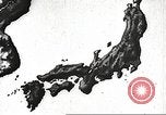
A Japanese film describes her Empire ambitions in the early 1930s
Film opens with animated map showing Japan and its nearby Asian mainland neighbors. Arrows from Japan point to areas and islands that Japan considers part of the Japanese empire. In addition to Pacific islands, they include Asian mainland places, Manchuria, and the Sakhalin Islands. The map shows the Northern limit of Japan's territorial reach with a line drawn on the map at about 47 degrees North latitude. The map shows the reach of Japan's empire extending South to include all of Manchuria and in the Pacific to encompass all the scattered islands in the Pacific accessible to Japan. The map begins drawing a circular boundary to the East encompassing all these areas of the Japanese Empire. Film shifts to Japanese navy warships patrolling the Eastern Pacific boundaries of the Empire, and bi-wing aircraft flying in formation overhead. Rising sun symbol seen on underwings of biplanes. Admiral Tōgō Heihachirō who was later Commander-in-Chief of the Combined Japanese Fleet during the Russo-Japanese War is seen seen as a young Admiral in 1895. Next, he is seen in 1934 at the age of 86, coming out of a barn and walking toward the camera. He is bent over and walks slowly, dressed in woolens and wearing thick eye glasses. (He died on May 30, 1934.)