


 Francais
 Deutsch
 Italiano
Refine Your Search
+"Russia" +1923 stock footage and images
- Showing 7 to 9 of 9 results more
more Hide
Hide
Maps of different countries show their relative oil production as compared to that of the United States.
Relative oil production of the United States and other countries for the year 1914 is depicted. A political map of the United States shows some states with dots and some with crosses and some states with dots and crosses both. A box on the top left corner of the map shows the state of Alaska. A map of the continent of South America with oil production of some of its countries. A box on the top right side of the map shows oil production in Trinidad. A map of Russia shows its neighboring countries such as Germany, Galicia, Roumania and others. Relative oil production in these countries is depicted using crosses and dots. Boxes on the top right corner of the map show relative oil production in Japan and Formosa. Another map shows India, Tibet and neighboring countries. Relative oil production in these countries is depicted. A box in the lower middle of the map shows relative oil production in Dutch East Indies.
Junkers F 13 passenger aircraft takes off from Berlin Tempelhof Airport
Animation depicts an airplane flying to cities such as Danzig (Gdańsk, Poland), Königsberg (Kaliningrad, Russia), Memel (Klaipėda, Lithuania), Riga (Latvia), and Reval (Tallinn, Estonia). Civilian travelers board a Junkers F 13 passenger plane at Tempelhof Airport (Platz d. Luftbrücke 5, 12101 Berlin, Germany) in Berlin, Germany. Men and women peer from the door and window of the aircraft before departure. A man opens the back of an Ullstein cargo truck. Men unload cargo from truck in front of the Junkers hangar. Cargo handlers load packages into the aircraft. The aircraft takes off from Tempelhof aerodrome.
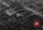
Aerial view of Berlin, Danzig (Gdansk) and Königsberg (Kaliningrad) from Junkers F 13 passenger aircraft in flight
Aerial view of Berlin as seen from a flying aircraft. Major landmarks such as Humbolt University, Unter den Linden Avenue, Brandenburger Tor, the Reichstag and the Victory Column (Siegessäule) are seen below. Aerial view of Danzig (present-day Gdańsk, Poland) as aircraft approach for landing. St. Mary’s Church is seen. Ships in the port of Gdańsk. Pilot and airport staff help men and women disembark from the Junkers F 13 aircraft after landing in Königsberg (Kaliningrad, Russia).