


 Francais
 Deutsch
 Italiano

Refine Your Search
+"Saipan Northern Mariana Islands" +1944 stock footage and images
- Showing 151 to 156 of 228 results
U.S. Fleet Admiral Ernest King and Admiral Richmond Turner tour the island after the capture of Saipan, Mariana Islands.
U.S. officers tour the island after the capture of Saipan, Mariana Islands during World War II. U.S. Fleet Admiral Ernest King and other officers tour the island. U.S. Admiral Richmond Turner talks to U.S. soldiers. Officers and men at quarters. The officers and the soldiers attend flag raising ceremonies.

United States Marines captures Saipan in the Mariana Islands during the Pacific Campaign of World War II.
Final stages of the Battle of Saipan in the Mariana Islands during World War II. U.S. carrier-based airplanes land at and are refueled at a captured airfield renamed as Conroy Airfield. Bombers and fighters take off to bomb Japanese positions on the northern tip of Saipan. Smoke billows up from a Japanese ammunition dump by U.S. bombings. U.S. Marine Commander Carlson confers with an officer. Marines and tanks advance. Mortars are fired at Japanese pillboxes and caves on a hill. Smoke billows up from the hillside. The marines continue advancing. Animated map connects Saipan with Tokyo and the Philippines. The marines after the capture of Saipan.
Animated map shows the location of Saipan and the geographical details of the Mariana Islands.
The film 'The Marianas Operation Phase I, Saipan' shows the location of the Mariana Islands through an animated map. Animation shows geographical details of Saipan. It shows its dry and wet seasons. Fringing and barrier reef on the Western Coast. A harbor at a wharf. The map shows the location of a boat yard.
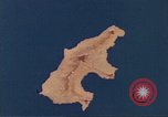
Animated map shows a mountainous ridge and a road network in Saipan, Mariana Islands.
Animated map gives geographical details of Saipan, Marian Islands. A mountainous ridge across the island shows Mount Topatchau, Mt. Marpi, Mt. Kagman and Mt. Nafutan. The map shows the Charan-Kanoa Marsh. Animation shows sugarcane plantations across the island. A road network shows Karaberra Pass, Flores Point, Charan Kanoa. Pictures of Japanese civilians in Kanoa.
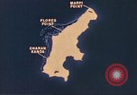
Animated map shows various air strips Marpi Point, Flores Point and Charan-Kanoa on Saipan, Mariana Islands.
Animated map gives geographical details of Saipan, Marian Islands during World War II. Animation shows air strips named Marpi Point, Flores Point and Charan-Kanoa. An aerial view pictures of Japanese held area on Saipan.
Animated map show U.S. forces landing on Saipan, Mariana Islands.
Animated map shows Saipan, Marian Islands. Animation shows U.S. forces acquiring the island from the Japanese during World War II. Advancement of Task Force 56. The 77th Infantry Division at Oahu. The 2nd and 4th Marine Division land on the island on the orders of a United States General. Animation shows the 37th Division troops landing on a beachhead from ships.