


 Francais
 Deutsch
 Italiano
Refine Your Search
+"Solomon Islands" +1944 stock footage and images
- Showing 91 to 96 of 99 results more
more Hide
Hide
Lt Col Dr Gordon Seagrave treats the wounded soldiers in Burma and U.S. transport planes drop supplies at jungle outposts.
Allied jungle outposts get supplies by parachutes during World War II. U.S. General Joseph Stilwell looks as soldiers bring wounded on stretchers into a field hospital in the jungles of Burma. Lieutenant Colonel Dr Gordon Seagrave and Burmese nurses treat the wounded. American transport planes drop supplies by parachute on the outposts on the Naga Hills on India Burma border. An airman drops the supplies out of the plane. A map shows Bougainville in the Solomon Islands. A Fiji soldier on a radio. American transport planes drop supplies by parachute for the Fijian troops in Bougainville.
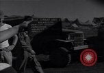
A runway strip under construction by Seabees at Banika Island during War II.
A runway strip under construction by Seabees,during World War II, at Banika Island (part of the Russell Islands, in the Solomon Islands). Aerial view of the runway strip under construction on the site of a coconut plantation. (This is the South Strip. Another airfield was also built across the bay, on the north side of the island.)
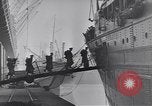
U.S. Army Service Forces transporting troops and supplies worldwide during World War II.
U.S. troops board a large troop transport ship via a gangplank. Troops on an intermediate deck of the ship. Some are sprawled out relaxing. View from above of more troops boarding a ship. Men and equipment on the pier below. American forces at various far flung places where the U.S. Army Services Forces facilitated their transport and logistic support. Fleeting glimpses of troops in: Ireland; Alaska; Trinidad; and South America. Troops jam the upper deck of a transport ship. Army Service Forces officers in a planning meeting. Naval officers on deck of a ship look through binoculars as U.S. Naval ships bombard the coast of Solomon Islands and landing craft carry marines in an amphibious assault. Next, a man is seen annotating a map of North Africa. Secret maps pertaining to Allied landings in Tunisia and Algeria. Animated map illustrates amphibious landings on North African coast, highlighting Casablanca, Oran, and Algeria. Landing craft carry troops and supplies that are piled up in the sand beach. Soldiers moving military supplies ashore, in fire brigade fashion. Soldiers working at desks in Offices of the Army Service Forces. Filing cabinet in background. Trucks on the move in remote locations. Supply ship being loaded at a terminal. Fuel drums and army vehicles a being loaded aboard ships. Officers seated at a conference table. Ordinary American enlisted soldiers in a griping session at an Army post in the United States. Camera pans over large formation of soldiers. Animated chart shows more than half of servicemen who are part of Army Service Forces (ASF), are unaware of that. Troops marching in review at a tropical location, where reviewing officers wear pith helmets. Chart illustrates lack of unit pride in ASF. Images of various ASF logos. Chart shows results of polling data from soldiers and service members. Signal Corps and Engineers elements of ASF have the greatest unit pride. But most think better of other branches of the Army. More troops marching, in steel helmets and carrying rifles with bayonets affixed. Troops marching overlaid by "50%" indicating that half don't believe their contributions to the war effort are significant. Troops lined up (for pay?). More charts expressing concern about low morale. A heavy gun firing. German paratroopers jumping from a formation of Junkers Ju 52 aircraft. Charts expressing prevailing U.S. troops view that Germany wouldn't be too hard to defeat. Chart showing lack of understanding about why the U.S. is fighting Germany. Image of President Franklin D. Roosevelt and Prime Minister Churchill seated in front of their key military officers at Casablanca Conference in World War 2. Chart shows U.S. soldiers believe that the greatest war effort is expended by the U.S. followed by Russia, with China and Britain providing little. Chart illustrates that only half U.S. troops want to get overseas and fight. Chart shows U.S. War Department films can correct this problem.

A map locates various islands of the Pacific and the invasion of these islands by U.S. forces.
A training film titled 'The Kwajalein Operations' on the operations of U.S. forces on Kwajalein Atoll in the Marshall Islands during World War II. A map locates islands in the Pacific Ocean. Animation depicts the area invaded by U.S. forces. The Gilbert Islands, the Solomon Islands, Midway Island, Tarawa and other islands located on the map. U.S. lines of communication on various islands. Kwajalein Atoll on the map. The atoll is selected as a base for U.S. forces. It is selected because of various benefits which would prove useful during the invasion of the Marshall Islands. Bases and installations on Kwajalein Atoll.
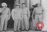
United States 81st ("Wildcat") Infantry Division soldiers board ship in Hawaii for Pacific mission (WW2)
Robert C. Richardson Jr., Commanding General of U.S. Army Forces in the Central Pacific Area, stands with his staff personnel outside headquarters in Hawaii. United States soldiers with the 81st ("Wildcat") Infantry Division on trucks heading to port during World War II. Soldiers with their supplies boarding the ship. Ships sailing out of Hawaii. Animated map shows the Pacific Ocean and important islands such as Hawaii, Solomon Islands (Guadalcanal), Palau (Angaur), and the Philippines. Servicemen spend their free time on deck of ship. Two bald servicemen chatting with their friends. Soldiers sleeping in their quarters on board ship. A shirtless soldier combs his hair. Soldiers play instruments in ship orchestra. Soldiers watch and clap for the band onboard ship.
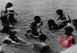
81st Infantry Division soldiers cook, bathe, and relax during break in the Battle of Angaur (WW2)
United States 81st Infantry Division troops relax in the middle of the Battle of Angaur in the Solomon Islands during World War II. Naked servicemen bathe and wash clothes. 81st Infantry Division “Wildcats” soldiers prepare a meal from a portable camp stove. Two of the soldiers are smoking cigarette and pipe. The soldier stirs from the metal can. He scoops some soup to taste. The soldier makes an “OK” hand gesture after tasting the soup. A soldier picks up a stray goat. They smile as they hold and pet the goat. A group of soldiers play with a Japanese record player. They laugh at the high-pitched warbled music from the record player.