


 Francais
 Deutsch
 Italiano
Refine Your Search
-Cebu,-Philippines stock footage and images
- Showing 6109 to 6114 of 58885 results more
more Hide
Hide
A group of American farm boys visit Chicago, Ford River Rouge plant in Michigan, and Cornell University in Ithaca New York.
The farm boys of Texas visit different states of United States. The farm boys walk on fences in a stockyard and look at cattle in Chicago Stockyards. View of exterior of part of the Ford River Rouge automobile manufacturing Plant in Detroit, Michigan. Group of boys walk in River Rouge plant yard and car factory workers emerge from the buildings. Scene changes to Ithaca New York on grounds of Cornell University. View from high up looking into gorges at the waterfalls cascading down rocks. A building built atop the rocks at Cornell.
A group of farm boys visit Manhattan, New York City and view buildings and traffic in United States.
Farm boys of Texas visiting different states of United States. The farm boys stand at a street corner in Manhattan, New York City. Camera pans slowly up the Woolworth Building skyscraper. A group of people cross a street. Cars of late 1910s and 1920 on a street find parking places. Cars parked at curb.

A group of Texas farm boys visit Washington DC, Virginia, and Alabama, and returns to Texas by train
Group of farm boys of Texas visit different states of United States. Dome of U.S. Capitol building seen framed by trees in Washington DC. Stream and a waterfall in Virginia. View of the Natural Bridge formation in Virginia. The farm boys stand at a long table outside and eat in Alabama. Two African American men stand and eat fried chicken. People stand at a train station in Texas, waiting for the railroad train. The train arrives. Boys hanging precariously from engine, cars, doors and windows. They wave happily and jump off the train as it arrives back in Texas.
Principal persons involved in Transcontinental Air Transport (TAT) and its combined rail-air operations carrying passengers coast-to-coast in 48 hours
Film titled 'Coast to Coast , in 48 hours' depicts advertisement of coast to coast trip by train and air. General W.W. Atterbury, President, Pennsylvania Railroad; Colonel Charles A. Lindbergh, Chairman, Technical Committee, TAT Maddux Airlines; Clement M. Keys, Chairman of the board, Transcontinental Air Transport incorporation; Daniel M. Sheaffer, Chairman, TAT inc., Executive Committee and Jack Maddux, President, TAT Maddux Airlines sit around a table. Chairman Keys introduces the other executives seated at the table and describes their novel operations carrying passengers across the American continent, from coast-to-coast, in 48 hours, by means of coordinated rail and air operations under the aegis of the Transcontinental Air Transport Company.
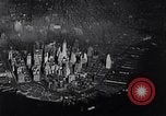
Transcontinental Air Transport (TAT) providing combined rail and air service taking passengers across the U.S.A. from coast-to-coast
Operations of the Transcontinental Air Transport (TAT) Company. Aerial view of New York City's Manhattan Island, below. Camera focuses on Pennsylvania Station (Penn Station) seen from above, and then at street level. Travelers purchasing tickets for combined transcontinental rail and air travel at a window in the station. Families seeing travelers off at one of the railroad gates. Temporary sign at gate reads "The Airway Limited, second section." View of passengers on rear car of train as it pulls out. The car displays Pennsylvania Railroad logo sign reading "The Airway Limited, Pennsylvania Railroad." Views of Pennsylvania RR passenger train and closeup of locomotive wheels in motion. Animated relief map shows train proceeding from New York, past Columbus, Ohio, to Port Columbus station in Ohio. Transcontinental Air Transport, Inc. billboard sign at the station shows picture of passengers connecting between a train and an airplane. Billboard reads: "Port Columbus, Eastern Transfer Point, Air-rail Service, Coast-to-Coast." Passengers leaving the train and entering the station waiting rooms. Their baggage being weighed (Narrator says 30 pounds is the allowance.) View from terminal roof, of a Ford 5-AT-B, trimotor passenger airplane ready to accept passengers for the next phase of their travel. A logo on fuselage has "TAT" with small ribbon through it reading, "Transcontinental Air Transport." View of passengers seated inside the aircraft. The plane taxis and takes off from the Port Columbus airport. Ground is snow-covered, but the runway is plowed. Closeup aerial view of the airplane flying over the city of Columbus, Ohio. Distant view of it flying close to the LeVeque Tower skyscraper (a 47-story Art Deco-style building at 50 West Broad Street). Aerial view of the airplane passing the train, continuing westward, from Port Columbus. Views inside passenger cabin of the plane. Animated map show plane heading to Indianapolis. Officer hands out TAT illustrated map and points out features to passengers. Closeup of map. Aerial view of the airplane on final approach to land at Indianapolis airport. Clerk at airport typing arrival message on teletype, and company executives reading it at their headquarters. Animated map show plane moving to St. Louis, Missouri. View from air of Missouri and Mississippi rivers. Passengers in cabin. aerial view of the plane on final approach, over snow, to St. Louis. The aircraft taxiing on ramp and parking at terminal building, where passengers enter, under cover of awning-covered walk. Closeup of the aircraft engines. Inserted view of TAT engine overhaul facility, with Charles Lindbergh, the airline's technical adviser, and TAT officials inspecting the operation.
Transcontinental Air Transport (TAT) carrying passengers from St. Louis to Waynoka, Oklahoma, on coast-to-coast trip from New York
Early commercial passenger airplane travel in the United States. Transcontinental Air Transport (TAT) company's coast-to-coast passengers proceed on their flight legs from Saint Louis, Missouri to Waynoka, Oklahoma. TAT employee closes door on Ford 5-AT-B tri-motor passenger airplane, at St. Louis airport. Ground crewman plugs in compressed air hose to assist start of engine number three. TAT logo seen on side of the airplane. Next, the airplane taxis and takes off on plowed runway of snow-covered field. Animated map shows airplane heading to Kansas City, Missouri. View of cockpit as co-pilot shows weather report to pilot. Shift to a TAT weather station where meteorologists launch a weather balloon to check winds aloft. Closeup of the pilot's weather report being prepared. TAT officer serving lunch food to passengers in the aircraft. View from airplane of Kansas City, and then aerial view as it descends to Wichita, Kansas. Pilots in cockpit. Copilot radios Wichita. View of TAT radio operator responding and saying they should lookout for Lindbergh who is flying the route today. Next, Colonel Charles A. Lindbergh is seen flying past the Ford Tri-motor in his Curtiss Falcon biplane. Passengers look out to see him. View from the passenger plane descending over the city of Wichita, Kansas. Aerial view of aircraft factory buildings in Wichita. Animated map shows next stop as Waynoka, Oklahoma. View from the air of numerous oil wells and oil derricks in Oklahoma. Passengers leaving the airplane and boarding a trailer-bus at Waynoka. Closeup of flowers and sign on restaurant table, reading, "TAT, Reserved for TAT travelers." Passengers dining.
CRITICALPAST.COM: About Us | Contact Us | FAQs - How to Order | License Agreement | My Account | My Lightboxes | Shopping Cart | Advanced Search | Featured Collections | Website Terms & Conditions | Privacy Policy ©2026 CriticalPast LLC.
License Agreement |
Terms & Conditions |
Privacy Policy
©2026 CriticalPast LLC.