


 Francais
 Deutsch
 Italiano

Refine Your Search
-Cebu,-Philippines stock footage and images
- Showing 33031 to 33036 of 58987 results more
 Hide
Color Sound
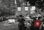
U.S. General of 5th Division Major General Albert E. Brown and Russian General Bogdonov at banquet table, Protivin (WW2)
U.S. Army exchange decorations with Russian Army in Protivin, Czechoslovakia during World War II. U.S. Commandant-General of 5th Division Major Albert E. Brown and Russian Commandant-General of 107th Infantry Division Bogdonov at banquet table. Russian officials at the banquet table.
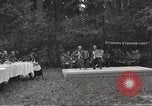
U.S. and Russian officials attend a banquet after exchanging decorations in Protivin, Czechoslovakia (WW2)
U.S. Army exchange decorations with Russian Army in Protivin during World War II. Russian and U.S. army officials seated at banquet table. Orchestra plays music. Two men play accordion. Russian Commandant-General of 107th Infantry Division Bogdonov talks with few officials. Russian official dances with a woman on lawn.

Major General Maxwell Taylor pins medals on U.S. officers in Berchtesgaden, at end of World War 2, in Europe.
Decoration of U.S. army officers in Berchtesgaden, Germany, at the former Reichskanzlei in Staggass, a week after the end of World War II in Europe. U.S. Major General Maxwell D. Taylor pins DSC (Distinguished Service Cross), Legion of Merit, and Silver Stars on U.S. officers. U.S. soldiers stand in a formation on lawn. Field Marshal Keitel's house and "Sleeping Witch" mountain in the background. Infantry march along a road. Brigadier General Gerald J. Higgins being awarded the Silver Star and Colonel William Gilmore receives promotion to Brigadier General.

Influx of foreign immigrants add to total population in Northeastern States of the United States.
Animated map of Northeastern United States bounded with Middle States and Southeastern States. Map depicts geographical condition of Northeastern States. Map marks States of Maine, New Hampshire, Vermont, Massachusetts, Rhode Island, Connecticut, New York, New Jersey, and Pennsylvania. Map shows Northeastern settlement during colonial period by Scotch, English, Dutch, Germans, and Swedes. Also shows influx of French Canadians during early 19th century and immigrants from different countries occupying urban Northeastern centers. Map explains the population occupying region.
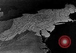
Animated map of Northeastern United States depicts dairy farming as the main agriculture, United States.
Dairy farming as main agricultural activity in Northeastern United States. Animated map of Northeastern States marks large metropolitan area consuming milk in a vast amount. Tank trucks move along road on their way to railroad shipping points and urban centers. Cattle graze at a field. Ducks in a poultry farm. Map marks growth of potatoes in Maine and Long Island. Apple growing areas in Middle States.
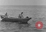
Northeastern coast of United States serving as main source of seafood, United States.
Northeastern coast of United States as main source of seafood, United States. Fishermen row boat around Northeastern coast. Fishermen on boats. Men fishing pull in a fish. Many cod or haddock fish heaped high on a fishing boat before heading back to shore. A lobster fishing boat off the Atlantic coast. Fisherman pulls in a lobster trap and removes a lobster from it that he holds for the camera. An oyster boat operating off of the Atlantic Coast. Oyster fisherman pull in a net filled with oysters and dump it on the boat. In a canning facility, fresh oysters are placed into one gallon cans labeled "Chesapeake Bay Salt Water Oysters."
CRITICALPAST.COM: About Us | Contact Us | FAQs - How to Order | License Agreement | My Account | My Lightboxes | Shopping Cart | Advanced Search | Featured Collections | Website Terms & Conditions | Privacy Policy ©2026 CriticalPast LLC.
License Agreement |
Terms & Conditions |
Privacy Policy
©2026 CriticalPast LLC.