


 Francais
 Deutsch
 Italiano
Refine Your Search
-Cebu,-Philippines stock footage and images
- Showing 56419 to 56424 of 58885 results more
more Hide
Hide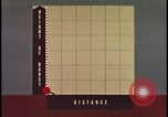
Animated graph shows atomic bomb height of burst versus distance.
Animated graphic compares the height of burst of an atomic bomb blast versus distance from the blast. Various comparisons of burst height are shown against several different targets, including a tank, a hand, a standing soldier, and a soldier in a trench.
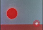
Animation showing radiation from an atomic bomb mushroom cloud.
Animation demonstrates radiation emanating from an atomic bomb explosion and subsequent mushroom cloud. Bomb cloud alone in the sky is shown with radiation. Initial burst before cloud shown with great radiation and reflection back from ground.
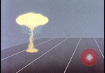
Animation of atomic bomb mushroom cloud and fallout effects from cloud.
Animation shows atomic explosion mushroom cloud with fallout and then cloud moving with fallout spreading through terrain. More animation shows fallout dispersion depending upon low, middle, high, and average wind conditions.
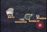
Animation predicts fallout path from Bikini Atoll atomic bomb explosion.
Animated map of Bikini Atoll area shows islands of Bikini, Ailinginae, Rongelap, and Rongerik. The predicted fallout radiation strength is posted for each area of the map with accumulated radiation doses to H+50 noted. The decreasing dose from 3000 to 1300 and then 800 is shown. A dotted line demonstrates path of fallout radiation over the Bikini Atoll area. Next, a map of the United States USA Eastern seaboard is shown with Washington D.C. as the origin of the atom bomb explosion and the fallout cloud extending to New York City.
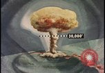
Bikini Atoll graphic shows atomic bomb mushroom cloud and fallout pattern.
Graphic of Bikini Atoll nuclear explosion mushroom cloud with markings indicating 30,000 feet on cloud with +97 of fallout above that point. Topographical display shows fallout pattern from blast.
Tactical nuclear device explosion in the desert with cloud dispersion.
Aerial view of a small tactical nuclear weapons in the desert. Atomic bomb explosion cloud elongates to cover a wide area of view.
CRITICALPAST.COM: About Us | Contact Us | FAQs - How to Order | License Agreement | My Account | My Lightboxes | Shopping Cart | Advanced Search | Featured Collections | Website Terms & Conditions | Privacy Policy ©2026 CriticalPast LLC.
License Agreement |
Terms & Conditions |
Privacy Policy
©2026 CriticalPast LLC.