


 Francais
 Deutsch
 Italiano
Refine Your Search
2nd-Rangers-D-Day stock footage and images
- Showing 6595 to 6600 of 13612 results more
more Hide
Hide
Imperial Japanese Army General Masaharu Homma discusses maps in his office in the Philippines (WW2)
The invasion of the Philippines by Imperial Japanese Army (IJA) troops during World War II. A Japanese pilot flying an airplane over Luzon. A high-altitude view of the area. Japanese Army General Masaharu Homma rides a horse on a field. General Homma leaves an old Filipino house. An assistant on horseback follows General Homma. He looks at a table map and a wall map in his office. A white elephant statuette is seen on the table. Occupation forces of Japanese soldiers firing artillery on battlefield.
A Japanese veterinarian gives anti-malarial injections to cavalry horses in occupied Philippines (WW2)
Japanese occupied Philippines during World War II. Smoke rises as soldiers fire artillery in a field. A pair of white horses. A Japanese soldier pours libation over a grave. A Japanese veterinarian and soldiers stand near a cavalry horse. The veterinarian gives anti-malarial injections to cavalry horses. Three bombers fly over Luzon.

Japanese officials discuss the map of Bataan in occupied Philippines (WW2)
Japanese troops during occupation of Philippines in World War II. Smoke from firing and bombarding in the foreground. A Japanese official standing on a field watches the bombardment. Men brush their teeth sitting near a stream. Officials discuss the map of Bataan. Mountains in the foreground. Smoke rises from the firing.
Japanese airplanes bomb Corregidor during invasion and occupation of Philippines (WW2)
Japanese invasion and occupation of the Philippines in World War II. Smoke rises as Japanese soldiers fire artillery in the foreground. Mountains in the foreground. Japanese bomber aircraft fly in formation. They drop bombs on Corregidor Island. Smoke rises from the bombardment. The soldiers fire artillery. Interior of an airplane. A pilot and a co-pilot seated in the cockpit. They drop bombs on a target area in Corregidor.
Japanese soldiers clean their weapons and prepare for an assault at Limay, Bataan, Philippines (WW2)
Japanese occupation of the Philippines following invasion during World War II. A map shows the various mountains of Bataan Peninsula in Japanese. Japanese infantrymen prepare for an assault on Bataan. Japanese soldiers clean their weapons. The infantry aboard a landing craft at Limay in Bataan. Groups of Japanese landing craft sailing to Corregidor Island.
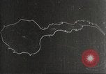
Destroyed trees, a sunken ship in a bay and wrecked U.S. forts due to battle in Corregidor, Philippines (WW2)
The Japanese invasion and occupation of the Philippines during World War II. A map of Corregidor Island. The map shows United States Army positions and the mission of each Japanese unit. Panorama of destroyed trees and installations. A sunken ship in Manila Bay. Damaged U.S. forts in Corregidor.
CRITICALPAST.COM: About Us | Contact Us | FAQs - How to Order | License Agreement | My Account | My Lightboxes | Shopping Cart | Advanced Search | Featured Collections | Website Terms & Conditions | Privacy Policy ©2026 CriticalPast LLC.
License Agreement |
Terms & Conditions |
Privacy Policy
©2026 CriticalPast LLC.