


 Francais
 Deutsch
 Italiano
Refine Your Search
Baltimore Maryland USA 1958 stock footage and images
- Showing 11557 to 11562 of 25435 results more
more Hide
Hide
USAF pilot checks fuel tank and canopy of U.S. F-84F Thunderstreak aircraft before take off, United States.
U.S. Air Force F-84-F Thunderstreak aircraft undergoes preflight inspection, United States. Pilot opens up fuel tank cover and works on it. He moves towards rear of canopy and checks for damage. Pilot climbs into the canopy and makes a thorough check.

Influx of foreign immigrants add to total population in Northeastern States of the United States.
Animated map of Northeastern United States bounded with Middle States and Southeastern States. Map depicts geographical condition of Northeastern States. Map marks States of Maine, New Hampshire, Vermont, Massachusetts, Rhode Island, Connecticut, New York, New Jersey, and Pennsylvania. Map shows Northeastern settlement during colonial period by Scotch, English, Dutch, Germans, and Swedes. Also shows influx of French Canadians during early 19th century and immigrants from different countries occupying urban Northeastern centers. Map explains the population occupying region.
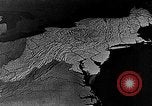
Animated map of Northeastern United States depicts dairy farming as the main agriculture, United States.
Dairy farming as main agricultural activity in Northeastern United States. Animated map of Northeastern States marks large metropolitan area consuming milk in a vast amount. Tank trucks move along road on their way to railroad shipping points and urban centers. Cattle graze at a field. Ducks in a poultry farm. Map marks growth of potatoes in Maine and Long Island. Apple growing areas in Middle States.
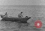
Northeastern coast of United States serving as main source of seafood, United States.
Northeastern coast of United States as main source of seafood, United States. Fishermen row boat around Northeastern coast. Fishermen on boats. Men fishing pull in a fish. Many cod or haddock fish heaped high on a fishing boat before heading back to shore. A lobster fishing boat off the Atlantic coast. Fisherman pulls in a lobster trap and removes a lobster from it that he holds for the camera. An oyster boat operating off of the Atlantic Coast. Oyster fisherman pull in a net filled with oysters and dump it on the boat. In a canning facility, fresh oysters are placed into one gallon cans labeled "Chesapeake Bay Salt Water Oysters."
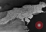
Woolen goods distributed to rest of the United States from Northeastern States.
Industrial regions of the Northeastern United States. Animated map depicts the availability of woolen goods in Northeastern regions. Exteriors of a textile mills with smoke stacks. Workers operate machines in a textile mill. Looms operate in mill. Animated map marks rest of the United States to which woolen goods are transported from Northeastern States.
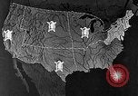
Large plants for machine production of shoes in Northeastern regions of the United States.
Industrial regions of the Northeastern United States. Animated map depicts the transportation of hides from western region of the United States to Massachusetts in Northeastern region. Map depicts plants producing shoes in Northeastern region. Workers operate machines in plant manufacturing shoes.
CRITICALPAST.COM: About Us | Contact Us | FAQs - How to Order | License Agreement | My Account | My Lightboxes | Shopping Cart | Advanced Search | Featured Collections | Website Terms & Conditions | Privacy Policy ©2026 CriticalPast LLC.
License Agreement |
Terms & Conditions |
Privacy Policy
©2026 CriticalPast LLC.