


 Francais
 Deutsch
 Italiano
Refine Your Search
Baltimore Maryland USA 1958 stock footage and images
- Showing 14629 to 14634 of 25435 results more
more Hide
Hide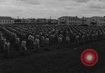
U.S. Army Air Forces Aviation Cadets in basic training..
In opening scene, hundreds of Army Aviation Cadet candidates are seen running in formations.This consumes most of the film. Next, they are seen lined up outside their quarters and practicing Judo throws, in pairs. Later, some run on a track around the field as others gather in the center of the field and play football.
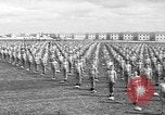
U.S. Army Air Forces Aviation Cadets in basic training physical exercises.
In opening scene, hundreds of Army Aviation Cadet candidates in formation are seen engaged in calisthenics. They perform several different types of exercises, starting at attention and moving their arms forward, then to their sides and down. After doing a number of repetitions, they begin doing numerous "Jumping jacks" combined with deep bends to the ground. They conclude their exercises with a number of squat pushups. (World War II; WW II; World War 2; World War Two)
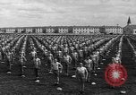
U.S. Army Air Forces Aviation Cadets in basic training perform calisthenics
In opening scene, hundreds of Army Aviation Cadet candidates are seen in formation with hands on their hips. They perform calisthenic exercises, principally Jumping Jacks, which the camera shows from several viewpoints. This activity dominates the remainder of the film. (World War II; WW II; World War 2; World War Two)
A map shows the Northwestern region, Canadian provinces and the Rocky Mountains of the United States.
The Northwestern United States. Animation : A map shows the north western states. Canadian provinces on the map. The Rocky Mountains.
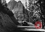
Tourists visit parks, ride horses and catch fish in a river in the Northwestern United States.
Tourists in the Northwestern United States. A car driven on a mountainous road. Tourists walk nearby a resort area and the giant lodge buildings of "Many Glacier Hotel" in Glacier National Park, Montana, Swiftcurrent Lake. Horses tied on posts nearby and a group of people walk toward the resort lodge. View of a boat underway in Glacier National Park. A man stands near a geyser in Yellowstone National Park. Tourists on a lake with the Grand Teton mountains in the background. A man, woman, and girl fish in a fast moving mountain stream and show their catch of trout fish on stringers. People ride on horses at a dude ranch. Animation of a map depicts highways, national parks, railroad and airlines routes, gold rich regions and lead rich regions. A copper mine. A railroad bridge. Animation of a map depicts petroleum producing regions, coal producing regions. Coal cars show amount of coal produced.
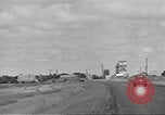
Students study in universities and farmers do weekly shopping in the Northwestern United States.
The Northwestern United States. Cars driven on a road. Trading centers in the United States. Grain elevators on farms near a road. Cattle and livestock shipping yards. 1930s and 1940s Automobile traffic on a main street in a small town of the western United States. Farmers do weekly shopping, going in various stores and shops. Sign "Barnard's" seen on one shop. Children in front of a school building. Students in a university. The clock tower with the "M" on it is Main Hall at the University of Montana in Missoula. Mount Sentinel is seen behind it. Fruits, vegetables and other articles on ships. Cattle and sheep in a field. Wheat fields. A harvester in operation on a field. Wheat is separated by a thresher.
CRITICALPAST.COM: About Us | Contact Us | FAQs - How to Order | License Agreement | My Account | My Lightboxes | Shopping Cart | Advanced Search | Featured Collections | Website Terms & Conditions | Privacy Policy ©2026 CriticalPast LLC.
License Agreement |
Terms & Conditions |
Privacy Policy
©2026 CriticalPast LLC.