


 Francais
 Deutsch
 Italiano
Refine Your Search
Baltimore Maryland USA 1958 stock footage and images
- Showing 25291 to 25296 of 25435 results more
more Hide
Hide
United States Army Redstone missile is displayed at the Grand Central Station in New York, United States.
Scene opens shows spectators looking at a U.S. Army Redstone missile lying in its side in Grand Central Station, New York City (89 E 42nd St, New York, NY 10017, United States). The Ordnance Corps logo is painted on the missile side. Some workmen use a manual hoist to raise the 5-ton missile upright. View from above of the missile being slowly tilted upright. Closeup of spectators looking upward as it moves. Another view from above as the missile is about half-way raised. Exhibit is a salute to the International Geophysical Year. Closeup of more people watching the missile being pulled up. Among others, they include a woman with two small girls, and a U.S. Airman in khaki uniform. View from above of the missile finally standing completely upright on the station floor with a large American flag displayed on the wall behind it.
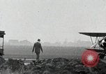
An aircraft piloted by aviator Charles Lindbergh takes off from a field in Hicksville, New York.
American aviator Charles Lindbergh takes off in an aircraft from Hicksville, New York. At an airfield, Charles Lindbergh walks towards a 1930 Perth Amboy Bird BK aircraft with registration number N727Y. He examines the aircraft. Men gathered around the plane. Propellers of the biplane aircraft rotate as engine starts. Lindbergh taxis and takes off in the aircraft and the plane is seen climbing.
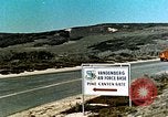
The First launch of an Atlas Intercontinental Ballistic Missile from Vandenberg Air Force Base, California
.Strategic Air Command launches its first Intercontinental Ballistic Missile from new facilities at Vandenberg Air Force Base, California. Shrouded Atlas missile on trailer enters the Pine Canyon Gate of Vandenberg AFB. Trailer being backed into the Missile Assembly Building (MAB). Electronic checkout of Atlas being carried out by computerized equipment at the MAB building. Views of Hollerith 88-column punch cards being loaded into the computer equipment and tape outputs being produced. Atlas on launch pad. USAF airmen and officers at controls and consoles at SAC (Strategic Air Command) headquarters and Vandenberg air base. The order to perform a test launch is issued by SAC headquarters and received by the launch control officers at Vandenberg AFB. The Atlas missile is successfully launched. (Note: According to a Convair technician, who was there, this launch was done in cooperation with Convair Astronautics of San Diego. Although this film shows only U.S. Air force personnel, it was the Convair Test Conductor and the Convair Crew that did the countdown for the launch, which was the final step to sell the Launch Sites (A-B-C) and the Block House to the Air Force. Reportedly, Convair celebrated with a launch party afterwards, that included James Dempsey, head of Convair Astronautics.)

U.S. 13th Air Forces B-17 Flying Fortress bombs Japanese airfield at Munda Point in New Georgia group of Islands.
A film titled 'Air Aspects of the Campaign against Munda' based on USAAF (United States Army Air Force) activities on the New Georgia group of Islands, Solomon Islands during World War II. USAAF P-38 Lightning in flight over the Solomon Islands. An animated map highlights Munda Point in New Georgia, Solomon Islands. A USAAF officer takes a look at aerial reconnaissance photographs. The officer talks over a phone at his desk. An animated map highlights Vila in Kolombangara. The map connects Vila and Munda Point with Henderson Airfield on Guadalcanal. U.S. 13th Air Forces B-17 Flying Fortress bombers take off from an airfield and bomb Japanese airfield at Munda Point.

U.S. 13th Air Forces B-17 Flying Fortress bomb Japanese airfield on Munda Point, New Georgia during World War II.
A film titled 'Air Aspects of the Campaign against Munda' based on USAAF (United States Army Air Force) activities on New Georgia group of Islands, Solomon Islands during World War II. USAAF P-38 Lightning in flight over the Solomon Islands. An animated map highlights Munda Point in New Georgia. A USAAF officer takes a look at aerial reconnaissance photographs. The officer talks over a phone at his desk. An animated map highlights Vila in Kolombangara. An animated map connects Vila and Munda Point with Henderson Airfield on Guadalcanal. U.S. 13th Air Forces B-17 Flying Fortress bombers take off from an airfield and bomb Japanese airfield at Munda Point.
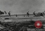
U.S. amphibious forces and reinforcements advance in New Georgia, Solomon Islands (WW2)
United States troops advance on the island of New Georgia in the Solomon Islands during World War II. The troops land on a small channel island between Rendova and Munda Point in New Georgia. An animated map highlights Munda Point location to be attacked by the U.S. forces. The map depicts landing of the U.S. forces on Zanana from Rendova. The troops advance on the island. U.S. Army Air Forces fighter aircraft take off to cover U.S. amphibious forces underway to New Georgia from Guadalcanal. The aircraft in flight over water. A submerged U.S. ship after being hit. U.S. reinforcements and equipment continues to arrive in New Georgia. A map depicts the invasion of Enogai Inlet by the U.S. forces and advance through Zanana. A bulldozer levels a muddy land in a jungle. A U.S. Army jeep drives along a muddy road in the jungle. Transport aircraft of U.S. Troop Carrier Command in the sky. The aircraft drop parachute supplies for the troops.
CRITICALPAST.COM: About Us | Contact Us | FAQs - How to Order | License Agreement | My Account | My Lightboxes | Shopping Cart | Advanced Search | Featured Collections | Website Terms & Conditions | Privacy Policy ©2026 CriticalPast LLC.
License Agreement |
Terms & Conditions |
Privacy Policy
©2026 CriticalPast LLC.