


 Francais
 Deutsch
 Italiano
Refine Your Search
Chalons-en-Champagne France 1921 stock footage and images
- Showing 5557 to 5562 of 5759 results more
more Hide
Hide
11th Armored Cavalry Regiment of the U.S. Army in a forest in Cambodia.
Soldiers of the 11th Armored Cavalry Regiment of the U.S. Army as they move through the forest en route to the base camp. An M-113 Armored Personnel Carrier in a Cambodian forest. A few soldiers stand near it. The M-113 APC starts moving. The luggage of soldiers and equipment on top of it. A bare chested soldier stands on the vehicle. Night scene. The soldiers set trip flares in front of vehicles. Soldiers near the vehicle.
The shooting of President John Kennedy in Dallas, Texas is announced to a gathering at the Dallas Trade Mart.
A man stands at a lectern bearing the Presidential seal and announces the news of the John F. Kennedy shooting at the Dallas Trade Mart gathering, saying "The motorcade has been shot." He says "we will tell you as much as we know, as soon as we know anything." Another man comes to the microphone to lead a prayer. All present stand up and pray. People depart after the prayer. (President Kennedy had been scheduled to speak at a luncheon at the Trade Mart at 12:15pm that day. He was en route to the Trade Mart when he was assassinated.)

Navigation in crescent city of New Orleans, United States.
Geographical map depicts location of New Orleans between Lake Pontchartrain and the Mississippi River. Elevated or low aerial view of some buildings in City of New Orleans. View of Levees that protect the city. Trains are ferried across rivers. View of paddle wheel steamships moving and anchored at port. A paddle wheel steamship named "Uncle Oliver" underway in the Mississippi River. Railroad train locomotive riding on a ferry boat en route and arriving at another port. A train locomotive and its attached trains drive off the ferry.
Battle off Empress Augusta Bay, during World War 2.
Night engagement off Empress Augusta Bay, during World War 2. Documents describing U.S. forces engaged in the battle. View of the Augusta Bay at dawn. Animation on screen shows the Guadalcanal naval battles and the attacks on Solomon Islands and Bougainville Island. A diagram depicts the movement of U.S. Navy Task Force 39 from Empress Augusta Bay to Shortland Island and diverting towards Treasury Island. Fleet of ships en route. United States B-24 Bomber in flight. Diagram shows the route of Japanese Forces and the United States Task Force 39. Fleet of Japanese ships on the way.
Sesquicentennial celebration of Captain Cook's discovery of Hawaii
Sesquicentennial celebration of Captain Cook's discovery of Hawaii: (1778-1928) held in the Hawaiian Islands, August 15 to 21, 1928. Monmouth-class British armored cruiser underway en route to Hawaii. Royal Hawaiian flag draped on tripod of submerged tablet, marking the site of Cook's demise. (The inscription reads: "Near this spot Captain James Cook, R.N., was killed, Feb. 14, 1779.") Smoke seen rising from naval guns on the British cruiser ship, in Kealakekua Bay, off coast of Hawaii, firing 21-gun salute. Camera pans over to the battleship, USS Pennsylvania (BB-38) also firing her guns in salute. A group of British buglers plays "The Last Post," during the ceremony. U.S. Secretary of War, Dwight F. Davis and Territorial Governor of Hawaii, Wallace R. Farrington, step into a Hawaiian outrigger canoe for a short trip across the bay. Next they are seen stepping from the canoe, to a Navy launch tied at the dock in Napoopoo, and thence to the dock, itself. Change of scene shows Secretary Davis and Governor Farrington, with many other dinner guests at a traditional Hawaiian Luau meal with many foods. There Secretary Davis is also seen delivering remarks to the gathering.
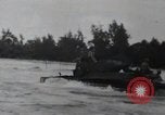
81st Army Division Marines attack Japanese sniper hidden in boat at Peleliu Island, Palau.
Soldiers of 81st Army Division in Landing Crafts en route to Peleliu Island, Palau. Japanese sniper in sunken boats offshore is shelled. Aircraft strafes and bombs over the Island. Marine fire at Japanese enemy with rifles, flame throwers, rocket launchers, hand grenades,tanks. Wounded and dead Marines are evacuated under enemy fire. (World War II period).
CRITICALPAST.COM: About Us | Contact Us | FAQs - How to Order | License Agreement | My Account | My Lightboxes | Shopping Cart | Advanced Search | Featured Collections | Website Terms & Conditions | Privacy Policy ©2026 CriticalPast LLC.
License Agreement |
Terms & Conditions |
Privacy Policy
©2026 CriticalPast LLC.