


 Francais
 Deutsch
 Italiano
Refine Your Search
Coney Island New York 1898 stock footage and images
- Showing 271 to 276 of 11259 results more
more Hide
Hide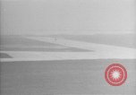
Vultee V-1A aircraft "Lady Peace"seen from the air at start of round trip transatlantic flight
the "Lady Peace" Vultee V-1A takes off, from the Floyd Bennett Airfield,in Queensbury,Brooklyn,New York,on round trip transatlantic flight, Plane in flight over sea and a ship underway. Aerial view of the airstrip. Aircraft flies over Long Island and then Eastward over the Atlantic Ocean.
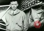
Charles Lindbergh takes off from Roosevelt Field in the "Spirit of St. Louis," on a solo flight across the Atlantic Ocean
Charles Lindbergh's poses next to his airplane, the "Spirit of St. Louis." Ground crew push the airplane, tail first, out of a hangar on Roosevelt Field, Long Island, New York. Its engine and nose are covered in canvas. Lindbergh shakes hands with an official. Ground crew top off the aircraft's fuel, by pouring several gallons into its tank from atop the wing. A man helps Lindbergh don his heavy flying coverall. The aircraft engine starts. Crowd surrounds the aircraft. Lindbergh climbs aboard and the "Spirit of St. Louis" starts its takeoff roll surrounded by group of people. Lindbergh makes a long takeoff roll, bouncing several times (once, quite hard) before breaking ground in a shallow climb.

U.S. task force underway for Peleliu (Palau) Invasion during World War II.
Opening slate reads LST 554, and date 8-13. Views of U.S. invasion task force vessels underway toward Peleliu Island (Palau), during World War 2. A 110 foot wooden Subchaser, number SC 633 is seen close, to starboard of camera boat (LST-554) and refueling lines are stretched between the LST and the Subchaser. Ensign Maynard K. Ross of Philadelphia, PA, directs the take-up of slack in the refueling lines while a Navy Commander on the LST bridge oversees the operation. (Note: SC 633 ended up running aground during the invasion.) Break in sequence and scene shifts to glimpse of slate reading August 20, 1944, and then view aft on LST 554. On the bridge, 21-year-old Ensign Charles Kahler, of Schenectady New York, uses a sextant to shoot sun lines. Another officer is seen taking relative bearings with a pelorus. Sailors are resting on deck. A series of splashes are created in the water by gunners testing their weapons. LST 557 is cruising to starboard. Puffs of black FLAK smoke appear overhead as antiaircraft weapons are tested.
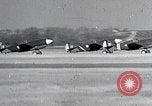
United States Curtiss P-40 aircraft of the 8th Pursuit Group take off and land after a short flight in the United States.
A flight of three Curtiss P-40 aircraft, from the U.S. Army Air Corps 8th Pursuit Group, make a formation takeoff at Mitchel Field, Long Island, New York. Next, two flights of three aircraft each, take off in a formation of six P-40s. Scene shifts to a formation of 15 P-40s in flight overhead. The aircraft return and land by flights of three, in formation. Closeup of several taxiing, with canopies open, after landing. A flight of three with landing gears down, flying on a downwind leg in formation. Closeup of two P-40s touching down on the runway. All three squadrons of the Group (33rd, 35th & 36th) appear to be represented.
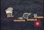
Animation predicts fallout path from Bikini Atoll atomic bomb explosion.
Animated map of Bikini Atoll area shows islands of Bikini, Ailinginae, Rongelap, and Rongerik. The predicted fallout radiation strength is posted for each area of the map with accumulated radiation doses to H+50 noted. The decreasing dose from 3000 to 1300 and then 800 is shown. A dotted line demonstrates path of fallout radiation over the Bikini Atoll area. Next, a map of the United States USA Eastern seaboard is shown with Washington D.C. as the origin of the atom bomb explosion and the fallout cloud extending to New York City.
Japanese actions leading to 2nd Sino-Japanese war and attack on United States at Pearl Harbor in World War II
Japanese army officers examining foreign military equipment. A Japanese worker employing electric drill developed in a Western country. The Japanese freighter, Tatsuno Maru, loading scrap iron at a port in the United States. Other Japanese freighters loading coal and oil for shipment back to Japan. View of the Washington Naval Conference in Memorial Continental Hall, Washington, DC, held in 1921-22 and again in 1927 and 1930, to deal with several lingering issues. Glimpse of Japanese people holding flags while gathered near the Imperial Palace in Tokyo. Glimpse of Japanese army troops on parade. Japanese Navy warships at sea. A fleet of Japanese Mitsubishi G3M bombers and Nakajima Ki-27 pursuit planes, parked on an airfield. A loose formation of Ki-27s airborne. Animated map illustrates Japanese fortification of Mariana, Caroline, and Marshall islands in the Pacific. Animated map illustrating China's greater size and population vis-a-vis Japan. Animated map illustrating Japanese occupation of Manchuria in 1931. New York Times newspaper with headline "Japs Seize Manchuria" hovers over fires burning in Manchuria. Other newspaper headlines reporting on Mussolini's invasion of Ethiopia; the Spanish civil war; surrender of Czechoslovakia; invasion of Poland; assaults on France, Belgium, and the Netherlands by Nazi Germany; the London Blitz; and Nazi advances against Russia on the Eastern Front. Fnally, a Boston Hearald extra edition headline reports: "Pearl Harbor Bombed." A still photograph of Japanese Baron Tanaka Giichi (on left) with two other dignitaries, circa 1929. Japanese infantry streaming into Manchuria and then celebrating as they walk into local town. A busy street in a Chinese city. Japanese soldiers in Manchuria escorting local prisoners along a street. Animated map illustrating Japananese warships surrounding harbor of Shanghai, China. View from a Japanese ship bombarding Shanghai. Smoke rising from shell striking on Shanghai waterfront. View from land of severely damaged buildings on a street, and a shell exploding in background, as Chinese defenders move to successfully repel the Japanese forces. New map illustrates subsequent Japanese move, annexing Jehol, from occupied Manchukuo, and Korea. Japanese troops entering a town in Jehol. Sun newspaper headline: "League Censures Japan." Chinese diplomat protesting at League of Nations. Japanese troops exiting railroad trains in Jehol. Aisin Gioro Puyi aka Henry Pu Yi, Kangde Emperor (Kang-te Emperor) of the Japanese puppet state of Manchukuo, is seen saluting Japanese troops on parade. Closeup of Puyi wearing shaded glasses, looking directly into the camera. chiang Kai-shek, with other Chinese officers. Reenactment of barbarian forces riding against China and thwarted by the Great Wall. Many Chinese walking in a long line along the Great Wall. Map tracing the Great Wall across China. Aerial view of the Great Wall from overflying airplane. Japanese troops marching through a city gate; infantry climbing a sheer cliff; and helmeted Japanese soldiers marching past civilians in a city. Map illustrated progress of Chinese unification by year 1937. Japanese officers conferring during occupation. Japanese troops leave a barracks, riding in open trucks. A line of the troop trucks moving along the dirt street of a town. The troops climb from their trucks in the town.
CRITICALPAST.COM: About Us | Contact Us | FAQs - How to Order | License Agreement | My Account | My Lightboxes | Shopping Cart | Advanced Search | Featured Collections | Website Terms & Conditions | Privacy Policy ©2026 CriticalPast LLC.
License Agreement |
Terms & Conditions |
Privacy Policy
©2026 CriticalPast LLC.