


 Francais
 Deutsch
 Italiano
Refine Your Search
Crimea Ukraine 1942 stock footage and images
- Showing 697 to 702 of 2514 results more
more Hide
Hide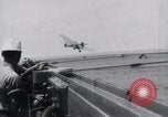
USS Wasp flight operations: crashing of F4F.
USS Wasp flight operations in Pacific Theater. F4F aircraft crashing into stern. Men running towards the aircraft. Other aircraft landing on the flight deck.
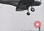
USS Wasp flight operation: crashing of SB2U.
USS Wasp flight operations in Pacific Theater. SB2U aircraft landing on the flight deck. It crashes into barrier. It crashes nearby the superstructure. Men watching the aircraft.
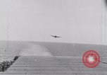
USS Wasp flight operations: landing of F4F.
USS Wasp flight operations in Pacific Theater. F4F aircraft landing on the flight deck. Superstructure in the background. Men watching the plane. Men waving signal boards towards the landing plane. Airplane lands.
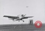
USS Wasp flight operations: crashing of SB2U.
USS Wasp flight operations in the Pacific Theater. F4F aircraft landing on the flight deck. It crashes as the wheel collapses. It crashes into barriers. Men running towards the plane. SB2U aircraft crashes into barrier aboard the Wasp. Another SB2U aircraft landing aboard the Wasp.
United States task force and aircraft carrier under Japanese air attack in the Pacific Theater.
United States task force under Japanese air attack in the Pacific Theater.Their primary target is a U.S. Aircraft Carrier. A lone sailor seen running along the flight deck. Japanese aircraft in the sky. Antiaircraft fire from the Carrier and other U.S. ships fills sky with black puffs of smoke. Two Japanese planes are shot down and crash in water. The Carrier experiences several near-miss bomb explosions. Smoke arises due to the firing. Douglas Dauntless bombers seen on deck of carrier. Other ships in the background. A U.S. Navy F4F fighter crash lands on the carrier deck and crewmen attempt to clear it away under fire from Japanese aircraft. Near miss bombs cause Carrier to rock so much that aircraft on the deck gets shaken off. A Douglas Dauntless aircraft takes off from the carrier to engage the Japanese. (World War II period).
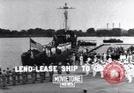
President Roosevelt presents the Crowell crest to the Hellenic Navy at Washington Navy Yards.
President Roosevelt presents the Crowell crest to the Hellenic Navy at Washington Navy Yards. Greek ambassadors respond. Greek sailors board the boat. Flag on the boat.
CRITICALPAST.COM: About Us | Contact Us | FAQs - How to Order | License Agreement | My Account | My Lightboxes | Shopping Cart | Advanced Search | Featured Collections | Website Terms & Conditions | Privacy Policy ©2026 CriticalPast LLC.
License Agreement |
Terms & Conditions |
Privacy Policy
©2026 CriticalPast LLC.