


 Francais
 Deutsch
 Italiano
Refine Your Search
Goodenough Island New Guinea 1943 stock footage and images
- Showing 619 to 624 of 13636 results more
more Hide
Hide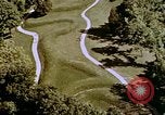
Various Buildings, Monuments and Landmarks of United States.
Views of various projects depicting man's creative engineering skills across the United States, including: The Indian Serpent Mounts, Ohio; Phoenix Mutual Life Insurance Headquarters, Connecticut; Mackinac Bridge, Michigan; Green Bank Radio Astronomy Antenna, West Virginia; Tanker "Manhattan" in the Northwest Passage; Chicago's Marina Towers, Illinois; NASA launch complex 39 in Cape Canaveral, Florida with a rocket in place; Watts tower, California; John Hancock Building, Illinois; Washington Monument; Dworshak Dam while under construction, Idaho; Newport Bridge, Rhode Island; U.S. Steel building, Pennsylvania; Mt. Glory Arch Bridge under construction in Wyoming; Johnson Wax Headquarters building, Wisconsin; Boeing 747 Factory Building Complex, Seattle Washington; A model of the proposed New Orleans Super Dome in Louisiana; Chesapeake Bay Bridge Tunnel; Dulles International Airport, Virginia; Tyrone Guthrie Theatre, Minnesota; Westinghouse Headquarters building, Pennsylvania; Rio Grande Gorge Bridge, New Mexico; Gulf Life Tower, Florida; Annunciation Greek Orthodox Church, Wisconsin; a paddle style River boat on the Ohio River; an artist depiction of the under construction Mobile River Highway Tunnel, Alabama; the Westinghouse Desalinization Plant, Florida; Model of master plan for the city of Gary, Indiana; Gulf Oil's "Big Brutus" crane at work on a dig site (The 160-foot tall coal shovel known as the 1850-B was designed and built by Bucyrus-Erie in Hallowell Kansas, for the Pittsburg & Midway, or P&M Coal Mining Company. It is the only one of its kind ever built. The mining company was purchased by Gulf Oil in 1963, and subsequently went under The Chevron Mining umbrella); Knights of Columbus headquarters building, Connecticut.
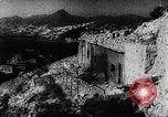
Japanese troops occupy Hong Kong after British forces surrender on Christmas day 1941 (WWII)
The Japanese occupation of Hong Kong following British surrender on Christmas day, 1941 (World War II). Japanese propaganda newsreel, narrated in accented English: Japan occupies the entirety of Hong Kong and British surrender on December 25, 1941. Destroyed British island defenses including bunkers and pill boxes. Wrecked buildings and oil storage tanks in Hong Kong. Japanese troops pose as a group and shout “Banzai” for the camera. Destroyed British tanks and artillery. British military prisoners gathered in a courtyard. Japanese officer inspects captured artillery. Japanese troops pile up shells from surrendered British forces. Captured British soldiers and sailors crowd British officers exit the "New Oriental Building" (Formerly 2 Connaught Road, Central, Hong Kong) after surrender discussions with Japanese forces. White flag hoisted on top of the New Oriental Building. Aerial view of Hong Kong area. Japanese aircraft in formation over the city making their formal occupation entry. Japanese troops parade through the streets with commanding officers on horseback.
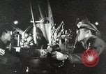
Japanese actions leading to 2nd Sino-Japanese war and attack on United States at Pearl Harbor in World War II
Japanese army officers examining foreign military equipment. A Japanese worker employing electric drill developed in a Western country. The Japanese freighter, Tatsuno Maru, loading scrap iron at a port in the United States. Other Japanese freighters loading coal and oil for shipment back to Japan. View of the Washington Naval Conference in Memorial Continental Hall, Washington, DC, held in 1921-22 and again in 1927 and 1930, to deal with several lingering issues. Glimpse of Japanese people holding flags while gathered near the Imperial Palace in Tokyo. Glimpse of Japanese army troops on parade. Japanese Navy warships at sea. A fleet of Japanese Mitsubishi G3M bombers and Nakajima Ki-27 pursuit planes, parked on an airfield. A loose formation of Ki-27s airborne. Animated map illustrates Japanese fortification of Mariana, Caroline, and Marshall islands in the Pacific. Animated map illustrating China's greater size and population vis-a-vis Japan. Animated map illustrating Japanese occupation of Manchuria in 1931. New York Times newspaper with headline "Japs Seize Manchuria" hovers over fires burning in Manchuria. Other newspaper headlines reporting on Mussolini's invasion of Ethiopia; the Spanish civil war; surrender of Czechoslovakia; invasion of Poland; assaults on France, Belgium, and the Netherlands by Nazi Germany; the London Blitz; and Nazi advances against Russia on the Eastern Front. Fnally, a Boston Hearald extra edition headline reports: "Pearl Harbor Bombed." A still photograph of Japanese Baron Tanaka Giichi (on left) with two other dignitaries, circa 1929. Japanese infantry streaming into Manchuria and then celebrating as they walk into local town. A busy street in a Chinese city. Japanese soldiers in Manchuria escorting local prisoners along a street. Animated map illustrating Japananese warships surrounding harbor of Shanghai, China. View from a Japanese ship bombarding Shanghai. Smoke rising from shell striking on Shanghai waterfront. View from land of severely damaged buildings on a street, and a shell exploding in background, as Chinese defenders move to successfully repel the Japanese forces. New map illustrates subsequent Japanese move, annexing Jehol, from occupied Manchukuo, and Korea. Japanese troops entering a town in Jehol. Sun newspaper headline: "League Censures Japan." Chinese diplomat protesting at League of Nations. Japanese troops exiting railroad trains in Jehol. Aisin Gioro Puyi aka Henry Pu Yi, Kangde Emperor (Kang-te Emperor) of the Japanese puppet state of Manchukuo, is seen saluting Japanese troops on parade. Closeup of Puyi wearing shaded glasses, looking directly into the camera. chiang Kai-shek, with other Chinese officers. Reenactment of barbarian forces riding against China and thwarted by the Great Wall. Many Chinese walking in a long line along the Great Wall. Map tracing the Great Wall across China. Aerial view of the Great Wall from overflying airplane. Japanese troops marching through a city gate; infantry climbing a sheer cliff; and helmeted Japanese soldiers marching past civilians in a city. Map illustrated progress of Chinese unification by year 1937. Japanese officers conferring during occupation. Japanese troops leave a barracks, riding in open trucks. A line of the troop trucks moving along the dirt street of a town. The troops climb from their trucks in the town.
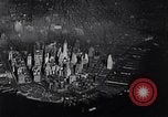
Transcontinental Air Transport (TAT) providing combined rail and air service taking passengers across the U.S.A. from coast-to-coast
Operations of the Transcontinental Air Transport (TAT) Company. Aerial view of New York City's Manhattan Island, below. Camera focuses on Pennsylvania Station (Penn Station) seen from above, and then at street level. Travelers purchasing tickets for combined transcontinental rail and air travel at a window in the station. Families seeing travelers off at one of the railroad gates. Temporary sign at gate reads "The Airway Limited, second section." View of passengers on rear car of train as it pulls out. The car displays Pennsylvania Railroad logo sign reading "The Airway Limited, Pennsylvania Railroad." Views of Pennsylvania RR passenger train and closeup of locomotive wheels in motion. Animated relief map shows train proceeding from New York, past Columbus, Ohio, to Port Columbus station in Ohio. Transcontinental Air Transport, Inc. billboard sign at the station shows picture of passengers connecting between a train and an airplane. Billboard reads: "Port Columbus, Eastern Transfer Point, Air-rail Service, Coast-to-Coast." Passengers leaving the train and entering the station waiting rooms. Their baggage being weighed (Narrator says 30 pounds is the allowance.) View from terminal roof, of a Ford 5-AT-B, trimotor passenger airplane ready to accept passengers for the next phase of their travel. A logo on fuselage has "TAT" with small ribbon through it reading, "Transcontinental Air Transport." View of passengers seated inside the aircraft. The plane taxis and takes off from the Port Columbus airport. Ground is snow-covered, but the runway is plowed. Closeup aerial view of the airplane flying over the city of Columbus, Ohio. Distant view of it flying close to the LeVeque Tower skyscraper (a 47-story Art Deco-style building at 50 West Broad Street). Aerial view of the airplane passing the train, continuing westward, from Port Columbus. Views inside passenger cabin of the plane. Animated map show plane heading to Indianapolis. Officer hands out TAT illustrated map and points out features to passengers. Closeup of map. Aerial view of the airplane on final approach to land at Indianapolis airport. Clerk at airport typing arrival message on teletype, and company executives reading it at their headquarters. Animated map show plane moving to St. Louis, Missouri. View from air of Missouri and Mississippi rivers. Passengers in cabin. aerial view of the plane on final approach, over snow, to St. Louis. The aircraft taxiing on ramp and parking at terminal building, where passengers enter, under cover of awning-covered walk. Closeup of the aircraft engines. Inserted view of TAT engine overhaul facility, with Charles Lindbergh, the airline's technical adviser, and TAT officials inspecting the operation.
Construction of houses for people involved in defense activities and workers at industrial centers in the United States.
Film 'Homes For Defense' on the construction of homes for war workers under the Division of Defense Housing Coordination in the United States during World War 2. Houses constructed for soldiers and war production workers through the Federal Defense Housing Program. Houses for the people who construct planes, ships and guns for the protection of America. View of run down tenements and slum housing in a city or town. A car parked outside a house. Children stand near a fence outside the house. A map shows industrial centers. Men move to various industrial centers. Newport News: workers work on machinery for the Battle of Atlantic. Hartford: workers work on machine guns. Detroit: workers in an auto industry. Rock Island: workers in industry make coastal field artillery. Rolla Waynesville: army men at a training center. Corpus Christi: Army men at a new airfield to accommodate the expanding air force. Aircraft in flight. San Diego: workers construct planes in a factory. Signs of the various housing agencies that are doing a special job under the coordinated program.
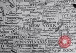
Fidel Castro raises funds, buy arms and ammunition in the United States and Mexico, for the revolution in Cuba.
Cuban rebels against the Batista government work in exile in the U.S. and Mexico in 1956. New York encircled on the U.S. map. View of papers fluttering all around baseball field as the freedom fighters' leaflets cause a delay in a baseball game at Yankee Stadium in New York. Players on the baseball field view the scene. Miami encircled on the U.S. map. Castro raises funds for the revolution in Miami. Police and officials inspect arms confiscated from the revolutionaries. Close up scene of a payoff, with money changing hands between two men. Mexico City and Quintana encircled on a map. A huge war chest is raised in Mexico City. Castro buys arms and a 58 foot yacht equipped to carry fourteen people in Quintana. Ammunition dumped into a carton. Aerial view of an island. Wheel house on Castro's boat, the Granma, that goes aground. Officers and men on the boat. The radio operator sends a message dictated by an officer leading to ambush of the rebels by troops and police loyal to Batista. Soldiers load ammunition, stand guard, and enter gates. Some of Castro's men escape to the Sierra Maestra Mountains. A woman lays flowers on a revolutionists' grave, killed during the ambush by Batista's men. Men with load on horses. They cross a stream. A man with a machine gun. Soldiers advance in the jungle, talk to civilians and rest. Soldiers eat fruits, including girls who have joined Castro's movement. Fidel Castro seated in a chair while a man trims his hair. Soldiers shoot at a plane in the sky. A soldier loads his rifle. A woman stitches a shirt with the name 'JULIO' on it. A woman dries clothes on a clothes line.
CRITICALPAST.COM: About Us | Contact Us | FAQs - How to Order | License Agreement | My Account | My Lightboxes | Shopping Cart | Advanced Search | Featured Collections | Website Terms & Conditions | Privacy Policy ©2026 CriticalPast LLC.
License Agreement |
Terms & Conditions |
Privacy Policy
©2026 CriticalPast LLC.