


 Francais
 Deutsch
 Italiano
Refine Your Search
Goodenough Island New Guinea 1943 stock footage and images
- Showing 67 to 72 of 13634 results more
more Hide
Hide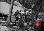
Royal New Zealand Air Force P-40 aircraft operating on Torokina Air Strip, Bougainville in World War II
Allied flight operations at Torokina Air Strip on Bougainville Island during World War 2. Pilots of the Royal New Zealand Air Force (RNZAF) gather near a tent on Bougainville, Papua, New Guinea, during World War 2. Two drink cups of water from a canvas Lister bag. View of control tower silhouetted against light sky background with tents clustered on ground below. A P-40, with RNZAF markings, taxis past the camera and is then seen on the active runway. A ground crewman waves on three more RNZAF P-40s as they taxi.
American Forces advance against Japanese held areas of New Guinea during World War II.
Animated map shows U.S. forces extending control in the Pacific the the Marshall and Gilbert Islands in the Pacific during World War 2. An American soldier sentry near a destroyed Japanese reinforced concrete bunker. Another looks at a destroyed Japanese coastal gun. More American soldiers looking over destroyed Japanese coastal defenses. A destroyed Japanese type 95 HA-GO tank. A U.S. troops look at a destroyed Japanese Mitsubishi G4M (Betty) bombers on a captured airfield. Animated map of New Guinea.showing Allied advance to Hollandia. U.S. aircraft carriers with their aircraft flying overhead. Closeup from behind of a Navy Grumman F6F Hellcat aircraft taking off from a carrier. Formations of U.S. Navy carrier-based aircraft in flight overhead. Escort aircraft carriers (called "Jeep" carriers by the narrator) are seen with decks full of airplanes. Douglas SBD Dauntless aircraft taxiing on a carrier deck. An F6F fighter plane taking off. A formation of Douglas SBD Dauntless airplanes viewed from above, flying over the sea. Gun camera films from U.S. aircraft strafing parked airplanes on Japanese airfields.
U.S. heavy bomber B-24 Liberator drops bombs over target areas in Buayan in Philippines Island during World War II.
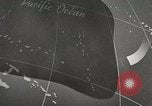
Philippines Campaign in Philippines during World War II. A pictorial map showing distance of 650 MI from Middleburg in New Guinea to Buayan in Philippines Island. U.S. Army men at work. Two U.S. officers on ground below an aircraft during inspection. A U.S. heavy bomber B-24 Liberator taxis and takes off. The B-24 in flight. The nose section of the aircraft. Other aircraft in flight. Bombs being dropped on target areas in Buayan in the Philippines Island. Smoke rises from explosions. Aerial views of inhabited areas in the Philippines Island. A wooded region in view. Paved ways in view on ground. A column of smoke rises from the bombarded areas
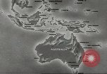
Americans strategy to attack and weaken Japanese position in South West Pacific during World War II.
An orientation film about the American campaign against the Japanese in the South West Pacific during World War II. A map of the South West Pacific area depicts islands of New Britain and New Ireland as the chief objectives of the Americans. By taking over these islands the Japanese would be isolated in the area. But a strong defense zone around these islands proves to be the main deterrent. U.S. officers including U.S. Army General Douglas MacArthur discuss the strategy to attack and isolate the Japanese in the South West Pacific region. Animated map of the region depicts American plan to capture the Admiralty Island by attacking the island of Manus and Los Negros to be followed by an attack in Madang in New Guinea. This would result in isolation of New Britain and New Ireland and weaken apanese position in the region.
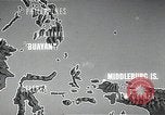
U.S. Army Air Corps strike on Langoan, Samate and Boela, during Philippines Campaign in Philippines Island during World War II.
Philippines Campaign in Philippines during World War II. A pictorial map showing the location of Langoan in Philippines. The bombs strike on Langoan on Celebes Island. A map showing the location of Samate. Bombs being dropped on Samate in New Guinea. A map showing the location of Boela. Bombs being dropped on Boela on Ceram Island. Smoke rise from explosions.
Vice Admiral Halsey looks at a map aboard a U.S. warship and infantry men advance across jungle swamps on the Solomon Islands.
A naval battle rages off the Solomon Islands during World War II. The Japanese fleet underway in the Pacific Ocean. A U.S. warship fires at Japanese ships. Animated map shows the main objective of the Japanese that is to capture Guadalcanal. A U.S. bomber lands and taxis. A signal officer gives a signal. A pilot in a cockpit. U.S. Navy Admiral Chester William Nimitz seated in a chair discusses the strategy of attack with an officer. U.S. Navy Vice Admiral William Halsey, Jr. looks at a map aboard a U.S. warship. U.S. ships underway in the Pacific Ocean. Animated map shows the positions of ships underway in different directions. A U.S. ship underway. Troops on its deck. U.S. Army General Douglas MacArthur gets off a car in New Guinea. U.S. infantry troops in trucks and jeeps advance along a dirt road. Troops in a jeep wearing gas masks. Troops seated in a truck hold guns. U.S. soldiers stand around an aircraft. A U.S. bomber aircraft in flight. The bomber aircraft taxis and takes off. The troops get off from the aircraft. Infantry men advance through a jungle. Men lay logs to make a bridge. A convoy moves over a bridge carrying supplies. Soldiers load shells in an artillery and fire. The troops advance through a jungle. They fire artillery. Smoke rises due to the firing. Artillery pounds Japanese positions. The infantry advances across jungle swamps.
CRITICALPAST.COM: About Us | Contact Us | FAQs - How to Order | License Agreement | My Account | My Lightboxes | Shopping Cart | Advanced Search | Featured Collections | Website Terms & Conditions | Privacy Policy ©2026 CriticalPast LLC.
License Agreement |
Terms & Conditions |
Privacy Policy
©2026 CriticalPast LLC.