


 Francais
 Deutsch
 Italiano
Refine Your Search
Goodenough Island New Guinea 1943 stock footage and images
- Showing 967 to 972 of 13636 results more
more Hide
Hide
U.S. convoy of freighters, aircraft carriers, and LSTs, reaching Saipan Island, Mariana Islands in World War II
The Pacific Campaign on the Island of Saipan, Mariana Islands during World War 2. Map titled 'Mariana Islands' showing the location of U.S. carrier convoy. Map showing the location of LSTs (Landing Ship, Tank). Map with heading '804th Aviation Engineers in Saipan'. Map and sea route marked from Hawaii past Johnson Island showing location of transport convoy, June 17, 1944. Convoy at sea showing men aboard the ships looking down at the water. Convoy showing the various types of vessels in the convoy, mostly freighters. Continuation of maps with sea markings of the route of the convoy showing the location of Kwajalein Islands and location of Eniwetok. Carriers underway showing planes aboard the carriers. Personnel on look out, aircraft spotters and others. Huge geyser of water erupting near a freighter. Convoy off the coast of Saipan showing a huge geyser of water going up. LSTs and freighters at anchor off the coast of Saipan. Personnel aboard LST as they move in towards the shore. Gun flashes can be seen ashore. Unloading operation showing the LST pulling into shore, the door falls down into the water and a half track pulls out and moves into the shore loaded with men and equipment. Trucks, jeeps and all types of equipment moving across the water in toward shore. Men walking ashore.
Animation locates areas of Burlesque and Camouflage Islands under northern attack forces in Kwajalein Atoll, Marshall Islands.
A training film on operations of U.S. forces on Kwajalein Atoll in the Marshall Islands during World War II. A map locates places which are under northern attack forces. Burlesque Island is located. Camouflage Island. Areas captured on the islands. A large concentration of Japanese buildings on Camouflage Island. Radio and radar stations are installed by the Japanese in these areas.
U.S. troops occupy Albert and Abraham Islands on Kwajalein Atoll in the Marshall Islands.
A training film on operations of U.S. forces on Kwajalein Atoll in the Marshall Islands during World War II. Aircraft in flight overhead. The aircraft drop bombs over target areas. Smoke rises from bombardment. Animated map locates Burlesque, Camouflage and Allen Islands. Landing teams come ashore. Trees on the shore. Men fire rifles at the shore. They fire machine guns and artillery. Rubbled houses and buildings. Animation shows the capture of Albert Island. Smoke rises from the island. The occupation of Abraham and Albert Islands.
Animated map shows U.S. forces advancing towards and arriving at Japanese acquired Saipan island in the Mariana Islands.
The Marianas Operation Phase I Saipan- Scheme of Maneuvers shows U.S. forces arriving and acquiring Saipan, Mariana Island from the Japanese during World War II.. Animated map shows U.S. Battalions arriving in formation on the island. Pictures of United States ships arriving at a target area. Fire and explosions on the island. Troops in landing crafts advancing towards the island.
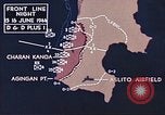
Animation and pictures show U.S. troops firing at Japanese positions on Saipan Island, Mariana Islands.
U.S. forces advance towards Japanese acquired Saipan island in the Mariana Islands during World War II.. Animated map shows U.S. forces arriving near Charan Kanoa area in Saipan. Pictures of United States soldiers arriving on the island. Troops advance on a field with rifles in hand and tanks. Two soldiers fire machine guns. Fire and explosions on the island. An aircraft drops bombs over Japanese target area.
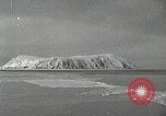
The USS Burton Island (AGB-1) arrives at King Island, Alaska on U.S. Navy cruise to assess ice conditions in Alaskan waters.
View from the icebreaker, USS Burton Island (AGB-1) as she approaches the two-square-mile King Island, at the Western most tip of Alaska. A village of simple dwellings is seen on the sharply sloped rocky side of the island. Local inhabitants gather at the shore to greet the arriving icebreaker. The crew lowers a gangway and villagers accept the invitation to come aboard the ship. The local Priest, Village Leader, and two school teachers are among several local people seen on the ship's deck during their visit. Eskimo women and children wait on shore with their children until being assured by their leaders and men that it is safe for them to visit. Several of the ship's company are invited to visit the village and are seen climbing up the steep way upward. View of house perched against steep mountainside, with skin boat laid up for winter, underneath. Clothing on washline. A larger building with a short wave radio. View from high up in village toward the icebreaker. Sailors climbing down the steep stairs from the village at the end of their visit. Some of them slip and slide down the hillside. Crew try hand at catching king crab through a hole in the ice. A large catch of king crab. View from the icebreaker as she departs Southward away from King Island.
CRITICALPAST.COM: About Us | Contact Us | FAQs - How to Order | License Agreement | My Account | My Lightboxes | Shopping Cart | Advanced Search | Featured Collections | Website Terms & Conditions | Privacy Policy ©2026 CriticalPast LLC.
License Agreement |
Terms & Conditions |
Privacy Policy
©2026 CriticalPast LLC.