


 Francais
 Deutsch
 Italiano
Refine Your Search
Goodenough Island New Guinea 1943 stock footage and images
- Showing 2809 to 2814 of 13658 results more
more Hide
Hide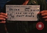
The officer in charge of a swift boat in the cabin of the boat underway in a river in Vietnam.
Swift Boats at An Thoi in Republic of Vietnam (RVN). A Swift Boat underway in a river. An island in the background. Small islands in the far background. The Swift Boat on a high speed run. Steam and water sprays in the foreground. The officer in charge of the Swift Boat in the cabin of the boat. He uses the communications mike in the cabin. A windshield in the background. The officer turns a wheel.
Captain Shepherd and Lieutenant F.D. Scovel fire an M-70 grenade launcher in Vietnam.
Swift Boat 'Point Grey' underway in Vietnam. A hilly shoreline in the background. A small island in the far background. A PCF-3 Swift Boat is docked at a pier at An-Thoi area. Captain Shepherd (U.S. Navy) on wooden dock area being instructed in firing of M-70 grenade launcher. The captain fires a grenade and lowers his gun. Lieutenant F.D. Scovel fires an M-79 launcher. Two Vietnamese look on. A harbor area in view. A small island in the far background. Lieutenant F.D. Scovel fires a grenade. Captain Shepherd fires the M-79 grenade launcher. The grenade strikes the water. The Swift Boat at the pier.
U.S. light aircraft L-5 Sentinel picks up U.S. officers on a beach in Philippines during Philippines Campaign of World War II.
Philippines Campaign in Philippines during World War II. U.S. light aircraft L-5 Sentinel in flight over a water body in Philippines Island. The shoreline in view. The aircraft in flight over the wooded region. The aircraft in low flight over the beach area on the island. Two U.S. officers on the beach. The aircraft lands on the beach. The officers with their baggage board the aircraft. The L-5 takes off from the beach. The aircraft in flight.
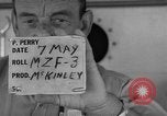
A sailor hands documents to a man working on a typewriter aboard USS Mount McKinley AGC-7 underway in the Pacific Ocean.
Activities aboard USS Mount McKinley AGC-7, serving as press observer ship for nuclear tests in the Pacific Ocean. A reporter works on a portable typewriter,on deck. A sailor hands documents to him. Animated map of the places in vicinity of Bikini atoll. Namu is circled with pencil. Aerial view of the island. Reporters come aboard the ship and the Captain greets them. Two reporters converse with the Captain. Several other reporters stand and chat on the deck. They discuss their credentials. One shows his identification card which reads "Uncleared Observer Program". A B-52 strategic bomber flies low over the ship. Another aircraft flies low over the ship. A group of reporters stands on the deck. Aerial view of island with target drawn on it.
Prosecutor Major Joseph D. Bryan reads a testimony during the World War II war crime trials in Ludwigsburg, Germany.
World War II war crime trials in Ludwigsburg, Germany. Trucks arrive at Ludwigsburg Palace. Witnesses and court personnel arrive and leave the palace. Vehicles lined up in the parking outside the palace. A truck arrives at the palace and prisoners exit the truck. The defendants are appearing for trial for killing seven U.S. airmen captured on Borkum Island after their aircraft crashed there on August 4, 1944. In the courtroom prosecutor Major Joseph D. Bryan reads a testimony. Three of the seven judges Colonel Barden, Colonel Jackson and Colonel Hicks are seated. Investigation officer Major Levine points out locations on a map of Borkum Island. Chandeliers hanging from the ceiling.
German fire fighters demonstrate their capabilities on the Lustgarten plaza, beside the Old Museum and the Berlin Cathedral
German fire fighters in Berlin, Germany on Museum Island. On the Lustgarten parade area of Museum Island (Museumsinsel) the firemen demonstrate fire fighting techniques and equipment outside the Old Museum building (Altes Museum) and the Berlin Cathedral (Berliner Dom). Fire brigade trucks move out from positions outside the Old Museum, toward the Berlin Cathedral. They stop in front of the Cathedral and in synchronized fashion they raise the ladders high into the air. A fireman operates a crank to turn on water, while standing in a small boat. Fire fighters standing in a line with hoses direct a flood of water from combine hoses southward from the Old Museum, high into the air, raining down into the Lustgarten in front of the Berlin Cathedral. Includes German narration and ambient background sound from the scene.
CRITICALPAST.COM: About Us | Contact Us | FAQs - How to Order | License Agreement | My Account | My Lightboxes | Shopping Cart | Advanced Search | Featured Collections | Website Terms & Conditions | Privacy Policy ©2026 CriticalPast LLC.
License Agreement |
Terms & Conditions |
Privacy Policy
©2026 CriticalPast LLC.