


 Francais
 Deutsch
 Italiano
Refine Your Search
Goodenough Island New Guinea 1943 stock footage and images
- Showing 457 to 462 of 13636 results more
more Hide
Hide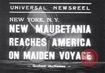
New ship Mauretania arrives in New York on its maiden voyage.
New ocean liner RMS Mauretania (1938) arrives in New York on its maiden voyage. A small ship escorts Mauretania. Aerial view of the Mauretania. People on the ship and photographers click photos of the Captain of the ship. Many ships in New York harbor near the Mauretania. Captain using binoculars to view the scene. Scene in New York harbor from aboard ship of the Statue of Liberty and New York city. Close up view of steam coming out from one of the ship stacks. Aerial views of the Mauretania and Manhattan Island skyscrapers, and New York harbor.
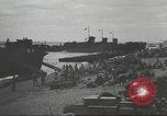
U.S. forces prepare for attack against Japanese forces on Munda, readying supplies, troops, and aircraft.
Planning and moving of U.S. equipment, supplies, aircraft, and soldiers in preparation for attack at Munda Point on New Georgia Islands, Solomon Islands during World War 2. U.S. Marines and infantry massed up on Guadalcanal beach prepare for the invasion of Munda Point. Gasoline barrels are rolled on the beach. Crated food in cargo nets hoisted aboard ships. Equipment is loaded onto ships. U.S. combat aircraft assemble for an aerial offensive. U.S. Army General Douglas MacArthur exits car and talks with another U.S. officer. General MacArthur, U.S. 13th Air Force Lieutenant General Hubert R. Harmon, U.S. Army Air Force General Nathan Twining and U.S. Fleet Admiral William Halsey plan the attack on Munda Point. United States Army Air Force P-40 Warhawk fighters taxi and take off from an airfield. U.S. aircraft including P-40 Warhawk, P-39 Airacobra, U.S. Navy F4F Wildcat, TBF Avenger, B-25 Mitchell and B-24 Liberator aircraft in flight heading to destroy enemy positions on Munda. Japanese aircraft seen taking off and in flight.
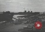
General MacArthur, General Hubert R. Harmon, Nathan Twining and Fleet Admiral William Halsey plan an attack on Munda.
The U.S. Army plans an attack at Munda Point on New Georgia group of Islands, Solomon Islands during World War II. U.S. Marines and infantry massed up on Guadalcanal beach prepare for the invasion of Munda Point. Gasoline barrels rolled on the beach. Crated and canned foods in cargo nets hoisted aboard ships. Equipment is loaded onto ships. U.S. combat aircraft assemble for an aerial offensive. U.S. Army General Douglas MacArthur gets out of car and talks with another U.S. officer. General MacArthur, U.S. 13th Air Force Lieutenant General Hubert R. Harmon, U.S. Army Air Force General Nathan Twining and U.S. Fleet Admiral William Halsey coordinate the attack on Munda Point. U.S. Army Air Force P-40 Warhawk fighter aircraft taxi and take off from an airfield. U.S. planes including P-40 Warhawk, P-39 Airacobra, U.S. Navy F4F Wildcat, TBF Avenger, B-25 Mitchell, and B-24 Liberator aircraft in flight head to destroy Japanese enemy positions on Munda. Japanese aircraft take off and in flight.
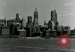
Views of Manhattan and the United Nations Headquarters Building under construction in New York City
Manhattan skyline in New York City, United States. Ship moving in New York Harbor and the East River. The Empire State Building (20 W 34th St., New York, NY 10001) and Chrysler Building (405 Lexington Ave, New York, NY 10174, United States) skyscrapers are seen. Brief aerial views above Manhattan Island. New York City skyline views. View of United Nations Headquarters building (405 E 45th St, New York, NY 10017, United States) under construction, as seen from the East River.
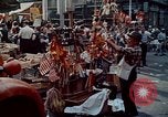
Italian influence on American life. Italian Festival San Gennaro at Mulberry Street, in New York City.
Italian influence on American life, reflected in gastronomy and history. A man selling flags and parade goods for the Feast of San Gennaro (Festa di San Gennaro) in Mulberry Street, New York City. An Italian American woman cooks Italian sausage and meats. Man holding a green parrot. Italian American woman inspects her boyfriend’s necklace. Poster reads “Feast of San Gennaro”. A man pins money on a string of cash attached to the carriage of San Gennaro. A metal effigy of San Gennaro. Italian American brass band. Italian chefs prepare and cook pizza at a restaurant kitchen. Exterior view of Marconi Restaurant signage in Little Italy. Views of Ferris Wheel; . decorative lights; a brass band. A chef rolls and toss a pizza dough by hand. Waiter takes a bottle of Chianti from the restaurant bar. Chef sprinkles cheese on a Pizza Margherita. Customers eating pizza in restaurant. A woman eats pizza while a man pours a glass of Chianti. Man and woman put napkin on dog and feed him pizza. A Casino. View of “Larry’s Bar” sign. View of George Washington Bridge over the Hudson River. Heroic sculpture of Italian explorer and navigator Giovanni da Verrazzano (c. 1485-1528) by Ettore Ximenes (1855–1926) in Battery Park, New York City. Home of Giuseppe Garibaldi, on Staten Island, New York. Visitors enter the home, which displays sign reading: (in Italian)" He lived in exile, 1851 to 1853. Giuseppe Garibaldi, Hero of two worlds." View of statue at Christopher Columbus Memorial Fountain, Columbus Circle. in front of the Union Station, Washington, DC. Italian Carabinieri march in Columbus Day parade on 5th Avenue, in New York City. Italian and American flags displayed on building. St. Patrick's Cathedral is seen. Italian journalists at work in Washington, DC and New York City. An Italian journalist speaks about his experience as a journalist in New York City.
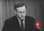
Vice President Nixon and Senator Kennedy debate over Quemoy and Matsu issue prior to presidential elections in the U.S.
The fourth presidential election debate held between Democratic nominee Senator John F. Kennedy and Republican nominee U.S. Vice President Richard Nixon in New York, United States on 21st October 1960. ABC News correspondent Quincy Howe speaks during the debate and allows NBC correspondent John Chancellor to pose a question to Richard Nixon a . Correspondent Chancellor asks a question about Quemoy and Matsu issue. Vice President Nixon points out inconsistency of Senator Kennedy. He further explains it by saying that Senator Kennedy signed a resolution in 1955 which gave the president the power to use United States forces to defend Formosa (Taiwan) and offshore islands. But he also voted for an amendment which was lost, an amendment which would have drawn a line and left out those islands. Vice President Nixon supports President Eisenhower's position. Correspondent Howe asks Senator Kennedy to comment on the topic. He speaks about President Eisenhower sending a mission to persuade Chiang Kai-shek in the spring of 1955 to withdraw from Quemoy and Matsu because they were exposed. The President was unsuccessful. He refers to the fact that in 1958, as a member of the Senate Foreign Relations Committee, he was very familiar with the position that the United States took in negotiating with Communist China (PRC) on these two islands. He further that the U.S. was unable to persuade China's Chiang Kai-Shek to withdraw and thus it was decided by the U.S. to defend the islands.
CRITICALPAST.COM: About Us | Contact Us | FAQs - How to Order | License Agreement | My Account | My Lightboxes | Shopping Cart | Advanced Search | Featured Collections | Website Terms & Conditions | Privacy Policy ©2026 CriticalPast LLC.
License Agreement |
Terms & Conditions |
Privacy Policy
©2026 CriticalPast LLC.