


 Francais
 Deutsch
 Italiano
Refine Your Search
Greek-Civil-War stock footage and images
- Showing 8467 to 8472 of 27484 results more
more Hide
Hide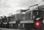
The problem of getting U.S. supplies from Calcutta to Santahar through rail road lines during World War II.
A film based on problems of getting U.S. supplies to China from Calcutta, India during World War II. U.S. trucks and jeeps parked at U.S. 28th Air Depot in Calcutta. Indian laborers unload supply crates from the trucks. The supply crates are transported to a dock. A barge at a dock in the Hooghly River. The laborers unload crates from a truck onto a rail road car. A train heads for Santahar. Native laborers unload supplies from the train in Santahar. Heavy trailers on flat rail road cars. The laborers carry gasoline drums on poles. They work around railroad tank cars. The laborers load boxcars with supplies.
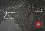
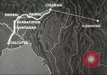
The problem of getting U.S. supplies from Parbatibur in Bangladesh to Chabua in Assam, India during World War II.
A film based on getting U.S. supplies to China from Calcutta, India during World War II. An animated map highlights Calcutta in India, Santahar and Parbatipur in Bangladesh. A train loaded with U.S. jeeps and trucks. The trucks and a jeep driven onto flat railroad cars. A train moves on a track. U.S. troops board boats on the banks of the Brahamputra River and are ferried to Pandu. A barge loaded with railroad cars moves towards the ferry point of Pandu. An animated map connects Parbatipur with Dhubri, Pandu and Chabua. Chabua is ultimately connected to Kunming in China. U.S. troops sort and unload supplies at Chabua satellite field.
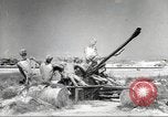
U.S. Army Air Force transport aircraft used for shuttle services in Chabua, India during World War II.
A film based on getting U.S. supplies to China from Chabua, India during World War II. A dummy antiaircraft emplacement at Chabua airfield. Gun crew around artillery gun at the field. Drums are rolled out from railroad cars. Fuel is poured into containers from the drums. Indian laborers at work. Bombs at a munitions dump. Native laborers unload crates from a truck and load them into U.S. Army Air Force C-46 Commando transport aircraft parked at Chabua airfield. A trainer plane and an ambulance are loaded aboard a C-46. The laborers roll bombs into the aircraft. C-46 taxi on the airfield for take off. Fuel barrels at Chabua airfield. A USAAF C-87 Liberator Express transport plane lands at Chabua airfield. Supply crates loaded aboard the C-87.
U.S. Army Air Force transport aircraft carry supplies over the Himalayan Mountains to Kunming during World War II.
A film based on getting U.S. supplies to Kunming, China from Chabua, India during World War II. An animated map links Chabua with Kunming. A USAAF (United States Army Air Forces) C-87 Liberator Express in flight over the Hump. An aerial view of the Himalayan Mountains. A USAAF C-54 Skymaster in flight. An animated representation of the content of materials carried by an aircraft over the Hump. USAAF transport planes land at Kunming in China. An animated map depicts the transportation condition over the Burma Road in January 1941 and by air over the Hump in January 1944. Dispersal of cargo and U.S. troops to various fighting fronts from Kunming. A transport aircraft takes off from Kunming. Chinese troops march. U.S. Army General Joseph Stilwell with U.S. Lieutenant General Claire Chennault in Kunming. A formation of transport planes.
U.S. 13th Air Forces B-17 Flying Fortress bomb Japanese airfield on Munda Point, New Georgia during World War II.
A film titled 'Air Aspects of the Campaign against Munda' based on USAAF (United States Army Air Force) activities on New Georgia group of Islands, Solomon Islands during World War II. USAAF P-38 Lightning in flight over the Solomon Islands. An animated map highlights Munda Point in New Georgia. A USAAF officer takes a look at aerial reconnaissance photographs. The officer talks over a phone at his desk. An animated map highlights Vila in Kolombangara. An animated map connects Vila and Munda Point with Henderson Airfield on Guadalcanal. U.S. 13th Air Forces B-17 Flying Fortress bombers take off from an airfield and bomb Japanese airfield at Munda Point.
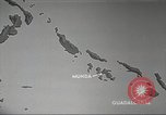
U.S. 13th Air Force plans an attack on Japanese locations on the Solomon Islands during World War II.
U.S. Army Air Forces plans an attack at Munda Point on New Georgia group of Islands, Solomon Islands during World War II. An animated map highlights locations from where the attack is to be launched and the Japanese locations to be attacked including Munda, Ballale Island, Vila, Kahili, Buka and Rabaul. Aerial views of various U.S. air bases on the Solomon Islands. U.S. aircraft in flight. An animation depicts the air cover for U.S. convoy moving between New Georgia and Guadalcanal and the need for fighter patrol. An animated map depicts air attack on Japanese land positions to neutralize air bases and disrupt shipping. The map also depicts direct cooperation of tactical group without ground forces to attack concentrated Japanese troops.
CRITICALPAST.COM: About Us | Contact Us | FAQs - How to Order | License Agreement | My Account | My Lightboxes | Shopping Cart | Advanced Search | Featured Collections | Website Terms & Conditions | Privacy Policy ©2026 CriticalPast LLC.
License Agreement |
Terms & Conditions |
Privacy Policy
©2026 CriticalPast LLC.