


 Francais
 Deutsch
 Italiano
Refine Your Search
Herne Germany 1945 stock footage and images
- Showing 8419 to 8424 of 10462 results more
more Hide
Hide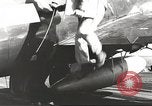
United States Navy warships underway in the China Sea during World War 2
Reconnaissance photographs removed from an aircraft on board United States Navy carrier underway in the China Sea during World War II. Officers analyze the photographs. Ships in the rough sea as waves crash over the flight deck. Aircrafts take off from carrier in typhoons. Oil refineries bombed in Saigon, Vietnam (Indochina) as smoke rises from them. Japanese warships and ammunition ship burn after blow up. Plane makes a crash landing on board an aircraft carrier.
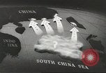
United States plane strafe Japanese ships and aircrafts along the Chinese coast
A map shows movement American troops towards Chinese coast. American aircrafts drop bombs over Japanese positions and strafe warships. Japanese planes shot down by America. United States Navy warships underway in the south China sea. (World War II period).
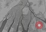
Destroyed buildings in an aftermath of atomic bomb explosion, Hiroshima, Japan
A map shows the epicenter of atomic bomb explosion in Hiroshima, Japan. Rubble covered area, one kilometer away from the epicenter. Concrete buildings completely destroyed and steel structures bent and distorted. (World War II period).
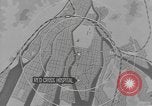
Destroyed Red Cross hospital in an aftermath of atomic bomb explosion, Hiroshima, Japan
A map shows the location of Red Cross hospital and its distance from the epicenter of atom bomb explosion in Hiroshima, Japan. Broken windows and rubble of the destroyed Red Cross hospital. Map shows location of Hiroshima Gas Company and the destroyed building. Former Imperial Headquarters building completely destroyed by atomic bomb explosion. Rubble covered area. (World War II period).
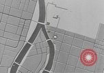
Undamaged Torri Gateway in an aftermath of atomic bomb explosion, Hiroshima, Japan
A map shows the location of Chamber of Commerce and industry building and Commerce and industrial exhibits building and their distance from the epicenter of atom bomb explosion in Hiroshima, Japan. Torri Gateway stands undamaged amidst bomb wreckage. Chamber of Commerce destroyed and industry building with destroyed parapets. Commerce and industry exhibits building with a destroyed dome shaped roof. A group of Japanese researchers of Nippon Iga Sha arrive in a truck and inspect the damaged buildings. (World War II period).
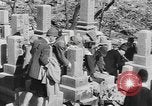
Damaged Ai-oi and Motoyasu Bridge in an aftermath of atomic bomb explosion, Hiroshima, Japan
A group of Japanese researchers of Nippon Iga Sha inspect the damaged buildings and make note of vital statistics after atomic bomb explosion in Hiroshima, Japan, soon after the end of World War 2. A map shows the location of Ai-Oi Bridge and Motoyasu Bridge. Damaged Ai-Oi Bridge with sidewalks blown apart. View of cap stones of Motoyasu Bridge jumped out of place in opposite direction as a result of explosion with blast wave centered at bridge. Wide sweeping camera pan view of destroyed, rubble covered area with low mountains behind.
CRITICALPAST.COM: About Us | Contact Us | FAQs - How to Order | License Agreement | My Account | My Lightboxes | Shopping Cart | Advanced Search | Featured Collections | Website Terms & Conditions | Privacy Policy ©2026 CriticalPast LLC.
License Agreement |
Terms & Conditions |
Privacy Policy
©2026 CriticalPast LLC.