


 Francais
 Deutsch
 Italiano
Refine Your Search
Hurtgen-Forest stock footage and images
- Showing 367 to 372 of 753 results more
more Hide
Hide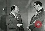
Dr Philip Hauser briefs George Stone on uses of census in United States,1960.
George Stone and Dr Philip Hauser at the presentation of United States census. A U.S. marshal in a forest with a Native American Indian. Recording of a tape is seen. Dr Philip Hauser explains the utilities of census. End of the presentation of the U.S. census,1960.

Preparing landing-zones during war in United States.
Rigger landing on ground. Firing in a forest area. Smoke and dust arise after a bomb blast. Officials shake hands with Detachment Commander in a meeting. The Detachment Commander shows them a map marked with landing-zones (LZ). Men level a LZ. Thick vegetation exists on one side of the LZ. Men remove shrubs and weeds from the LZ. A man carries another man as a piggy-bag, on the runway to check sub-soil firmness.

Animation of specificity of landing-zones in United States.
Animation showing runway specifications for landing. Specifications for landing of light and medium aircrafts during day and night are displayed. Runway length and breadth and safety area are marked in steps for various aircrafts in the animation. 25 feet strip along length of the runway is marked in the animation. A landing-zone cleared in a forest area is animated. It has 1-2 nautical miles turning zones. Mountain on one side of the runway is animated. Light and medium aircrafts along the slope of the mountain are shown in animation. Climb and glide ratios are marked for them. Safe distances of the obstruction from the runway and the permissible height of the obstruction are animated.
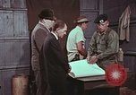
U.S. military activities to assure safe landing of aircraft in landing-zones
U.S. military training film excerpt about planning landing zones. Detachment Commander in meeting with officials. He wraps the map and men exit from the hut located in forest. A coded message carrying specifications required by Special Forces for air operations is written on a page. Map of landing-zone (LZ) is created on ground with various marks. Detachment Commander along with soldiers surrounds the map. Detachment Commander explains the landing operations to be carried out. Red chips are used to mark the stations on runway. Detachment Commander uses a stick to indicate these. RCL (Reception Committee Leader) is shown with blue chips. A soldier submits a document to an officer. Two other soldiers come to him. The officer gives the document. Detachment Commander receives a document brought by a soldier. Soldiers move on LZ and check the security. Men move on LZ. An aircraft approaches LZ. Two enemy soldiers see the air craft. One of them talks on phone. In an enemy base a soldier looks at a map. Another soldier notes down on a pad. Soldier at LZ see his watch. RCL burns a marker light lasting 4 minutes to signal the plane. The aircraft lands. Animation shows the pathway of landing taken by the aircraft on LZ. RCL man moving on runway signals approaching aircraft to parking area. Soldiers move to the parked aircraft. A signal is blown off as the aircraft takes off.
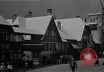
Scenes from "Midget Village" in the Chicago "Century of Progress" World's Fair.
"Midget Village" scenes at the "Century of Progress" Chicago World's Fair of 1933-1934. Buildings in the "Midget Village" which was modeled as a miniature reproduction of the ancient German Bavarian walled city of Dinkelsbühl, and staffed by three groups of midget professional performing artists: the Ritter Troupe, Rose Troupe, and the Singer Troupe. Bavarian-type building with sign reading: "The Black Forest." Visitors strolling through the area. A Hawaiian show performed on stage by midgets, who play guitars while a little person performs a Hula dance. Midgets play a "craps" dice game on the street, with wagers of silver coins tossed on the ground. Fair visitors gather around the group and watch the game, before it is broken up by a group of midgets dressed as police officers.

Animated map explains islands and mountainous range in Japan.
Animated map of Japan explains the geologic formation and the geographic placing of the Japanese islands. Japan is the land of rising sun. Animated map explains many islands in Japan. Tokyo and the Pacific Ocean drawn on the globe. Animated map shows the four main islands (from north to south) Hokkaido, Honshu, Shikoku and Kyushu in Japan. Mountain range is explained on animated map. View of forest and mountains.