


 Francais
 Deutsch
 Italiano
Refine Your Search
Hurtgen-Forest stock footage and images
- Showing 505 to 510 of 753 results more
more Hide
Hide
Canadian Dispatch riders ride motorcycles on rugged terrain during test riding in Canada.
Canadian Dispatch riders take their final cross country riding tests in Canada. They ride their motorcycles over rugged terrain and forest area. Dispatch riders ride on an open field amidst firing during test rides. (World War II period).
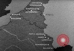
German troops advance with tanks and United States prisoners taken near Luneville in France.
German troops advance with Panther tanks near Rhine River in France. Western Front map. German soldiers on tanks move on road. German officers look at the map and converse with each other. Troops advance. Trucks move in forest area. 'Moncel-les' written on a building. United States prisoners taken near Luneville in France. German soldiers patrol on streets. Damaged buildings and debris. (World War II period).

A 15000 pound "Daisy Cutter" bomb dropped from C-130 Hercules aircraft in Vietnam War.
463rd Airlift Operations in support of humanitarian and combat operations in South East Asia. Interiors of C-130 Hercules aircraft in flight. BLU-82 bomb ("Daisy Cutter") dropped by a parachute. 15000 pound bomb explodes in thick forest area for creation of a landing zone.
Film 'Why We Fight' gives historical background to Adolf Hitler's plan of world conquest in 1930s
Film 'Why We Fight' provides historical perspective on Adolf Hitler's plan of world conquest. Image of Otto von Bismark and year 1863 is seen with quote,"We will dominate the whole world." Year 1914 and image of Kaiser Wilhelm II and quote,"God has made us for civilizing the world. Woe and death to all who resist my will." Year 1933 and image of Adolf Hitler and quote: My motto is,'Destroy by all and any means. National Socialism will reshape the world'." German eagle monument with swastika. Troops in precise large formation during Totenehrung (honoring of the dead) at the 1934 Nuremberg Rally as Adolf Hitler, Heinrich Himmler, and Viktor Lutze walk forward during the ceremony. Buglers blow and troops march at another Nazi rally. Images of military graves in a cemetery. Images of British soldiers blinded by gas attacks in World war I. Bodies of persons dead from diseases due to war. Fleeting images of destruction and grief from war, including hanged persons. Hitler at a podium flanked by Himmler. Closeups of Hitler. The buglers previously shown are seen again.Hitler standing with Viktor Lutze and Rudolf Hess. Brief images of Mongols marching and riding horses, with image of Genghis Khan. Map showing Mongolian 13th Century conquests in Asia and Eastern Europe. German Institute of Geopolitics in Munich, founded by Karl Ernst Haushofer. Closeup of Haushofer with backdrop of world map. Clerks in the institute cataloging information. German soldiers entering and studying in the institute. Brief images of economic wealth of the world, roughnecks setting pipe at an oil well, a "forest" of oil well derricks, harvested trees, steam shovels at an open pit mine, ore on a conveyer, cattle, farmers harvesting grain, flocks of sheep, and human labor. Animated map showing distribution of land area in the world and comparing Hitler's plan of conquest to that of Gengis Khan.
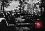
Dragon's teeth along the Siegfried Line in Germany.
The Siegfried Line in Germany. Dragon's teeth (tank traps) along the Siegfried Line. German farmers work in fields. River Rhine with barbed wire fencing in the foreground. Barbed wire fencing tied along trees. An observation tower in a forest area. View of a bunker. A diagram shows the interlocking field of fire from points of the Siegfried Line.
An aerial view of a bombing target in Europe.
Bombing missions over Europe. An aerial view of a bombing target. A mountainous terrain with a river and forests.