


 Francais
 Deutsch
 Italiano
Refine Your Search
Kiribati Gilbert Islands 1943 stock footage and images
- Showing 907 to 912 of 6730 results more
more Hide
Hide
A technical group attends a meeting to carry out investigations for U.S. Army chemical warfare tests on San Jose Island, Panama.
U.S. chemical warfare tests on San Jose Island, Panama during World War II. Close-up view of U.S. 6th Air Force B-25 Mitchell bomber flying low over islands near San Jose Island. More distant shot of formation of B-25 bombers in flight. A field located near San Jose shows a bomb dump. U.S. airmen load bombs on a bomber aircraft. A technical group consisting of U.S. NDRC (National Defense Research Committee) scientists, trained officers of United Kingdom's Army and Navy and U.S. Army Air Force officers attend a meeting in front of a chart.
U.S. Navy warships operating off the coast of Enewetak, Marshall Islands during World War II
U.S. naval operations off Enewetak Island in the Marshall Islands during World War 2. A Vought OS2U Kingfisher float plane, with sailor standing in its cockpit, is hoisted on a crane. Camera focuses on a U.S. Porter Class Destroyer moving to the right, and then pans astern, to another one headed in the opposite direction and several destroyer escorts. Next, a Northampton CA class heavy cruiser is seen. Closeup of 3-inch being fired aboard a warship. Scene switches to Five-inch 25 caliber guns being fired from Northampton class cruiser. Camera pans horizon. Scene shifts to deck of Northampton CA class cruiser and catapulting of its OS2U Kingfisher observation plane. Smoke rising from Naval gunfire striking the island. landing craft seen in the water. Image temporarily obscured by heavy smoke.
The ship passes Hannibal Victory Diamond Head in the Hawaiian Islands and joins a large convoy anchored at Eniwetok.
The sea voyage of the victory ship Hannibal Victory from San Francisco to the Philippine Islands during World War II. The ship underway in the Pacific ocean. A man standing at the deck of the ship. Animated map locates the Hawaiian Islands and Eniwetok. The ship passes Diamond Head in the Hawaiian Islands. It joins a large convoy anchored at Eniwetok.
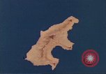
Animated map shows a mountainous ridge and a road network in Saipan, Mariana Islands.
Animated map gives geographical details of Saipan, Marian Islands. A mountainous ridge across the island shows Mount Topatchau, Mt. Marpi, Mt. Kagman and Mt. Nafutan. The map shows the Charan-Kanoa Marsh. Animation shows sugarcane plantations across the island. A road network shows Karaberra Pass, Flores Point, Charan Kanoa. Pictures of Japanese civilians in Kanoa.
Animated map show U.S. forces landing on Saipan, Mariana Islands.
Animated map shows Saipan, Marian Islands. Animation shows U.S. forces acquiring the island from the Japanese during World War II. Advancement of Task Force 56. The 77th Infantry Division at Oahu. The 2nd and 4th Marine Division land on the island on the orders of a United States General. Animation shows the 37th Division troops landing on a beachhead from ships.
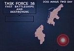
Animated map U.S. forces approaching and bombarding a beachhead in Saipan, Mariana Islands.
Animated map shows Saipan, Marian Islands. Animation shows U.S. forces acquiring the island from the Japanese during World War II. Advancement of Task Force 58 with battleships and destroyers. Animation shows bombardment by Group 1 and Group 2 on the island. Fire Support Units fire at the Japanese. The gun boat support group advances towards the beach.
CRITICALPAST.COM: About Us | Contact Us | FAQs - How to Order | License Agreement | My Account | My Lightboxes | Shopping Cart | Advanced Search | Featured Collections | Website Terms & Conditions | Privacy Policy ©2026 CriticalPast LLC.
License Agreement |
Terms & Conditions |
Privacy Policy
©2026 CriticalPast LLC.