


 Francais
 Deutsch
 Italiano
Refine Your Search
Kiribati Gilbert Islands 1943 stock footage and images
- Showing 1723 to 1728 of 6726 results more
more Hide
Hide
United States F4U and F4F aircraft at Henderson Field on Guadalcanal Island during World War II
United States Navy TBF Avenger aircraft in formation over Quadalcanal during World War 2. Ground crew works on U.S. F4U Corsairs. Pilots converse 'Nylorac' written on an F4F Wildcat plane number 17. F4U Corsair taxis and in flight. F4F Wildcat stand in line on field, one plane is named 'Susan'. A pilot gets out of a F4F plane. A gas truck passes. TBF Avenger aircraft in large formations overhead.
United States Navy destroyers tied up together in Guadalcanal, Solomon Island during World War II.
United States Navy ship underway in Pacific Theater during World War II. A United States YP-415 underway with the shoreline in the background. United States Navy light cruiser anchored at the harbor. A harbor at Guadalcanal. A pig with a flag floats onto the water surface. Overcast sky at dusk. Two United states Navy destroyers tied up side by side at the harbor.
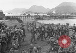
Canadian troops preparing for deployment in the Aleutian Islands during World War II.
Canadian troops preparing for transport in WWII. In the background there is a body of water with a pier and ships off in the distance, and even further behind that some mountains. More Canadian soldiers marching. Closeups of a few soldiers sitting on a dirt embankment, mostly seeming to be in good spirits. Troops walking across a pier with transport ships in the distance. Most soldiers have full packs, equipment, and rifles. Soldiers boarding transport ship, each handing his identification slip to an officer before boarding. Closeup of identification slips carefully handled by the officer. Closeup of officer's face. Troops with full packs and equipment cross gangway onto transport ship.
An aerial view of the crowded seashore of Long Island New York, United States.
Scorching summer heat and great humidity drive millions of people to the Long Island seashore and other watering places. An aerial view of the crowded Long Island seashore in New York, United States. Crowds of people on a Long Island New York beach. Children frolic in fountains under streams from fire hydrants.

Animated map explains islands and mountainous range in Japan.
Animated map of Japan explains the geologic formation and the geographic placing of the Japanese islands. Japan is the land of rising sun. Animated map explains many islands in Japan. Tokyo and the Pacific Ocean drawn on the globe. Animated map shows the four main islands (from north to south) Hokkaido, Honshu, Shikoku and Kyushu in Japan. Mountain range is explained on animated map. View of forest and mountains.
The Battle off Samar near the island of Leyte in the Philippines on 25th October 1944.
Shows the Battle off Samar which was the central action of the Battle of Leyte Gulf. It took place in the Philippine Sea off Samar Island near the island of Leyte in the Philippines on 25th October 1944. Animated map shows advancement of U.S. armed forces on Leyte Island. An Allied fleet of destroyers and escorts shown on map. USS Fanshaw Bay is their flagship. Signal-man intercepts Japanese communication relays in a Combat information center. Shows naval battle between Allied and the Japanese armed forces. (World War II period).
CRITICALPAST.COM: About Us | Contact Us | FAQs - How to Order | License Agreement | My Account | My Lightboxes | Shopping Cart | Advanced Search | Featured Collections | Website Terms & Conditions | Privacy Policy ©2026 CriticalPast LLC.
License Agreement |
Terms & Conditions |
Privacy Policy
©2026 CriticalPast LLC.