


 Francais
 Deutsch
 Italiano
Refine Your Search
Kiribati Gilbert Islands 1943 stock footage and images
- Showing 2851 to 2856 of 6726 results more
more Hide
Hide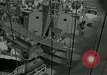
SOC Seagull biwing seaplane being catapulted from warship during Peleliu campaign in World War II
U.S. Naval bombardment of Peleliu island in Palau, Pacific ocean, during World War 2. A scout and observation (SOC) Seagull floatplane is catapulted from the heavy cruiser, USS Portland, CA-33.
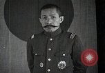
Japanese film using various kinds of imagery and analogies to illustrate Japan's National frustrations in 1933.
General of the Imperial Japanese Army Baron Sadao Araki speaks for a while, with the National flag of Japan (Sun-mark flag) in the background. A group of Japanese hikers is seen on the windy slope of a snow-covered mountain. Camera pans across the snowy scene. Closeups of individual hikers, who seem intimidated by the prospect of continuing their journey. Next, they are seen climbing the mountain, using picks, and lifelines, in an experienced manner. As the leader reaches the summit, he secures their lifeline and assists those behind as they arrive. Shadow of the leader is cast on the snow at the summit. As they cross a Crevasse, one of the climbers falls in, but his descent is stopped by the lifeline. Others work securing the line and pulling him up. With their help, he gains footing up the side of the crevasse and climbs out. Scene shifts completely to the Palace of Nations, Geneva, Switzerland, home of the League of Nations. Inside, Japan's chief delegate, Foreign Minister Yosuke Matsuoka, is seen objecting to the League's report charging Japan with responsibility for the hostilities in Manchuria. Animated map shows Europe with arrow pointing to Geneva, Switzerland. A cartoon explosion rises there and drifts East to encircle Japan in its smoke, transforming into a steel chain around Japan and environs. It shrinks, successively tightening its grip, choking Japan into its home islands, where the Japanese national Sun-mark flag flies. A train arrives at a crowded station. The crowd contains many persons displaying protest banners and waving small Japanese National flags. Many police are amongst the crowd, maintaining order. Next, Minister of Foreign Affairs, Yosuke Matsuoka, arrives from Geneva to report to the Emperor and Government. He steps from a limousine, and walks across an esplanade, followed by many officials. He and they, all bow toward the Imperial Palace, as a photographer takes their picture. For a moment, Yosuke Matsuoka holds a handkerchief to his face as he proceeds across the esplanade. The animated map appears again, this time showing the encircling cartoon smoke ring looping out to enclose part of Manchuria, where the flag of Manchukuo now flies. Scene shifts back to the mountain climbers, who now are descending from the summit. View of clouds below them as they stand with arms raised celebrating their accomplishment with what appears to be three "Banzai" shouts. Final scene is a view from moving railroad train of Mount Fuji and other views of Mount Fuji.
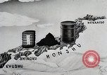
Japanese natural resources related to Second Sino-Japanese war and World War II
Animated map illustrating shortage of indigenous raw materials in Japan. As stockpiles vanish during Second Sino-Japanese war, Japan's domestic sources supply only 10% of the nation's needs for war. Animated sequence shows lack of steel, aluminum, copper, and power generation for the conduct of war. But one of the nation's greatest resources is the population of skilled Japanese workers, who are shown at various high tech jobs, as well as on the farms and in the fishing industry. Japanese workers are seen who work for the Zaibatsu (four ruling families of Japan). Banks of Japanese women typists and women in a factory. Young women painting faces on a "Kewpie doll." A Japanese family at dinner time. Women engaged in fabric spinning. Animated graphic illustrates Japan's war-related resources for World War 2, by showing a Japanese soldier standing astride map of Japan with lines extending to sources of needed raw materials from Japanese possessions in Korea, Manchuria,Formosa, China,Indochina,Malaya, and its network of Pacific Islands. Final scene displays copy of Los Angeles Times newspaper with headline reading: "Jap Supply Lines Blasted." It also features a story that appears to refer to the U.S. 6th Army invasion of Leyte in the Philippines, in October, 1944 (when General MacArthur waded ashore and stated,"I have returned"). (Note: Although produced during World War 2, this film shows prewar scenes of Japan. The animated illustrations and maps and, of course, the newspaper shown at the end, date from World War II.)
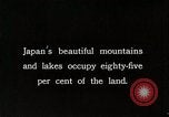
Maps depict Japanese-occupied countries and other countries colonized by Western colonial powers in Asia; Ships docked in port in Japan
Mountains and lakes in Japan. A pair of islands in a lake. Boats sailing on a lake in Japan. Snow-capped mountains in Japan. A lake near a forest. Map depicts the main industries in Japanese-occupied areas- Korea and Manchuria. Map of Asia showing the countries occupied by Western colonial powers. Japanese Navy ships docked in a port. A ship sailing past a port with smokestacks. An actor acting out Jesus in the Sermon on the Mount. A Japanese woman puts her infant child on her back.
Skiing in the premises of Touou Gizyuku High School, Hirosaki-City, Aomori-Prefecture, Japan
Both of American and Japanese children ski on snow in the premises of Touou Gizyuku High School near the residence for foreign teachers hired by above High School in Hirosaki-City, Aomori-Prefecture, Nothern Part of Honshu Island, Japan. Japanese man on a sleigh pulled by horse on the street near Hirosaki Castle. The donjon of Hirosaki Castle covered with snow. Japanese school teachers and boys enjoy skiing in during winter season. The Peak of Mt. Iwaki covered with snow. Young Japanese boys take turn to ski down from snow covered slope of the roof top of the school building of Touou Gizyuku High School. Goods carried on a sleigh pulled by horse on snow. Film shot in approximately 1934-35.
Japanese actions leading to 2nd Sino-Japanese war and attack on United States at Pearl Harbor in World War II
Japanese army officers examining foreign military equipment. A Japanese worker employing electric drill developed in a Western country. The Japanese freighter, Tatsuno Maru, loading scrap iron at a port in the United States. Other Japanese freighters loading coal and oil for shipment back to Japan. View of the Washington Naval Conference in Memorial Continental Hall, Washington, DC, held in 1921-22 and again in 1927 and 1930, to deal with several lingering issues. Glimpse of Japanese people holding flags while gathered near the Imperial Palace in Tokyo. Glimpse of Japanese army troops on parade. Japanese Navy warships at sea. A fleet of Japanese Mitsubishi G3M bombers and Nakajima Ki-27 pursuit planes, parked on an airfield. A loose formation of Ki-27s airborne. Animated map illustrates Japanese fortification of Mariana, Caroline, and Marshall islands in the Pacific. Animated map illustrating China's greater size and population vis-a-vis Japan. Animated map illustrating Japanese occupation of Manchuria in 1931. New York Times newspaper with headline "Japs Seize Manchuria" hovers over fires burning in Manchuria. Other newspaper headlines reporting on Mussolini's invasion of Ethiopia; the Spanish civil war; surrender of Czechoslovakia; invasion of Poland; assaults on France, Belgium, and the Netherlands by Nazi Germany; the London Blitz; and Nazi advances against Russia on the Eastern Front. Fnally, a Boston Hearald extra edition headline reports: "Pearl Harbor Bombed." A still photograph of Japanese Baron Tanaka Giichi (on left) with two other dignitaries, circa 1929. Japanese infantry streaming into Manchuria and then celebrating as they walk into local town. A busy street in a Chinese city. Japanese soldiers in Manchuria escorting local prisoners along a street. Animated map illustrating Japananese warships surrounding harbor of Shanghai, China. View from a Japanese ship bombarding Shanghai. Smoke rising from shell striking on Shanghai waterfront. View from land of severely damaged buildings on a street, and a shell exploding in background, as Chinese defenders move to successfully repel the Japanese forces. New map illustrates subsequent Japanese move, annexing Jehol, from occupied Manchukuo, and Korea. Japanese troops entering a town in Jehol. Sun newspaper headline: "League Censures Japan." Chinese diplomat protesting at League of Nations. Japanese troops exiting railroad trains in Jehol. Aisin Gioro Puyi aka Henry Pu Yi, Kangde Emperor (Kang-te Emperor) of the Japanese puppet state of Manchukuo, is seen saluting Japanese troops on parade. Closeup of Puyi wearing shaded glasses, looking directly into the camera. chiang Kai-shek, with other Chinese officers. Reenactment of barbarian forces riding against China and thwarted by the Great Wall. Many Chinese walking in a long line along the Great Wall. Map tracing the Great Wall across China. Aerial view of the Great Wall from overflying airplane. Japanese troops marching through a city gate; infantry climbing a sheer cliff; and helmeted Japanese soldiers marching past civilians in a city. Map illustrated progress of Chinese unification by year 1937. Japanese officers conferring during occupation. Japanese troops leave a barracks, riding in open trucks. A line of the troop trucks moving along the dirt street of a town. The troops climb from their trucks in the town.
CRITICALPAST.COM: About Us | Contact Us | FAQs - How to Order | License Agreement | My Account | My Lightboxes | Shopping Cart | Advanced Search | Featured Collections | Website Terms & Conditions | Privacy Policy ©2026 CriticalPast LLC.
License Agreement |
Terms & Conditions |
Privacy Policy
©2026 CriticalPast LLC.