


 Francais
 Deutsch
 Italiano
Refine Your Search
Kiribati Gilbert Islands 1943 stock footage and images
- Showing 3223 to 3228 of 6726 results more
more Hide
Hide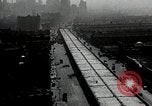
Miller Highway, the first elevated highway, under construction in New York City, United States.
Ground and aerial views during construction of the Miller Highway on the west side of Manhattan Island in New York, United States. It was named after Julius Miller, the President of New York's Manhattan Borough from 1922 to 1930. It was also known as the West Side Elevated Highway or the West Side Highway. It was the first elevated highway in the United States. The elevated highway under construction. Men work on the highway. Sections also designated NY Routes 9A and NY 27A. The Miller Highway was shut down in 1973 and largely dismantled in 1989.

Atlas and Thor missiles at the Vandenberg Aerospace Air Force Base in California, United States.
Missile development and build up facilities at Vandenberg Aerospace Air Force base in California, United States. Atlas Intercontinental ballistic missile (ICBM) on a launch pad at the air base. Airmen around the Atlas missile. Shrouded Atlas missile on a trailer as it drives past a sign that reads ' Vandenberg Air Force Base, Pine Canyon gate ¼ mile ' . Atlas checkout building as airmen work on the missile. Thor intermediate range ballistic missile raised on an a launch pad. Officers talk on the launch pad of Thor missile. U.S. and British RAF airmen work around the missile. Atlas missile on the launch pad. Thor Agena missile being launched. Scene shifts to explosion of Hydrogen bomb in test at Eniwetok, Marshall Islands, in 1952.
A project to review methods of attack against Japanese-type fortifications at Dugway Proving Ground, Utah.
Coverage of project to determine the most effective means for destroying Japanese-type cave positions at Dugway Proving Ground, Utah. Paper with typewritten introduction. U.S. Air Force P-38 Lightning fighter aircraft in a napalm incendiary bomb attack. U.S. B-25H Mitchell bomber fires 75mm cannon and U.S. Army Air Force P-47N Thunderbolt fighter aircraft fires 11.75 inch Tiny Tim rocket at targets on hillside. Mountainous terrain and caves similar to Japanese positions on island. Tall Boy (12,000 pound HE bomb) being hoisted from a trailer. U.S. P-38 parked with napalm bombs under wing. P-47N with 11.75 inch Tiny Tim rocket on launcher rail. U.S. Army Air Forces A-26 Invader bomber plane in flight and fires Tiny Tim rocket. Ordnance men load 75mm rounds into B-25H equipped with APG-13B radar ranging device. Gun crew fires 105mm howitzer at hillside. (World War II period).

Influx of foreign immigrants add to total population in Northeastern States of the United States.
Animated map of Northeastern United States bounded with Middle States and Southeastern States. Map depicts geographical condition of Northeastern States. Map marks States of Maine, New Hampshire, Vermont, Massachusetts, Rhode Island, Connecticut, New York, New Jersey, and Pennsylvania. Map shows Northeastern settlement during colonial period by Scotch, English, Dutch, Germans, and Swedes. Also shows influx of French Canadians during early 19th century and immigrants from different countries occupying urban Northeastern centers. Map explains the population occupying region.
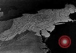
Animated map of Northeastern United States depicts dairy farming as the main agriculture, United States.
Dairy farming as main agricultural activity in Northeastern United States. Animated map of Northeastern States marks large metropolitan area consuming milk in a vast amount. Tank trucks move along road on their way to railroad shipping points and urban centers. Cattle graze at a field. Ducks in a poultry farm. Map marks growth of potatoes in Maine and Long Island. Apple growing areas in Middle States.
Bombing of Tokyo by United States 21st Bomber Command's B-29 Superfortresses during World War II.
View of B-29 superfortress aircraft, of 21st Bomber Command,flying over Tokyo,Japan, with Mount Fujiyama clearly visible. Bombs falling from the B-29s. Near ground view of street and smoke rising from bomb strikes. In Washington, DC, General Henry (Hap) Arnold, Chief of Staff of the U.S. Army Air Forces, and Lieutenant General Hoyt S. Vandenberg, Assistant Chief of Staff , give a sendoff to crew of a XXI Bomber Command B-29 bound for the Pacific Theater. The B-29 crew write a message in chalk on a bomb, reading: "To the Warlords of Japan. We have not forgotten--the B-29s will remind you Again and Again and Again!!!" Views of the city of Tokyo, Japan, showing streets, buildings, cars and pedestrians. Animated map fades to Saipan Island. B-29s of the 21st Bomber command,73rd Bombardment Wing, 497th Bombardment Group,landing at Isley Field, Saipan, watched by airmen at the base. Animated map showing B-29 access to Japan, itself, from Saipan.Formation of B-29s in flight, and bombs falling over Japan.
CRITICALPAST.COM: About Us | Contact Us | FAQs - How to Order | License Agreement | My Account | My Lightboxes | Shopping Cart | Advanced Search | Featured Collections | Website Terms & Conditions | Privacy Policy ©2026 CriticalPast LLC.
License Agreement |
Terms & Conditions |
Privacy Policy
©2026 CriticalPast LLC.