


 Francais
 Deutsch
 Italiano

Refine Your Search
Kiska Aleutian Islands Alaska 1944 stock footage and images
- Showing 715 to 720 of 9862 results more
 Hide
Color Sound
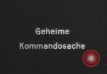
Animation shows how steam launches V-1 glide bomb via catapult (WW2)
Title card says “Geheime Kommandosache” (“Secret commando operation” in English). “Erprobungsstelle der Luftwaffe Karlshagen” (“Test site of the Air Force Karlshagen” in English). “Flakzielgerät 76 Schnittautnahmen und Trick 6.+9.1.1944” (“Flak target device 76 cut recordings and trick 01/6-9/1944” in English). Close up of Argus engine on V-1 glide bomb as it starts, with variable intake compensating between jet pulses. Animation demonstrating how steam propels the V-1, with arrow pointing at the piston being pushed by steam within the Walter catapult. Various views of the Walter catapult ramp, including an unusual view from below the launch ramp as a V-1 buzz bomb is launched during World War II.
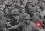
Allied forces fighting in naval battles, Normandy landing and aerial view of Normandy (WW2)
Soldiers form a human barricade to make way for important Allied military officials such as General Jacques Philippe Leclerc (Free France), United States General Omar Bradley and British Field Marshal Bernard Montgomery. United States General Omar Bradley walking during World War II. United States General George Patton uses a pair of binoculars. United States Army conducts mopping-up operations in a destroyed French town. United States infantry move through a forest. Soldiers walking on a street. Television host Alexander Scourby narrates while holding a book titled “Breakout and Pursuit” by Martin Blumenson. An excerpt of the book “Breakout and Pursuit”. United States, British and Canadian troops engage in a naval battle with German forces on the English Channel July 1, 1944. Gun turrets of battleship aiming and firing at German position. Battleships firing artillery. Thick smoke forms from heavy firing from naval artillery. Soldiers climbing down a marine rope ladder. Smoke covers the Normandy coast after Allied ships fired at German positions. Allied infantry wade through the waters after landing near a beachhead in Normandy on D-Day June 6, 1944. Famous shot of some soldiers collapsing after reaching the beachhead after landing. Some soldiers attempt to swim to reach the beach. Smoke forms away from the beach. A line of Allied infantry wade through the beach. A barrage balloon floats over a beach in Normandy. Alexander Scourby shows a map of Western Europe during World War 2 and points to the area of Northwestern France to demonstrate the goal of Operation Cobra. Aerial view of marshlands and hedgerows in Normandy. Tanks are seen on marshlands. German soldiers enter a French village. German soldier carries an MG42 machine gun. German troops sprinting near a berm. Explosion from bombing. German troops ducking in a berm alongside a hedgerow. A bomb explodes in field.

People walking and cycling on the Pont Alexandre III bridge after Allied liberation of Paris (WW2)
Various Paris landmarks after liberation of Paris during World War 2. Two French soldiers from the 2nd Armored Division look at the camera from their M4 Sherman tank “Mangin” (September 25 1944). Liberation of Paris on August 25 1944. The French and United States flag flying above Paris. Aerial view of crowds crossing a bridge. Aerial view of people frantically running. French men and women use bicycles and walk on a bridge. French people cycling on Pont Alexandre III bridge (Pont Alexandre III, 75008 Paris, France). View of the Pont Alexandre III bridge and the Eiffel Tower. An artillery gun is placed in front of the Statue of Nantes in the Place de la Concorde. People walking in the Place de la Concorde with fountain in foreground. (Place de la Concorde 75008 Paris, France). People crossing the Pont Alexandre III bridge. A damaged metal barricade at bridge with Grand Palais in background. People cycling across Pont Alexandre III bridge. as man takes pictures with camera. A boat “Beaujolais” moored next to the Pont Alexandre III bridge. People on bicycles crossing between bridge abutments on Pont Alexandre III bridge with Les Invalides in background.

A map locates various islands of the Pacific and the invasion of these islands by U.S. forces.
A training film titled 'The Kwajalein Operations' on the operations of U.S. forces on Kwajalein Atoll in the Marshall Islands during World War II. A map locates islands in the Pacific Ocean. Animation depicts the area invaded by U.S. forces. The Gilbert Islands, the Solomon Islands, Midway Island, Tarawa and other islands located on the map. U.S. lines of communication on various islands. Kwajalein Atoll on the map. The atoll is selected as a base for U.S. forces. It is selected because of various benefits which would prove useful during the invasion of the Marshall Islands. Bases and installations on Kwajalein Atoll.
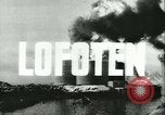
British Commandos raid Lofoten Islands, Spitsbergen Island, and Vaagso Island during World War II.
Pictures taken by military and news cameramen during World War II. Operation Claymore, March 1941: British Commandos raid Lofoten Islands in assault boats. They destroy a fish oil refinery off the coast of Norway. Soldiers and civilians on the docks. Burning refineries and buildings. Clouds of black smoke. 1941: British and Canadian troops on Spitsbergen Island. They destroy Soviet coal mines to prevent the Germans from occupying them. Black smoke clouds due to the explosions. Operation Archery on Vaagso Island, 1941: British Commandos raid the Island. Soldiers walk in the snow. Nazi prisoners surrender and marched by British soldiers. Battle ensues on the Island. Soldiers walk past a fence. Burning buildings in the background.
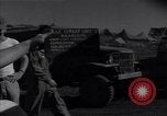
A runway strip under construction by Seabees at Banika Island during War II.
A runway strip under construction by Seabees,during World War II, at Banika Island (part of the Russell Islands, in the Solomon Islands). Aerial view of the runway strip under construction on the site of a coconut plantation. (This is the South Strip. Another airfield was also built across the bay, on the north side of the island.)
CRITICALPAST.COM: About Us | Contact Us | FAQs - How to Order | License Agreement | My Account | My Lightboxes | Shopping Cart | Advanced Search | Featured Collections | Website Terms & Conditions | Privacy Policy ©2026 CriticalPast LLC.
License Agreement |
Terms & Conditions |
Privacy Policy
©2026 CriticalPast LLC.