


 Francais
 Deutsch
 Italiano

Refine Your Search
Kiska Aleutian Islands Alaska 1944 stock footage and images
- Showing 3871 to 3876 of 9862 results more
 Hide
Color Sound
A project to review methods of attack against Japanese-type fortifications at Dugway Proving Ground, Utah.
Coverage of project to determine the most effective means for destroying Japanese-type cave positions at Dugway Proving Ground, Utah. Paper with typewritten introduction. U.S. Air Force P-38 Lightning fighter aircraft in a napalm incendiary bomb attack. U.S. B-25H Mitchell bomber fires 75mm cannon and U.S. Army Air Force P-47N Thunderbolt fighter aircraft fires 11.75 inch Tiny Tim rocket at targets on hillside. Mountainous terrain and caves similar to Japanese positions on island. Tall Boy (12,000 pound HE bomb) being hoisted from a trailer. U.S. P-38 parked with napalm bombs under wing. P-47N with 11.75 inch Tiny Tim rocket on launcher rail. U.S. Army Air Forces A-26 Invader bomber plane in flight and fires Tiny Tim rocket. Ordnance men load 75mm rounds into B-25H equipped with APG-13B radar ranging device. Gun crew fires 105mm howitzer at hillside. (World War II period).

Influx of foreign immigrants add to total population in Northeastern States of the United States.
Animated map of Northeastern United States bounded with Middle States and Southeastern States. Map depicts geographical condition of Northeastern States. Map marks States of Maine, New Hampshire, Vermont, Massachusetts, Rhode Island, Connecticut, New York, New Jersey, and Pennsylvania. Map shows Northeastern settlement during colonial period by Scotch, English, Dutch, Germans, and Swedes. Also shows influx of French Canadians during early 19th century and immigrants from different countries occupying urban Northeastern centers. Map explains the population occupying region.
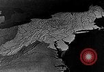
Animated map of Northeastern United States depicts dairy farming as the main agriculture, United States.
Dairy farming as main agricultural activity in Northeastern United States. Animated map of Northeastern States marks large metropolitan area consuming milk in a vast amount. Tank trucks move along road on their way to railroad shipping points and urban centers. Cattle graze at a field. Ducks in a poultry farm. Map marks growth of potatoes in Maine and Long Island. Apple growing areas in Middle States.
Lowland portions with mountains and sugar farms in Puerto Rico.
Lowland portions of the island in Puerto Rico. A coastal area with buildings and palms. Sugar farms with farmers at work. Hills at Manati. Trees bearing fruits. Women work in a refinery. Farms on mountains.

Peasants use cattle to plow farms on mountains in Puerto Rico.
Lowland portions of the island in Puerto Rico. Mountains in Puerto Rico. Houses for peasants on the mountains. Cattle plows farms on a mountain. Women and children outside a hut.

USS Seahorse SS (304) submarine patrols off the coast of Tori Shima, Japan during World War II.
USS Seahorse SS (304) submarine off the coast of Tori Shima in Japan during World War II. Periscope view of coastline of island. Shows half ship in air, other half in water.
CRITICALPAST.COM: About Us | Contact Us | FAQs - How to Order | License Agreement | My Account | My Lightboxes | Shopping Cart | Advanced Search | Featured Collections | Website Terms & Conditions | Privacy Policy ©2026 CriticalPast LLC.
License Agreement |
Terms & Conditions |
Privacy Policy
©2026 CriticalPast LLC.