


 Francais
 Deutsch
 Italiano
Refine Your Search
Long Binh Vietnam 1968 stock footage and images
- Showing 2323 to 2328 of 5711 results more
more Hide
Hide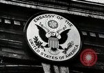
Beginnings of the Second Sino-Japanese war
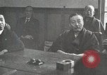
Sign over American Embassy in China. Colonel William Mayer, former military attache in that embassy relates events precipitating Second Sino-Japanese war. Scenes of the Marco Polo bridge near Peking, on night of July 7, 1937, as Japanese artillery bombards the area. Animated map shows movement of Japanese forces out of Manchuria to occupy Peiping and Tientsin. Victorious Japanese troops stand atop a building, raising their flags and shouting cries of victory. Japanese army officers sit around a table smiling and contended and others walk in a group. Chinese artillery crews are seen retaliating as they fire field pieces at Japanese positions in Shanghai. Shells explode in background, and Chinese infantry advance through damaged buildings and rubble. Animated map shows Shanghai and other cities, and film transitions to view of the bustling city of Shanghai on the Yangtze River. In the seaport, large ocean liners and freighters, as well as tug boats and Junks, are seen. What looks like a Japanese Tachikawa Ki.54 Type 1 transport plane takes off over a Chinese pagoda. Double-decker buses travel through the streets. Rickshaws are also seen. Map outlines the foreign residential areas of the French Concession and the International Settlement. American, British and Japanese flags are shown in the International Settlement. Detachments of troops from Japan, Britain, France, and United States Marines are seen. A U.S. Marine is posted as a sentry at the Shanghai Power Company. Coolies carry heavy bucket on a long pole. British, French and Japanese troops also performed sentry duties. Japanese troops and armored cars are seen. A scuffle breaks out in August, 1937, and Japanese soldiers start moving in trucks, take up firing positions, and begin firing guns from their armored cars. Map shows Chinese counterattack pushing the Japanese contingent toward the Khangpoo River. Next it shows Japanese warships and reinforcements in the Yangtze River and their advance toward Woosung and Shanghai. Views of Japanese warships bombarding the shore and large explosions from their striking shells. Beachhead is shown South of Shanghai, where two divisions of Japanese infantry are seen arriving in landing craft. They advance across the fields toward Shanghai. Map shows Chinese withdrawals to West and South, toward Nanking and Hangchow. Chinese medics along with infantry march in retreat. Japanese pilots are seen being briefed. Next, Japanese Mitsubishi G3M bombers are seen in flight, and bombardiers and other crew in them. Bombs falling on the city. Civilians running for cover as bombs explode. Aichi D3A1 aircraft dropping bombs. The Shanghai waterfront being bombed and civilians running.
Chungking (Chongqing), new capital of China, is bombed by Japanese forces during Second Sino-Japanese war
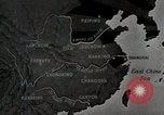
The Republic of China establishes its wartime capital at Chungking (Chongqing), China during the Second Sino-Japanese War. Animated map depicts areas of Japanese occupation and highlights cities including Lanchow (Lanzhou), Chengtu (Chengdu), and Kunming. It highlights Chungking (Chongqing) as the new capital of Nationalist China. Generalissimo Chiang Kai-shek is seen leading a group of Chinese leaders as they walk through an arched gate in Chungking (Chongqing). A busy street with shops and apartment houses, in the commercial district. It is filled with pedestrians, cart traffic along the curbs, and automobiles in the road center. Boatmen on the Yangtze River are seen below long steep steps leading up to the streets above. Views of houses clustered along the cliffs, and workmen digging bomb shelters into the cliffs. View from inside a shelter being hollowed out of the rock. Back in the Japanese occupied area, a car brings a Japanese Air Force leader who addresses a large group of fliers at an airbase. Next, Japanese air crews are seen running to their airplanes from their camp on the airfield and taking off in their Mitsubishi G3M bombers, to attack Chungking (Chongqing). Nakajima Ki-27 airplanes take off from the field and join in large formations overhead. A formation of Chinese World War 1 era is seen inflight, ostensibly to engage incoming Japanese bombers. Japanese crew member in a bomber sees the Chinese fighters and gunners in the bombers get ready to fire on them. The Chinese fighter planes dive at the bombers but are intercepted by Nakajima Ki-27 airplanes flying cover. Aerial dogfights ensue with Chinese planes being shot down, and the bombers continuing their way. Air raid sirens sound in Chungking and people run to their shelters, including many school children. Views of bomber crews at their stations and then of bombs falling with the Yangtze River below. Bombs exploding along the riverfront and inland, along the cliffs. View of machinery operating, and Chinese workers occupied in underground factories in Chungking (Chongqing). Fires burning throughout the city, from the bombing, and Chinese fire fighters working to extinguish them.
China builds Burma Road to carry war materiel and supplies and creates flood of Yellow River to thwart Westward expansion of Japanese occupied territory
Japanese officials meeting in strategy session. Japanese infantry on mission to cut Chinese supply lines during 2nd Sino-Japanese war. Black smoke rises as they move along a river bank. Chinese prisoner-workers are forced to rebuild railroads destroyed by the Chinese people during their great Westward trek. Japanese soldier closely guards workers. A Japanese army armored train underway on the rebuilt railroad, as Japanese soldiers cheer. Animated map shows China's supply lines by sea, to Tsingtao, Hangchow, and Amoy, cut off by Japanese naval blockade. Japanese Navy launch with officers and crew moving near commercial ships as they take over Chinese river ports. War materiel and other supplies destined for China, including trucks, sit idle, unable to be transported to their destinations. Large oil tanks and drums of gasoline are shown, as well as gun barrels and a flightline filled with parked Curtiss P-36 Hawk aircraft. The Imperial Japanese Navy destroyer Asakaze (DD-3) and another, next to it, in a Chinese river port. A Japanese freighter with anchored weighed, secured by long lines to a wharf. Small boats flying Japanese Naval ensigns are next to it. View of map showing china, Burma, Indo-China, and Chungking, with Japanese blockading fleet stationed in the South China Sea. It traces path of narrow gauge rail line from Indo-china to Kumming,China, where it connected to an overland road to Chungking. Next it traced the old Camel Caravan route, across China, from Russia. Narrator notes these were to small to be useful and too close to Japanese-occupied territory. Next, the map traces a railroad that from the port of Rangoon to Lashio, Burma. It is separated from the road to Chungking, by mountains and gorges. Views of the actual mountainous terrain. Animal pack trains moving through the area. Construction engineers in a large drafting room designing a road to transit the area. View of modern road-building caterpillar tractor equipment of the type needed to accomplish this. View of Chinese laborers using manpower instead. They push large rollers and employ pickaxes and other hand-held tools to carve away and dig road beds. Masses of Chinese laborers at work, carving a road along the edge of a mountain. Two-men teams using manual tampers to pound down the roadbed. Children are employed along with adults. A woman with a baby on her back, pounding large rocks into gravel, surrounded by other children doing the same. View from above of the "Burma Road," the product of their labors, winding its way through the mountains and gorges. Many scenes of trucks moving along portions of the Burma Road. P-40 airplanes flying past white cumulus clouds, overhead. Animated map shows continued expansion of Japanese occupied areas to encompass two thirds of the rail lines in China with goal of controlling the remainder, starting at Chengchow, in Summer, 1938. View of Chengchow region, on banks of the Yellow River. Map illustrates flow pattern of the Yellow River. View from past of the Yellow River's Spring floods toward the Sea, with Chinese people throwing rocks onto dikes that keep the river flowing in a more Northerly direction than its former course. Illustration shows how with Japanese encrouching on Chengchow, the Chinese decided to destroy those dikes and allow the river to flood over its former more Southerly course. Japanese soldiers being inundated by the flooding river. Japanese infantry and tanks regrouping on their occupied side of the new (old) path of the Yellow River. Local Chinese residents of Chengchow, wade with belongings as they leave their flooded homes.
Chinese employ guerrilla warfare against Japanese occupying forces in the Second Sino-Japanese War (WW2)
Opening scene shows closeups of many smiling Chinese Guerrilla fighters during the Second Sin-Japanese War (World War II). Animated map shows Japanese occupied areas as clinging to lines of communication (roads, railroads, and waterways), Japanese troops, carrying Rising Sun flag, march into a Chinese town. A Japanese armored boat, flying the naval ensign, cruises along a narrow stretch of river, with a large Chinese fortress in the background. Its officers watch carefully through binoculars. A Japanese armored train is seen patrolling a stretch of railroad. A long line of Chinese guerrilla fighters marching along a dusty road carrying a variety of weapons. Some, both men and women, are seen. One carries a homemade flag. The camera pans across them, all carrying shouldered arms. Chinese farmers threshing grain by shoveling it into the air, as they might have done before becoming guerrilla fighters. One guerrilla carrying two grenades around his neck. Many marching with shouldered arms and conical straw hats on their backs. Views of their feet clad in sandals. More scenes of Chinese guerrilla fighters marching. Animated map shows guerrilla attacks against Japanese-held lines of communication. A Chinese guerrilla fighter running through a field, banging a tin to sound a call to arms. Others picking up weapons and responding. Next, a group of them are seen diving into a river and moving along low to the water. Others are seen running across a ridge of rock. Still others come over a hill ostensibly attacking a Japanese patrol. Two large explosions and black smoke are seen behind running guerrilla fighters. Another scene also shows Chinese guerrillas running from an explosion. Heavy smoke and Wreckage of building and equipment at a railroad site. Japanese troops struggling to transit marshes and mud, with horses pulling artillery pieces, and many men pulling a rope to retrieve a sunken field piece from a stream. One Japanese officer wipes his face with a handkerchief, as he confers with others about the situation.
U.S. Lieutenant General Daniel Sultan explains Japanese aggression in China and need for troops in India and Burma during WW2
World War II film about the China, Burma, India (CBI) Theater of Operations. A soldier is seen filling out a form seeking information about him and inviting him to write in questions about anything he hadn't learned through normal information channels. Scene shifts to Information and Education Department of the Burma-India Command, where it is being processed by a soldier. Lieutenant General Dan I. Sultan, commander of Burma-India Theater, is seen next, seated at a desk, with wall map of the region behind him. He is appearing in an information film intended to inform troops under his command. He notes that more than half the troops who filled out the information form, asked why American troops were stationed in India and Burma. He refers to the recent recall of General Stillwell and the splitting of CBI into two theaters (China and India/Burma). He states that the purpose is a path toward Japan. An animated map shows China (that narrator notes has been fighting Japan since 1937). Animation shows Japan walling off China from the outside world, by seizing her ports, and then concentrating its grip on the Eastern part of the country. Without access by sea, the allies had only one option to assist China in the fight against Japan. That was to open the Burma Road. Film shifts to scenes of Japanese bombing of Shanghai and Chinese civilians abandoning the city in 1937 during Second Sino-Japanese War. Wounded and injured Chinese fighting fires while tending casualties in an open area. Glimpse of Chinese soldiers near one of their few large artillery pieces. A gun crew manning one of her few antiaircraft guns. Chinese jam road in trek to the unoccupied provinces of the country. Chinese carrying casualties on stretchers, making do without ambulances. Chinese coping in the face of all kinds of shortages. In contrast, well supplied Japanese troops are shown in formation. Japanese troops, military vehicles and equipment are seen. Japanese firing machine guns and heavy artillery against Chinese positions. Japanese armor and long lines of troops engaged against the Chinese, who continue to resist in spite of shortages and hardship. Chinese soldiers without shoes, marching in a column.
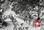
Chinese and American troops battle Japanese forces as they proceed along the Ledo road in the China-Burma-India theater of operations in World War II
On Christmas Eve, 1943,during World War 2, the Chinese 38th and 22nd Divisions are seen marching along a road toward North Burma. A regiment of Merrill's Marauders is seen joining the march from India through Burma. (Narrator says they will engage the Japanese 18th Division.) Along the line of march a road sign reads,"Shinbwiyang, Mile 110." Numerous views of troops struggling through jungles and natural obstacles. They employ pack animals that sometimes had difficulty in rough terrain. Animated map shows the route from Ledo, Assam, India, to the places of Chinese and American engagement with Japanese forces, in the Hukawng Valley. U.S. troops are seen moving under fire from Japanese enemy during active combat and returning fire with rifles, Browning M 1917, and M 1919 machine guns. Some of Merrill's Marauders wear standard M1 steel combat helmets, while others wear older M1917A1 "Kelly" helmets. One is seen firing a Bren gun with top-mounted curved box magazine. Others fire mortars. Chinese troops seen firing small artillery pieces. M3A3 Stuart light tanks of the joint Chinese-American 1st Provisional Tank Group (1st PTG) are seen with infantry walking behind them. Next, Allied casualties on litters are seen being placed in an ambulance. Numerous wounded are seen on the ground. Chinese troops carry a wounded on a litter. Views of Japanese soldiers being burned out of their hiding places by Chinese troops. Numerous views of dead Japanese soldiers. Scene shifts to air support by U.S. Army Air transport command providing aerial resupply from C-47 transport aircraft. C-47 aircraft seen flying over jungles. Monitors at a headquarters location are seen charting the changing positions of the Allied troops on the ground. View in a warehouse where air drop ready supplies are stored. Numerous views of supplies of all kinds being readied for air drop, including mail for the troops. Shipments being loaded aboard a transport airplane. C-47 airplane taxiing out after loading. Troops on the ground in radio contact with a transport plane. A long sequence ensues showing aerial resupply air drops from C-47 transport planes. After that, medical personnel are seen on the ground providing care to seriously wounded under difficult circumstances. Closeup of a surgeon tending to a patient. Many wounded seen on the ground awaiting attention and others in tents. A wounded on litters are transferred from an ambulance to an airplane. A woman nurse with other medics transferring patients. View inside an airplane set up for air evacuation. A nurse gives a wounded patient some water to drink. At a location unreachable by larger transport airplanes, a wounded soldier is placed aboard a single engine Stinson L-5 Sentinel liaison airplane which is then seen taking off and flying away. Animated map shows progress of Chinese troops on the Ledo road.