


 Francais
 Deutsch
 Italiano
Refine Your Search
Long Binh Vietnam 1969 stock footage and images
- Showing 2167 to 2172 of 5714 results more
more Hide
Hide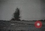
Japanese army conducts military exercises that involve inflatable rafts and pontoon bridges
Japanese Army conducts military exercise. Artillery shells explode in the distance. Some raise white smoke, while others create craters and throw large amounts of earth into the air. Japanese soldiers run carrying rolled up canvases. From them they remove and inflate rubber rafts that they carry up over a hill and down to a shoreline. They jump into the rafts and paddle furiously toward an opposite shore. The national red ball flag (sun-mark flag) is displayed on one raft. Closeup of occupants in one raft. Machine gun fire is heard in the background. The rafts reach the opposite shore where the troops jump out and charge up a hill in smoke. View from camera located at defensive obstacle as the troops arrive there. They place sections of pontoon bridges over the obstacles and cross over them. Then they carry bridge sections down a steep embankment to another shoreline where they place them end-to-end in the water to form a serpentine floating bridge. Soldiers on each section maneuver them with long poles into position spanning the water to the next shore. Next, armed troops are seen running across the new pontoon bridge. Two of them carry a version of a Hotchkiss machine gun (licensed by Japan as their Type 3 Heavy Machine Gun). One of the last few soldiers crossing the bridge, carries the sun-mark flag.
Use of human waste in Japan
Sewage treatment in Japan. Sewage consisting of human waste is brought from Japanese cities in carts to remote villages. Oxcarts carry barrels containing human waste. Farmers process raw sewage. Raw sewage is spread out in the field before it is compacted and treated with powder. A young child slips and falls into the edge of the sewage treatment pool and is rescued by a slightly older boy, who escorts the crying child in soiled clothing away from the pit. A man wears strapped-on long boards to mash the waste which is eventually to be used for farm fertilizer.
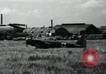
Japanese planes parked in airfield of Tokyo Municipal Airport after WW2
An assortment of Japanese planes scattered all over in the grass at Tokyo municipal airport. Included are a Japanese "Shiragiku" plane with green cross on side. A helicopter flying by. A 2PA-B3 plane built by Seversky corporation (based on the P35 fighter, purchased pre-war as a long-range escort fighter but sold off for civil use). Japanese "hickory" plane. Scrapped Douglas DC5 transport . Several DC-3s and other unidentified aircraft are also seen. Salvaged Japanese planes from World War II. Hangars and airfield. An American C-47 and small high wing monoplane with radial engine (possibly a UC-81).Transport ship on bay and a Japanese Mitsubishi C5M "Babs" reconnaissance aircraft.
Second Sino-Japanese War
Opening scene shows formation of Japanese Mitsubishi G3M bombers in flight. View of bombardier at bomb sight inside a bomber. Bombs falling from the aircraft, upon the Chinese city of Shanghai, on a day in September, 1937. Ground level view of bomb exploding and Chinese civilians running for cover. A huge explosion throwing earth up. Aerial view of smoke rising from bomb strikes below. More ground views of bombs destroying structures. Chinese people fleeing across a bridge. Cluster of bombs falling from a Japanese airplane. More explosions and destruction. view from a G3M bomber, of others with bombs falling from them. View from above of civilians filling a street as they run for shelter. People on the ground rushing in all directions. Some are in horse-drawn carriages with luggage on top and other in rickshaws, apparently fleeing the city altogether. Bombing victims lying on the ground near destroyed structures. Heavy dark smoke rising from the attacks. Scene shifts to Japanese army officers entering the Yasukuni shrine in Tokyo. Behind them is A Shinto Tori (Gate) and behind that, the monument (statue) of Omura Masujiro. Scene shifts again, to view of the Temple of Heaven, an ancient Imperial Sacrificial Altar in Peking (Beijing) China. Chinese agriculture. Crowds of Chinese people. Stone statue of traditional Chinese lion. Picture of 1851 oil-on-canvas painting by the German American artist Emanuel Gottlieb Leutze, of Washington crossing the Delaware. Drawing of 15th century ship similar to one in Columbus'1492 voyage to America. Drawing of Roman Empire era building. Michelangelo’s statue of Moses. Drawing of ancient Egyptian pyramid and statue. Drawing of Chinese city and environs representing 4 thousand years ago. Extant ancient Chinese shrines and statues. Animated Relief map of China and surrounding countries of U.S.S.R., India,Burma,Thailand, Indo-China, Philippines, and Japan. Animation outlines China Proper. It also shows Manchuria and scenes from there of desolate mountainous land, with miners at work extracting raw materials. Mongolia and Sinkiang are outlined. The Gobi desert is seen with a long camel caravan crossing it. Closeup of nomads transporting animal skins by camel. The last region outlined is Tibet. The ice covered Himalayan mountains are shown. Buddhist monks praying in the courtyard of a shrine in Tibet. The Yellow, Si Kiang, and Yangtze Rivers are shown on the map. Views of Chinese sailing vessels.
Japanese actions leading to 2nd Sino-Japanese war and attack on United States at Pearl Harbor in World War II
Japanese army officers examining foreign military equipment. A Japanese worker employing electric drill developed in a Western country. The Japanese freighter, Tatsuno Maru, loading scrap iron at a port in the United States. Other Japanese freighters loading coal and oil for shipment back to Japan. View of the Washington Naval Conference in Memorial Continental Hall, Washington, DC, held in 1921-22 and again in 1927 and 1930, to deal with several lingering issues. Glimpse of Japanese people holding flags while gathered near the Imperial Palace in Tokyo. Glimpse of Japanese army troops on parade. Japanese Navy warships at sea. A fleet of Japanese Mitsubishi G3M bombers and Nakajima Ki-27 pursuit planes, parked on an airfield. A loose formation of Ki-27s airborne. Animated map illustrates Japanese fortification of Mariana, Caroline, and Marshall islands in the Pacific. Animated map illustrating China's greater size and population vis-a-vis Japan. Animated map illustrating Japanese occupation of Manchuria in 1931. New York Times newspaper with headline "Japs Seize Manchuria" hovers over fires burning in Manchuria. Other newspaper headlines reporting on Mussolini's invasion of Ethiopia; the Spanish civil war; surrender of Czechoslovakia; invasion of Poland; assaults on France, Belgium, and the Netherlands by Nazi Germany; the London Blitz; and Nazi advances against Russia on the Eastern Front. Fnally, a Boston Hearald extra edition headline reports: "Pearl Harbor Bombed." A still photograph of Japanese Baron Tanaka Giichi (on left) with two other dignitaries, circa 1929. Japanese infantry streaming into Manchuria and then celebrating as they walk into local town. A busy street in a Chinese city. Japanese soldiers in Manchuria escorting local prisoners along a street. Animated map illustrating Japananese warships surrounding harbor of Shanghai, China. View from a Japanese ship bombarding Shanghai. Smoke rising from shell striking on Shanghai waterfront. View from land of severely damaged buildings on a street, and a shell exploding in background, as Chinese defenders move to successfully repel the Japanese forces. New map illustrates subsequent Japanese move, annexing Jehol, from occupied Manchukuo, and Korea. Japanese troops entering a town in Jehol. Sun newspaper headline: "League Censures Japan." Chinese diplomat protesting at League of Nations. Japanese troops exiting railroad trains in Jehol. Aisin Gioro Puyi aka Henry Pu Yi, Kangde Emperor (Kang-te Emperor) of the Japanese puppet state of Manchukuo, is seen saluting Japanese troops on parade. Closeup of Puyi wearing shaded glasses, looking directly into the camera. chiang Kai-shek, with other Chinese officers. Reenactment of barbarian forces riding against China and thwarted by the Great Wall. Many Chinese walking in a long line along the Great Wall. Map tracing the Great Wall across China. Aerial view of the Great Wall from overflying airplane. Japanese troops marching through a city gate; infantry climbing a sheer cliff; and helmeted Japanese soldiers marching past civilians in a city. Map illustrated progress of Chinese unification by year 1937. Japanese officers conferring during occupation. Japanese troops leave a barracks, riding in open trucks. A line of the troop trucks moving along the dirt street of a town. The troops climb from their trucks in the town.
Beginnings of the Second Sino-Japanese war
Sign over American Embassy in China. Colonel William Mayer, former military attache in that embassy relates events precipitating Second Sino-Japanese war. Scenes of the Marco Polo bridge near Peking, on night of July 7, 1937, as Japanese artillery bombards the area. Animated map shows movement of Japanese forces out of Manchuria to occupy Peiping and Tientsin. Victorious Japanese troops stand atop a building, raising their flags and shouting cries of victory. Japanese army officers sit around a table smiling and contended and others walk in a group. Chinese artillery crews are seen retaliating as they fire field pieces at Japanese positions in Shanghai. Shells explode in background, and Chinese infantry advance through damaged buildings and rubble. Animated map shows Shanghai and other cities, and film transitions to view of the bustling city of Shanghai on the Yangtze River. In the seaport, large ocean liners and freighters, as well as tug boats and Junks, are seen. What looks like a Japanese Tachikawa Ki.54 Type 1 transport plane takes off over a Chinese pagoda. Double-decker buses travel through the streets. Rickshaws are also seen. Map outlines the foreign residential areas of the French Concession and the International Settlement. American, British and Japanese flags are shown in the International Settlement. Detachments of troops from Japan, Britain, France, and United States Marines are seen. A U.S. Marine is posted as a sentry at the Shanghai Power Company. Coolies carry heavy bucket on a long pole. British, French and Japanese troops also performed sentry duties. Japanese troops and armored cars are seen. A scuffle breaks out in August, 1937, and Japanese soldiers start moving in trucks, take up firing positions, and begin firing guns from their armored cars. Map shows Chinese counterattack pushing the Japanese contingent toward the Khangpoo River. Next it shows Japanese warships and reinforcements in the Yangtze River and their advance toward Woosung and Shanghai. Views of Japanese warships bombarding the shore and large explosions from their striking shells. Beachhead is shown South of Shanghai, where two divisions of Japanese infantry are seen arriving in landing craft. They advance across the fields toward Shanghai. Map shows Chinese withdrawals to West and South, toward Nanking and Hangchow. Chinese medics along with infantry march in retreat. Japanese pilots are seen being briefed. Next, Japanese Mitsubishi G3M bombers are seen in flight, and bombardiers and other crew in them. Bombs falling on the city. Civilians running for cover as bombs explode. Aichi D3A1 aircraft dropping bombs. The Shanghai waterfront being bombed and civilians running.