


 Francais
 Deutsch
 Italiano
Refine Your Search
Naha Okinawa Ryukyu Islands 1945 stock footage and images
- Showing 1291 to 1296 of 9403 results more
more Hide
Hide
A map locates various islands of the Pacific and the invasion of these islands by U.S. forces.
A training film titled 'The Kwajalein Operations' on the operations of U.S. forces on Kwajalein Atoll in the Marshall Islands during World War II. A map locates islands in the Pacific Ocean. Animation depicts the area invaded by U.S. forces. The Gilbert Islands, the Solomon Islands, Midway Island, Tarawa and other islands located on the map. U.S. lines of communication on various islands. Kwajalein Atoll on the map. The atoll is selected as a base for U.S. forces. It is selected because of various benefits which would prove useful during the invasion of the Marshall Islands. Bases and installations on Kwajalein Atoll.
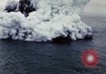
Smoke and steam rise as lava spews from volcano and a chain of island during the birth of Surtsey island on coast of Iceland.
Volcanic eruption during the birth of the Surtsey island located near Geirfuglasker island on the Vestmanneayjar island, Iceland. Smoke and steam rise as lava spews from volcano. Wing of an aircraft while in flight. Chain of islands. Lava erupts out of the volcano. Black mass is spewed up discoloring the pure white steam momentarily. Black mass falls in water. Large steam cloud covers entire island. Turbulence along edges during eruption. An opening in center of a steam cloud. Wing of aircraft seen while in flight. A chain of island.
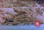
LVTs (landing vehicle, tracked) on beach of Kerama Retto in Pacific Theater.
United States LVTs (landing vehicle, tracked) on beach of Kerama Retto, Okinawa in Pacific Theater. Rocky shoreline with steep cliffs. LVTs underway. Green plants on top of mountains.
Rocket barrage fired on beach of Kerama Retto in Pacific Theater.
Bombardment on beach of Kerama Retto, Okinawa in Pacific Theater. Rocky shoreline in the background. LSMs (Landing Ship, Medium) underway. Rockets fired from Landing Ships. Rocket barrage fired. Black smoke rises up. Several LSMs in view. Battle ships and destroyer ships bombarding. (World War II period).
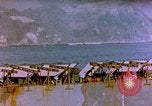
Rockets fired on beach of Kerama Retto in Pacific Theater.
Bombardment on beach of Kerama Retto, Okinawa in Pacific Theater. Rocket launcher on deck of LSM. Several LSMs in view. LSMs (Landing Ship, Medium) underway. Rockets fired from Landing Ships. Rocket barrage fired. Black smoke rises up. Rocky shoreline in the background. (World War II period).
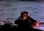
Landing Ships underway near the beach of Kerama Retto in Pacific Theater.
United States soldier sits on a craft. Rocky shoreline in the background. Bombardment on beach of Kerama Retto, Okinawa in Pacific Theater. LSMs (Landing Ship, Medium) underway. Rocket barrage fired. Black smoke rises up. (World War II period).
CRITICALPAST.COM: About Us | Contact Us | FAQs - How to Order | License Agreement | My Account | My Lightboxes | Shopping Cart | Advanced Search | Featured Collections | Website Terms & Conditions | Privacy Policy ©2026 CriticalPast LLC.
License Agreement |
Terms & Conditions |
Privacy Policy
©2026 CriticalPast LLC.