


 Francais
 Deutsch
 Italiano
Refine Your Search
Naha Okinawa Ryukyu Islands 1945 stock footage and images
- Showing 2545 to 2550 of 9416 results more
more Hide
Hide
George Edward Pendray launches The American Interplanetary Society's first liquid fueled rocket from Staten Island in New York, United States.
The American Interplanetary Society's first liquid fuel rocket is launched from Staten Island in New York, United States in 1933. George Edward Pendray of the AIS, and his associate preparing for the launch. The 7 1/2 foot rocket is placed on a stand. Other men look on. The rocket, fueled with gasoline and liquid oxygen, takes off. Its fuel tank overheats and explodes moments after takeoff and the rocket crashes to the beach below. (From a November 10, 1958 newsreel recounting events 25 years earlier. The world's first successful liquid fuel rocket was launched by Robert Goddard in Auburn, Massachusetts, on 16 March 1926. This film records the first such attempt under auspices of the American Interplanetary Society, in 1933. )

Simulation of a jet crash in a residential area during the Third Annual Fire Chief Steel Conference in Long Island, New York.
The Third Annual Fire Chief Steel Conference in Long Island, New York. Simulation of a jet crash in a residential area. Emphasis on latest methods of coping with blazing jet fuel. Heavy columns of smoke rise up from the wrecked aircraft. The firemen douse the fire with fire hoses.
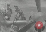
U.S forces intercept and shoot down Admiral Isoroku Yamamoto of the Imperial Japanese Navy in Bougainville Island (WW2)
United States airmen on wing and fueling a P-38 Lightning aircraft to prepare for a mission in World War II. A military jeep carrying some airmen drives by. An airman gets off the jeep and runs to a P-38. The United States airman climbs the P-38 and takes his seat, his comrade closes the aircraft canopy. An airman closes his aircraft canopy. A P-38 with engines running. A fighter-bomber (Lockheed P-38 Lightning) begins to taxi in the airfield. An airman in the control tower signals using a light. The Lockheed P-38 Lightning takes off from the airfield. A group of Lockheed P-38 Lightning aircraft zoom in the sky. Aerial shot of Bougainville Island coast. Japanese Zeroes flying in the sky, seen via gun camera footage. Two Japanese bombers are flying, one of the bombers catches fire after it was attacked by American aircraft. A Lockheed P-38 Lightning slightly angles in a maneuver. A Lockheed P-38 Lightning fires at the Japanese in front. A Lockheed P-38 Lightning chases and fires at the Japanese aircraft, a Mitsubishi Betty. Cockpit aims at Japanese aircraft. A Lockheed P-38 Lightning fires, the Japanese bomber is hit and explodes into a ball of fire. Three Lockheed P-38 Lightning aircraft fly in the sky. Three airmen, Lieutenant Besby Holmes, Captain Tom Lanphier and Lieutenant Rex T. Barber, laugh facing the camera. Ending slate.
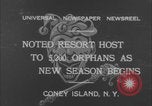
Thousands of orphans enjoy a day at Luna Park in Coney Island, New York
Luna Park in Coney Island, New York, opens to 5200 orphans from New York City. Children, many wearing white, walk in large groups on the park grounds. A vendor hands out ice cream cones at a counter. Children eat ice cream and other food. A large crowd sits in the stands of an arena, watching children on the dirt below attempt to ride a mule. One boy is knocked over by the animal, but another succeeds and climbs its back to ride. Boys and girls climb over a short fence. Scene changes to view from moving coaster known as the "Shoot the Chutes" as it speeds down an incline and splashes into water. Shots from and of a moving coaster as it goes up and down multiple hills. Older boys sit at the front. Man performing a human cannonball act climbs into the barrel of a large cannon, and a young boy licks an ice cream cone. Smoke puffs from the barrel of the cannon as the man is propelled from the cannon. He soars through the air, arms outstretched before tucking forward and landing on a taut net.
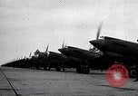
Curtiss P-40 aircraft of the USAAC 8th Pursuit Group on the flight line at Mitchel Field, and airborne over shore of Long Island, New York.
View from the front, of Curtiss P-40 aircraft, from the U.S. Army Air Corps 8th Pursuit Group parked side-by-side with engines running on the flight line of Mitchel Field, Long Island, New York. View from their rear. Next, three flights of three aircraft each are flying at low altitude, over the shore and waters of Long Island.

'Aquazanies' entertain with comedy diving acts at an Aquashow in Flushing, Long Island.
'Aquazanies' entertain with comedy diving acts at an Aquashow in Flushing, Long Island. A diver takes position on a diving board at the pool. He executes a forward somersault dive. 'Aquazanies', a troop of men who perform comedy and diving acts. Aquazanies dressed in funny costumes rush onto the diving boards, and jump into the water. They dance outside the pool. Several stunt jumps of the aqua zanies are seen, as they jump from spring and platform boards, including stunts where the divers jump together, intersect during jumps, and belly flop into the pool.
CRITICALPAST.COM: About Us | Contact Us | FAQs - How to Order | License Agreement | My Account | My Lightboxes | Shopping Cart | Advanced Search | Featured Collections | Website Terms & Conditions | Privacy Policy ©2026 CriticalPast LLC.
License Agreement |
Terms & Conditions |
Privacy Policy
©2026 CriticalPast LLC.