


 Francais
 Deutsch
 Italiano
Refine Your Search
Naha Okinawa Ryukyu Islands 1945 stock footage and images
- Showing 2575 to 2580 of 9416 results more
more Hide
Hide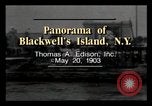
A film titled 'Panorama of Blackwell's Island, N.Y.' in New York City, United States
A film titled 'Panorama of Blackwell's Island, N.Y.'. Shore of Blackwell's Island seen, from boat . The lighthouse, at extreme Southern end of the island. Smoke from the Island's power plant stacks is visible. Sea wall built by inmates. Insane Asylum, including octagonal Lunatic asylum for women; Large Workhouse. Piers for construction of the Queensboro (59th street) Bridge. The Penetentiary Warden's home nearby; and the Penetentiary, itself. Finally, we see the Charity Hospital.
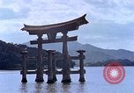
A sacred shrine in Miyazima Island, Hiroshima, Japan.
Life in Hiroshima, Japan after the explosion of the atomic bomb during World War II. Miyajima, a shrine island. The famous Itsukushima Shrine (1-1 Miyajimacho, Hatsukaichi, Hiroshima 739-0588, Japan) in waters off Miyajima. Another Torii in waters. Shrine on island of Miyajima. A deer grazes on the island. Japanese people walk past the sacred shrine. Bronze and stone statues near the shrine. A ferryboat takes sightseers from the mainland to the island of Miyajima. A spire of five storied pagoda.
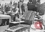
United States 7th Infantry Division troops and Marines invade islands in the Pacific Theater (WW2)
United States amphibious invasion of small islands in the Pacific Theater during World War II. Men load supplies for Marines. Equipment and trucks loaded. 7th Infantry Division troops on landing crafts. Troops land on island. Landing craft beached. Combat between Japanese troops and U.S. Marines. Wounded soldiers given aid. Several Japanese soldiers surrender. A man holds the forms 'Prisoner of War'. Japanese prisoners on island. Destroyed aircraft, equipment and buildings in view. Wounded soldiers carried on stretchers in landing craft. The wounded lifted in ships. Dead bodies on the island. The U.S. flag.
Allied amphibious assault against Japanese held Island in the Pacific, during World War II
Film opens with animated map of the Pacific theater of operations in World War 2. It illustrates Allied advances through network of islands supporting supply lines of Japan. View from an Allied ship in an invasion task force headed to a Japanese occupied island (probably in the Mariana Islands) during World War 2. U.S. troops descend rope net from their transport ship to board landing craft. Numerous landing craft making way in loose formation. Warships in the task force bombard the target island. Huge black explosion occurs. B-25 Mitchell bombers displaying "Z" on tails, are seen briefly in flight. Landing craft maneuvering and approaching the shore where numerous shells are bursting from the naval bombardment. Landing craft number 25, from the USS Bolivar (APA-34) is seen in the water. Troops rush across the sand after leaving their landing craft. Closeups of U.S. troops using small arms and flame throwers to drive Japanese defenders from their caves, blockhouses and other fortifications. Dead Japanese soldiers beside their defensive positions. At the beachhead, several large Landing Craft Infantry LCI(L) 334, 330,335, and 336 are unloading troops into the surf. Closeup front view of troops wading ashore from LCI(L)335. Troops carrying boxes of supplies ashore. At the beachhead, troops are unloading a large truck, while in the background, a Landing Vehicle Tracked is driving away from Landing Ship Tank (LST-47). Her deck is crowded with troops. A tractor drives off a nearby landing craft. Wide view of beachhead jammed with troops and equipment.
Japanese soldiers advance and give victory banzai in Corregidor Island, Philippines (WWII)
Japanese victory at the Battle of Corregidor during Japanese occupation of Philippines in World War II. Japanese troops land on Corregidor Island (also known as Fort Mills during the American Colonial Period). Japanese troops disembark from boats during their landing at the island of Corregidor. Japanese soldiers climb their way up the island. Soldiers advance on Corregidor Island. Japanese troops march past destroyed buildings. Captured American and Filipino prisoners of war are taken away. Japanese soldiers stand near gun batteries and give victory banzai. View of the Mile Long Barracks of Corregidor. The soldiers advance and walk past a destroyed building. The Japanese flag is raised. Japanese soldiers take down the United States flag in Corregidor.

An amphibious landing and bombers on a mission and troops battle on a Pacific Island.
Dramatization shows how one defective walkie-talkie can impair battle plans, United States. U.S. transporters including cruisers, destroyers and crew carrying ships underway in South Pacific on a mission to attack on Japanese installation and Island no. 6. A personnel plays whistle from the bridge of cruiser. Interior of manned radio operations room:Task Force officers sitting around table and discuss over battle plans. A personnel talks on radio device. American bombers in formation flight. Pilot and copilot in cockpit. American aircraft drop bombs on Japanese installation. Explosion and large column of smoke rise. Task Force officers look at map of Japanese island no. 6 in the radio room. Animated map shows Japanese Island no. 6 showing an amphibious landing and bombers on a mission. U.S. soldiers on landing crafts with walkie-talkies. Artillery fire on the Pacific island. Troops disembark from the landing craft and heads towards beach area. Soldiers move into action and fire artillery. (World War II period).
CRITICALPAST.COM: About Us | Contact Us | FAQs - How to Order | License Agreement | My Account | My Lightboxes | Shopping Cart | Advanced Search | Featured Collections | Website Terms & Conditions | Privacy Policy ©2026 CriticalPast LLC.
License Agreement |
Terms & Conditions |
Privacy Policy
©2026 CriticalPast LLC.