


 Francais
 Deutsch
 Italiano

Refine Your Search
Naha Okinawa Ryukyu Islands 1945 stock footage and images
- Showing 3253 to 3258 of 9416 results more
 Hide
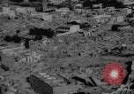
Earthquakes of 1960 trigger losses in Morocco and Chile, and Hurricane Donna strikes Caribbean shores.
Natural disasters strike nations like Morocco, Chile, and Caribbean Islands in the year 1960. Moroccan rescue workers clear out pile of debris after the 1960 Agadir Earthquake. Demolished houses and broken roads in the city. Next scene shows aftermath of intense earthquakes in Chile that caused damage to property and loss of lives. An aircraft flies over a Chilean town damaged by the 1960 Valdivia earthquake. The bust sculpture of a Chilean leader is shown toppled and damaged by earthquake. A bridge road over water is shown buckled following an earthquake in Chile. Chileans attempt to cross the buckled bridge. Next seen shows Hurricane Donna striking shores of Caribbean Islands. Fast winds blowing palm trees and spraying tidal surf.
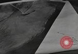
Animated map of Betio depicts position of Japanese coastal defenses during World War II.
A training film about the Allied invasion of Tarawa during World War II. Photographs of Tarawa taken by reconnaissance aircraft before the Battle of Tarawa. Animated map of Betio island. Depiction of position of 8 inch and 140 mm guns. A map depicts the position of Japanese tank traps. Position of barbed wire fences around the island. Position of coconut barriers.
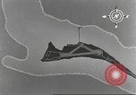
An invasion convoy underway in the Pacific Ocean heads for Tarawa amidst coastal bombings during World War II.
A training film about Allied invasion of Tarawa during World War II. Animated map of Betio island depicts the area where transports arrived at the island. An invasion convoy underway in the Pacific Ocean. Aircraft in flight as they provide air cover. A coast being bombarded. Smoke rises from coastal installations.
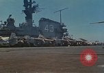
Scenes aboard USS Coral Sea underway in the South China Sea during the Vietnam War.
U.S. Navy 7th fleet operations in South China Sea during the Vietnam War. Island structure aboard the aircraft carrier, USS Coral Sea (CVA-43) underway in South China Sea. Several Douglas A-3B Skywarrior twin jet bomber aircraft parked next to the island. Men load mail into U.S. Navy UH-2B helicopter on the flight deck.
A U.S. officer outlines military base requirements by showing aerial photographs of U.S. military facilities in Panama Canal Zone.
An outline of U.S. military canal defense and base security requirements and future requirements regarding proposed canal relocations in Panama. A U.S. officer conducts a JCS (Joint Chiefs of Staff) briefing in the United States. Maps of the Canal Zone and Panama shows military installations, communications facilities and training areas. An officer points out Quarry Heights, Fort Amador, Howard AFB, Fort Kobbe, Rodman Naval Air Station and Fort Clayton on the map of Panama. An aerial photograph of Quarry Heights which will provide operational support for United States Southern Command Headquarters. An aerial picture of a bridge in Panama City and Quarry Heights in the background. Aerial photographs of Bridge of the Americas, Albrook AFB, Rodman Naval Station, Howard AFB and Fort Amador. An officer briefs. Maps of Fort Sherman and Galeta Island. Aerial photographs of Fort Sherman and Galeta Island.
United States 5th Air Force bombers and fighters destroy Japanese targets on New Guinea in World War II.
U.S. Army Air Forces operations in New Guinea Island during World War 2. Animated map highlights New Guinea and shows limit of Japanese defenses. U.S. troops board U.S. Army Air Forces C-47 Skytrain transport plane. Formation of C-47s in sky. C-47 lands. Troops getting off the C-47 and running for cover. Australian troops getting equipment moving armament. Wounded soldier being placed aboard C-47. U.S. Army Air Forces C-56 Loadstar buzzing airfield. American troops making a runway. U.S. Army Air Forces P-38 Lightening fighter aircraft takes off. Shutter of a B-25 Mitchell bomber aircraft. Bombs exploding on Japanese targets. B-25s bomb Japanese ships. B-25s strafing Japanese planes on ground. Parafrog bombs being dropped by B-25s. Shells exploding. U.S. Army Air Forces B-24 Liberator bombers in flight. View at Wewak Island. B-17 Flying Fortress bombers and P-38s in flight.
CRITICALPAST.COM: About Us | Contact Us | FAQs - How to Order | License Agreement | My Account | My Lightboxes | Shopping Cart | Advanced Search | Featured Collections | Website Terms & Conditions | Privacy Policy ©2026 CriticalPast LLC.
License Agreement |
Terms & Conditions |
Privacy Policy
©2026 CriticalPast LLC.