


 Francais
 Deutsch
 Italiano
Refine Your Search
New Mexico United States 1946 stock footage and images
- Showing 18781 to 18786 of 30776 results more
more Hide
Hide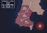
U.S. 2nd Infantry Division tanks advance and a P-47 Thunderbolt aircraft taxis on a runway in Saipan, Mariana Islands.
U.S. forces battle against the enemy on Saipan, Mariana Islands during World War II.. Animated map shows southern territory occupied by U.S. forces. Officers converse with each other. 2nd Infantry Division tanks advance. A United States Army Air Force P-47 Thunderbolt aircraft taxis on a runway.
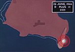
Japanese airplanes bomb Aslito Airfield and other positions held by U.S. forces on Saipan, Mariana Islands.
U.S. forces battle against the enemy on Saipan, Mariana Islands during World War II.. Animated map shows Japanese aircraft bombing Aslito Airfield at night. United States troops place dead soldiers onto vehicles. Japanese airplanes bombing U.S. occupied territories. Fire and explosions due to the bombings. U.S. aircraft carry out air strikes on Mount Marpi. Animated map shows the position of 27th Infantry Division. Engineers repair roads and airfields are being constructed.
U.S. 2nd Marine Division advances towards the northern region amidst firing by the Japanese on Saipan, Mariana Islands.
U.S. forces battle against the enemy on Saipan, Mariana Islands during World War II. United States 2nd Marine Division advances towards the northern region of Saipan. The Japanese fire from houses and from behind bushes in Garapan. Soldiers pass through debris and damaged buildings. U.S. aircraft drop bombs over Japanese targets. Animated map shows Japanese attack on U.S. occupied areas from Tinian island.
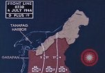
2nd and 4th Marine Divisions and 27th Infantry Division head towards Tanapag Harbor and fire at enemy positions on Saipan.
U.S. forces battle against the Japanese on Saipan island, Mariana Islands during World War II. Animated map shows territories occupied by U.S. forces. The map shows the 2nd and 4th Marine Divisions along with the 27th Infantry Division heading towards Tanapag Harbor. United States tanks fire at Japanese positions resulting in fire and explosions. 27th Infantry Division troops reach a beach and fire rifles. American aircraft air raid Saipan. A map shows air strikes on northern Saipan and Tinian Island. Marines advance uphill.
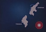
Animated map shows U.S. forces capturing Saipan and moving towards Tinian Island in the Mariana Islands.
U.S. forces battle against the enemy in the Mariana Islands during World War II. Animated map shows U.S. forces occupying Saipan and moving towards Tinian Island. A United States officer shakes hands with soldiers.
The USAAC Alaska Flight of 1934, progresses through Edmonton and Prince George, Canada
Animated map shows propsed course of the U.S. Army Air Corps (USAAC) Alaskan flight, originating in Washington, DC, United States, and heading northwest, across North America, to Alaska. It shows progress to Edmonton, Alberta, Canada. Next, Canadians are seen waving skywards, and scene shifts to aerial views of the expedition's Martin YB-10 aircraft flying in formation. On the ground at Edmonton, a Royal Canadian Mounted Policeman (RCMP) sits on horseback and talks with one of the fliers. A large crowd of visiters surround YB-10 aircraft parked on display, at an airfield. Several RCMP on horseback patrol the area. The animated map tracks the Alaskan Flight to Prince George, Canada. YB-10s are seen again, flying in formation. View out window of one showing snow-covered mountains.
CRITICALPAST.COM: About Us | Contact Us | FAQs - How to Order | License Agreement | My Account | My Lightboxes | Shopping Cart | Advanced Search | Featured Collections | Website Terms & Conditions | Privacy Policy ©2026 CriticalPast LLC.
License Agreement |
Terms & Conditions |
Privacy Policy
©2026 CriticalPast LLC.