


 Francais
 Deutsch
 Italiano
Refine Your Search
New Mexico United States 1946 stock footage and images
- Showing 27151 to 27156 of 30777 results more
more Hide
Hide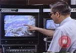
Role of satellites in meteorology. Tracking and warning of severe weather phenomena.
A man shows satellite weather details on a computer monitor. High waves around a bridge. A tornado progressing and hitting houses. Animation of a satellite above the earth. Animation of map of earth marked with changing coverage areas of satellite as it circles the earth. Views of Hurricane being tracked by satellite images. A U.S. Coast Guard helicopter rescuing some boaters. Piedmont Boeing 737 aircraft in flight. Cargo ship in harbor. Engineers preparing satellite. Space Shuttle, in orbit with open cargo bay.
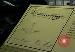
50th Anniversary of the Douglas DC-3 passenger transport aircraft. Scenes of the aircraft in use over the years.
Original design document of the DC-3. View of a Douglas DC-3 suspended from the ceiling of the Smithsonian Air and Space museum in Washington, DC. View of DC-3 plane taking off and in flight. 'Bonanza' written on the plane. Historic views of military use of the DC-3 over the years, including use in WWII for dropping paratroops, for carrying cargo, such as the Berlin Airlift, and as a gunship in the Vietnam War. Personnel inside a C-47 "Gooney Bird" operating M134 rotary-barreled machine gun miniguns. A newspaper headline reads 'US Depends on Air to Ship Berlin Freight' referring to use of the aircraft in the Berlin Airlift. Interior view of the DC-3 as a luxury passenger aircraft, circa 1939. Discussion with a current executive of the McDonnell Douglas aircraft Company, Michael Burch. Scenes of DC-3 aircraft being manufactured by war production workers in large factory plants during World War 2 era. Various scenes of vintage DC-3 aircraft, crews, passengers, DC-3 at airports, and interior and exterior views over the years. A DC-3 passenger airplane at a commercial airport taxis on a runway.
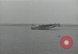
Pan American 314 Clipper arrives. Small boat brings passengers to shore. Press conference about Boeing 314 Clipper
A Boeing 314 Pan American Clipper taxis in on two outboard engines, after a water landing. A DC-2 flies overhead. Passengers from the Clipper are ferried to an inclined pier and walk up towards shore. Several dozen people are seen boarding three buses parked on the inclined pier. An official at the microphones in a press conference. Wall-sized sectional drawing of Boeing 314 seaplane behind him, labeled "Giant Flying Clipper Ships of Pan American Airways." Igor Sikorsky comes to microphones and poses for photographs. A young couple appears at the microphones. Two gentlemen arrive at inclined ramp. One uses walkway to ramp, while the other hops up to the ramp. They are warmly greeted by a group of people and head up towards shore.

American Information Agency film showing that people in friendly countries also hold misconceptions about America and Americans
From a U.S. Information Agency film about the role of that agency. Colored map shows Soviet- controlled area in red and other areas in blue. Expressing concern about false impressions among Allies, regarding America and Americans, a chart is shown depicting results of a public opinion poll conducted in January 1953. In this poll French respondents expressed the view that Americans have poor taste; are overgrown children; and are only interested in money. and no family life. Narrator adds that many French also believe most Americans live in skyscrapers and have no family life.
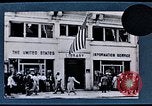
USIA film describing its Libraries and Cultural Centers abroad
Segment of U.S. Information Agency film describing its libraries and Cultural Centers that provide public information abroad. View of a USIA library displaying its name in English. Another USIA cultural center and library in Burma. Buddhist monks attend a lecture by the USIA. An Asian boy writing on desk. People assembled for lectures and discussions in such centers in various countries. Patrons surround a USIA traveling library in Burma. Visitors viewing displays in a USIA center. Chart showing USIA information centers closed by Communist Governments in Bulgaria, Romania, Czechoslovakia, USSR, China, Hungary, Poland. Map showing Hakodate, Japan, where 40,000 residents signed a petition to keep a USIA library open.

Segment of U.S. Information Agency film about its Voice of America radio broadcasting operations
Illustration of microphone, announcer, and radio transmission tower. A spanish speaker broadcasting on a microphone labeled, "la voz de los Estados Unidos de América." A Japanese woman broadcasting in Japanese. A man broadcasting in German on a microphone labeled, "Die Stimme Amerika." Others broadcasting in Russian, and English. Cartoon illustrates 70% of broadcasts beamed at listeners behind the "Iron Curtain." World map illustrating U.S. radio transmitters and their coverage in the world.
CRITICALPAST.COM: About Us | Contact Us | FAQs - How to Order | License Agreement | My Account | My Lightboxes | Shopping Cart | Advanced Search | Featured Collections | Website Terms & Conditions | Privacy Policy ©2026 CriticalPast LLC.
License Agreement |
Terms & Conditions |
Privacy Policy
©2026 CriticalPast LLC.