


 Francais
 Deutsch
 Italiano
Refine Your Search
Okinawa Ryukyu Islands 1972 stock footage and images
- Showing 817 to 822 of 4614 results more
more Hide
Hide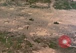
Aerial view of army vehicles and men advancing across Engesebus Island in Peleliu, Palau Islands.
The Peleliu operation in Peleliu, Palau Islands during World War II. Aerial view: The tanks and men advance across Engesebus Island. Landing boats go across a lagoon. Shell holes due to bombardment. M-4 tanks and amphibious tractors. Men get out of the amphibious tractors and run inland. Fire as a tank moves in the background.
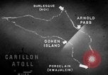
Information about arms, ammunition and equipment used to fortify various islands of the Marshall Islands is given.
A training film on operations of U.S. forces on Kwajalein Atoll in the Marshall Islands during World War II. Animated map of Kwajalein Atoll locates Cohen Island, Porcelain, Arnold Pass and Burlesque Island. Major air facilities are on Burlesque Island and Porcelain. Guns, machine guns, defense installations, artillery, trenches, anti tank ditches, barricades and embankments are used to fortify Burlesque Island. Burlesque and Camouflage Islands are located. Camouflage Island is the most strongly defended island. Abraham, Allen, Andrew and Anton Islands also had gun emplacements. On Allen Island are three tower radio station. On Jacob Island is a radar installation.
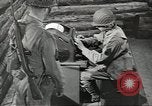
Amphibious vehicles land and U.S. Marines are attacked by Japanese snipers on Rendova Island, Solomon Islands.
Propaganda film 'The Price of Rendova' documents the taking of Rendova Island in the Solomon Islands during World War II. A naval task force assembles at Guadalcanal. Cargo is hoisted. Animated map shows the strategic importance of Rendova Island and that it is taken in order to facilitate operations against the air base at Munda. General MacArthur with other officers. Face of older officer. Big naval guns fire. Faces of tired and worried G.I.s. Landing crafts with soldiers are unloaded from a ship and they move towards Rendova Island. Amphibious vehicles land on the island. Troops take positions on the island. The island is covered with tall trees. Marines are attacked by Japanese snipers. The troops advance on the island. Coconut logs on the ground. The troops fire artillery. Explosions occur and smoke rises. Dead Japanese soldiers on the ground. Soldiers talk on a radio device. Signal officers wave semaphore flags to signal the troops on a beachhead. Essential materials needed for war, medical supplies and food are unloaded from a ship onto the landing crafts.
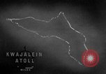
Code names of islands and operations of United States forces on Kwajalein Atoll in the Marshall Islands during World War II.
A training film on operations of United States forces on Kwajalein Atoll in the Marshall Islands during World War II. Animated map locates Kwajalein Atoll. Islands, atolls and operations are given code names. The code name for Kwajalein Atoll is Carillon atoll. The operation's name is Flintlock Operation. The Arnold pass and the Cohen Island. The code names are given alphabetically and begin with Abraham and end with Jasper. The areas of Roi Island and Namur Island are called Burlesque and Camouflage respectively. The 4th Marine Division is active in the northern area and is called Task Force 53. The southern attack force is the 7th Division and is called Task Force 52. Burlesque and the Camouflage islands are located. The two islands are connected with a concrete causeway. Average annual rainfall in the area is about 80 inches. Average annual temperature is about 81 degrees Fahrenheit. Out of the 25 navigable passes into the lagoon, only 6 are considered good. These are Jacob Pass, Ivan Pass, Bennett Pass, Chester Pass, Conrad Pass and Elton Pass. Flow of wind and current in the area is shown.
U.S. convoy of freighters, aircraft carriers, and LSTs, reaching Saipan Island, Mariana Islands in World War II
The Pacific Campaign on the Island of Saipan, Mariana Islands during World War 2. Map titled 'Mariana Islands' showing the location of U.S. carrier convoy. Map showing the location of LSTs (Landing Ship, Tank). Map with heading '804th Aviation Engineers in Saipan'. Map and sea route marked from Hawaii past Johnson Island showing location of transport convoy, June 17, 1944. Convoy at sea showing men aboard the ships looking down at the water. Convoy showing the various types of vessels in the convoy, mostly freighters. Continuation of maps with sea markings of the route of the convoy showing the location of Kwajalein Islands and location of Eniwetok. Carriers underway showing planes aboard the carriers. Personnel on look out, aircraft spotters and others. Huge geyser of water erupting near a freighter. Convoy off the coast of Saipan showing a huge geyser of water going up. LSTs and freighters at anchor off the coast of Saipan. Personnel aboard LST as they move in towards the shore. Gun flashes can be seen ashore. Unloading operation showing the LST pulling into shore, the door falls down into the water and a half track pulls out and moves into the shore loaded with men and equipment. Trucks, jeeps and all types of equipment moving across the water in toward shore. Men walking ashore.
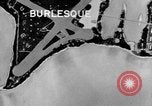
Animation locates areas of Burlesque and Camouflage Islands under northern attack forces in Kwajalein Atoll, Marshall Islands.
A training film on operations of U.S. forces on Kwajalein Atoll in the Marshall Islands during World War II. A map locates places which are under northern attack forces. Burlesque Island is located. Camouflage Island. Areas captured on the islands. A large concentration of Japanese buildings on Camouflage Island. Radio and radar stations are installed by the Japanese in these areas.
CRITICALPAST.COM: About Us | Contact Us | FAQs - How to Order | License Agreement | My Account | My Lightboxes | Shopping Cart | Advanced Search | Featured Collections | Website Terms & Conditions | Privacy Policy ©2026 CriticalPast LLC.
License Agreement |
Terms & Conditions |
Privacy Policy
©2026 CriticalPast LLC.