


 Francais
 Deutsch
 Italiano
Refine Your Search
Okinawa Ryukyu Islands 1972 stock footage and images
- Showing 2155 to 2160 of 4623 results more
more Hide
Hide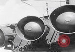
81st ("Wildcat") Infantry Division troops listen to PA announcement of final orders on ship sailing to Angaur Island (WW2)
View of PA speakers on ship during World War II with announcement, "now hear this...the objective of this task force is the Palau Islands." United States 81st "Wildcat" Infantry Division troops on ship deck listen intently to announcement of final orders regarding their attack of Angaur Island. United States 81st Infantry Division officers study map of Angaur Island. Finger points to Red Beach on map of Angaur island, where the 322nd regiment will attack, then points to Blue Beach where the 321st regiment will attack. Admiral William H. P. Blandy and General Paul J. Mueller (misidentified by narrator as "gen. Miller") discuss battle plan. Soldiers listen to further instruction. Soldier sharpens trench knife. Soldier test fires flamethrower over side of ship.
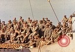
Scenes aboard a U.S. Navy Transport ship in the Pacific off Okinawa during World War II.
Troops and sailors lining the the decks and rails of a U.S. Navy transport ship in the Pacific at start of naval bombardment campaign agaist Iwo Jima in World War 2. A collection of nautical flags displayed on the ship. Antiaircraft gun position at top of ship. Formations of U.S. Army Air Force aircraft overhead headed toward Iwo Jima. Deck area covered in gunpowder storage containers (each holding 3 bags of powder for 8-inch guns). Sailors offloading the gunpowder storage tanks by means of a slide from the ship. A triple battery of 8-inch naval guns firing at Iwo Jima.
An aerial view of the crowded seashore of Long Island New York, United States.
Scorching summer heat and great humidity drive millions of people to the Long Island seashore and other watering places. An aerial view of the crowded Long Island seashore in New York, United States. Crowds of people on a Long Island New York beach. Children frolic in fountains under streams from fire hydrants.

Animated map explains islands and mountainous range in Japan.
Animated map of Japan explains the geologic formation and the geographic placing of the Japanese islands. Japan is the land of rising sun. Animated map explains many islands in Japan. Tokyo and the Pacific Ocean drawn on the globe. Animated map shows the four main islands (from north to south) Hokkaido, Honshu, Shikoku and Kyushu in Japan. Mountain range is explained on animated map. View of forest and mountains.
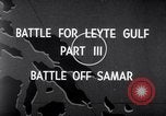
The Battle off Samar near the island of Leyte in the Philippines on 25th October 1944.
Shows the Battle off Samar which was the central action of the Battle of Leyte Gulf. It took place in the Philippine Sea off Samar Island near the island of Leyte in the Philippines on 25th October 1944. Animated map shows advancement of U.S. armed forces on Leyte Island. An Allied fleet of destroyers and escorts shown on map. USS Fanshaw Bay is their flagship. Signal-man intercepts Japanese communication relays in a Combat information center. Shows naval battle between Allied and the Japanese armed forces. (World War II period).
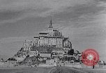
Views of Mont-Saint-Michel island at the mouth of the Couesnon River in France.
Mont-Saint-Michel island at the mouth of the Couesnon River in Normandy, France. Views of the tidal island from afar and on the island itself. Houses and buildings in the village. The abbey of Norman architecture style located near a garden. Arches and pillars. Pillars in the passageway. The spire of Saint-Michel and Gothic details. A glass window in the arched hallway.
CRITICALPAST.COM: About Us | Contact Us | FAQs - How to Order | License Agreement | My Account | My Lightboxes | Shopping Cart | Advanced Search | Featured Collections | Website Terms & Conditions | Privacy Policy ©2026 CriticalPast LLC.
License Agreement |
Terms & Conditions |
Privacy Policy
©2026 CriticalPast LLC.