


 Francais
 Deutsch
 Italiano
Refine Your Search
Okinawa Ryukyu Islands 1972 stock footage and images
- Showing 3601 to 3606 of 4623 results more
more Hide
Hide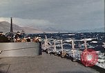
USS New York (BB-34) departs U.S. Naval Station Argentia, New Foundland, as part of convoy, during World War II
Gun crew,on the USS New York (BB-34),wearing steel helmets, check out her 3-inch antiaircraft gun on the stern deck, as she departs from U.S. Argentia Naval station, Newfoundland, during World War 2. Sailors are dressed in winter clothing. Snow-covered hills in background. As they are underway, a large transport ship is seen astern. Scene shifts to warmer, sunny weather at sea. Sailors play a game with quoits on the deck of the USS New York. Others relax in a warm sunny spot. Sailors stand on the deck. An island visible nearby. Sailors download a bomb from a Vought OS2U Kingfisher aircraft aboard the battleship New York. International maritime flags displayed near the bridge.
Wounded men and German U boat crew being transferred aboard USS Guadalcanal from whale motor boats in the Atlantic Ocean.
USS Guadalcanal escort carrier captures German U boat-505 while underway in the Atlantic Ocean during World War II. A motor whale boat along the side of USS Guadalcanal as a patient in a stretcher being hoisted aboard the ship. Island of USS Guadalcanal with five German flags marked on it. A motor whale boat heads towards the ship. The motor whale boat along the side the ship as a German U boat-505 crew member climbs up a Jacob's ladder. German crew comes down a catwalk on the deck of the escort carrier. The motor whale boat underway. It is alongside USS Guadalcanal as men climb up a Jacob's ladder. The bridge of USS Guadalcanal with five German flags marked on it. Three destroyer escorts underway. A motor whale boat underway. A destroyer escort on the horizon. The captain of USS Guadalcanal leans over the side of the flying bridge. German U boat-505 underway at sea. Bow and conning tower of the U boat. USS Guadalcanal attempts to come along side the U boat. Men on the signal bridge of the ship. U boat -505 and a motor boat at sea.

Crew members of captured German U boat -505 aboard USS Guadalcanal in the Atlantic Ocean during World War II.
USS Guadalcanal escort carrier captures German U boat-505 while underway in the Atlantic Ocean during World War II. U.S. sailors on the bridge of USS Guadalcanal. German U boat-505 under tow. U boat underway with the American flag on its conning tower. Pilots gathered on the deck of the ship as they talk. The U boat underway. Island of USS Guadalcanal. A motor whale boat alongside USS Guadalcanal as German prisoner of war climb up a Jacob's ladder as they come aboard the ship. A wounded on a steel stretcher being hoisted aboard the ship. USS Guadalcanal underway with a U.S. Navy TBF Avenger flying overhead. German prisoners on the main deck of USS Guadalcanal.
Warships bombard the coast of Iwo Jima, Japan during World War II.
Views of shells being fired by Allied warships at the coast of Iwo Jima, Japan during World War 2. Explosions occur at the coast of Iwo Jima as the shells strike the island. A twin Bofors 40mm gun being fired from a warship. Fire and billows of smoke rising from the coastline. A crew loads a 3 inch-50 caliber fixed round into a gun aboard a warship. The round is then fired.
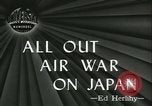
U.S. Army air Force B-29 Superfortress bombard Japanese cities of Nagasaki, Tokyo and Iwo Jima during World War II.
American air attack on Japanese cities during World War II. A U.S. Army Air Force B-29 Superfortress aircraft in flight as it drops bombs over an airplane factory in Nagasaki. Bombs impact and billows of smoke rise up. A map depicts the air strike on Tokyo by U.S. aircraft that took off from Saipan, Mariana Islands. During an American air attack on Iwo Jima, Japan U.S. Army Air Force P-51 Mustangs shoot down Japanese aircraft. A Japanese airplane descends as smoke rises. B-29 aircraft in formation flight as bombs are being dropped and smoke rises. A damaged B-29 comes in for landing at an air base. The damaged B-29 aircraft. U.S. Army Air Force aircraft lined up at an air field.

A hole on the deck of USS Intrepid after a Japanese plane crashed into it in the Pacific Ocean during World War II.
USS Intrepid aircraft carrier underway in the Pacific Ocean during World War II. A sailor examines a hole on the deck of the aircraft carrier made by Japanese aircraft. Flight deck of the aircraft carrier. An island in the background and foam on the deck in the foreground.
CRITICALPAST.COM: About Us | Contact Us | FAQs - How to Order | License Agreement | My Account | My Lightboxes | Shopping Cart | Advanced Search | Featured Collections | Website Terms & Conditions | Privacy Policy ©2026 CriticalPast LLC.
License Agreement |
Terms & Conditions |
Privacy Policy
©2026 CriticalPast LLC.