


 Francais
 Deutsch
 Italiano

Refine Your Search
Puerto Princesa Island Philippines 1945 stock footage and images
- Showing 1447 to 1452 of 9932 results more
 Hide
Color Sound
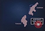
Animated map shows U.S. Aircraft Task Force bombarding Tinian and Saipan Island in the Mariana Islands.
Animated map shows Saipan, Marian Islands. Animation shows U.S. forces acquiring the island from the Japanese during World War II. Aircraft Task Force 58, 52 and 53 approach Tinian and Saipan islands. Aircraft destroy anti aircraft guns, sugarcane fields, coastal areas, buildings and communication centers on the islands.

Pictures and animation show U.S. forces bombing Japanese islands in the Mariana Islands.
Animated map shows Saipan in the Marian Islands. Animation shows U.S. forces acquiring the island from the Japanese during World War II. Pictures of U.S. ships approaching the island. A fleet of United States aircraft bombard Japanese islands.
Westinghouse ocean bottom scanning sonar equipment is lowered aboard a ship at Sao Miguel Island of the Azores Islands.
U.S. ships at Sao Miguel Island of the Azores Islands. Two small ships tied to a pier. A mobile crane on the pier loading equipment on a ship. Equipment coming aboard is Westinghouse ocean bottom scanning sonar. The equipment is lowered by the crane hook over the fantail of the ship. USS Preserver takes aboard the ocean bottom scanning equipment. USS Hoist is secured outboard of USS Preserver. Officers lean against gunwale aboard USS Compass Island. A steady line is attached to the cable directly above the crane hook. The ocean bottom scanning sonar is secured to a wooden platform setting on the deck. Some crewmen standing in the background on the deck of USS Compass Island. Insignia of Westinghouse painted on the side of the scanning sonar. Several crewmen move the scanning sonar platform into position for hoisting. Men spread out a cargo net.
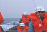
Crewmen help in the transfer of cargo from a boat to a ship at Sao Miguel Island in the Azores Islands.
U.S. ships at Sao Miguel Island in the Azores Islands. Crewmen in a boat underway. A crewman holds a walkie-talkie in hand. Two men in the background. The crewmen are wearing life-jackets and hard hats. USS Compass Island underway at sea in the background. USNS Mizar underway. A boat crew in a whale boat underway. USS Compass Island in the background. A small boat along the beam of USNS Mizar on the starboard side. A utility boat alongside the starboard side of USNS Mizar. A cargo net loaded with cargo is hoisted from the boat. Crewmen and a civilian using a dolly move equipment on the deck. An ocean bottom scanning sonar is situated on the deck of the ship.
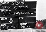
Vegetation on the island, beach and wharf and unloading of lumber at the Galapagos Islands.
U.S. Admiral Byrd's special navy mission in the South Pacific. Vegetation on the island. View of the island. Houses in the background. Beach and wharf at the island. Ships in the water. Unloading of lumber from a boat on the beach.

U.S. naval fleet during the Battle of Leyte Gulf.
General MacArthur maps the drive on Leyte with field commanders. Guarding the operation in the Philippines is a vast naval force. Battle map shows location of U.S. 7th fleet (Kinkaid) and U.S. 3rd fleet (Halsey). The air and sea Battle of Leyte Gulf. Aircraft carrier operation, planes land and take-off. Japanese plane shot down; hit by anti-aircraft fire Japanese plane cartwheels through the sky and crashes into the ocean. The USS Princeton is loss in battle. Aerial view of damage and later view of Princeton magazine exploding. Damaged plane landing on carrier deck on one landing gear. Admiral Nimitz reports on battle. (World War II period).
CRITICALPAST.COM: About Us | Contact Us | FAQs - How to Order | License Agreement | My Account | My Lightboxes | Shopping Cart | Advanced Search | Featured Collections | Website Terms & Conditions | Privacy Policy ©2026 CriticalPast LLC.
License Agreement |
Terms & Conditions |
Privacy Policy
©2026 CriticalPast LLC.