


 Francais
 Deutsch
 Italiano
Refine Your Search
Puerto Princesa Island Philippines 1945 stock footage and images
- Showing 3739 to 3744 of 9920 results more
more Hide
Hide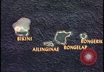
Animation predicts fallout path from Bikini Atoll atomic bomb explosion.
Animated map of Bikini Atoll area shows islands of Bikini, Ailinginae, Rongelap, and Rongerik. The predicted fallout radiation strength is posted for each area of the map with accumulated radiation doses to H+50 noted. The decreasing dose from 3000 to 1300 and then 800 is shown. A dotted line demonstrates path of fallout radiation over the Bikini Atoll area. Next, a map of the United States USA Eastern seaboard is shown with Washington D.C. as the origin of the atom bomb explosion and the fallout cloud extending to New York City.

Native men and women carry belongings, push outrigger in shallow water during evacuation of Bikini Atoll
A man and a woman carry their belongings as they evacuate Bikini Atoll during U.S. preparations for nuclear weapon testing under Operation Crossroads. Their young children follow behind them. Native women carrying sacks and boxes on their shoulders. A man pushes a canoe loaded with boxes in the water. Bikini Atoll coast. A boy paddles with a small canoe. Native man pushes outrigger in shallow water (loaded with belongings). A moving DUKW. Belongings of island natives are gathered on the beach before evacuation. United States Navy personnel on LST (LST 1108) wait for natives.
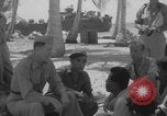
Commodore Ben Wyatt addresses natives of Bikini Atoll through interpreter
United States Commodore Ben Wyatt, the military governor of the Marshall Islands, addresses the natives of Bikini Atoll through his local interpreter James during “Operation Crossroads” (U.S. nuclear weapon testing program). Locals of Bikini Atoll sit down and listen to Wyatt. Other United States Navy personnel are present in the meeting. Interpreter speaks to the natives. A group of United States sailors gather outside a hut. They hold a sign that reads “CROSSROADS TAVERN”. Natives carry belongings and banana or pandan leaves toward LST. A woman carrying a large sack on her shoulders. Natives bring their belongings into a United States LST (Landing Ship, Tank). An outrigger loaded with boxes floats near the LST.
Gun camera footage from 19th Fighter Squadron of 318th Fighter group attacks on targets at Tarumizu in Kyushu Japan
Gun camera footage of U.S. Army Air Force 19th Fighter Squadron, 318th Fighter Group Aircraft commanded by a Lieutenant Hill, strafing target buildings and ships in area of harbor at Tarumizu in Kyushu Japan. Fire and explosions on bay area of the Island. Heavy smoke rises. Aircraft strafes over open field areas and factories, and then strikes ships in harbor. (World War II period).
B-29 Superfortresses of the 314th Bomb Wing at North Field Guam, during World War II.
U.S. B-29s of the 314th Bomb Wing parked and taxiing at North Field, Guam, Marianas Islands during World War 2. Among those seen are two displaying tail code, Square M, of the 19th Bomb Group; one without tail code, displaying tail number: 42-93967, of the 19th Bomb Group ("City of Lansford"); and five displaying Square P tail code, of the 39th Bomb Group. One of the parked B-29s displays tail code Square K and, on its forward fuselage, what looks like the logo of the "City of San Francisco" (K-29) of the 330th Bomb Group.
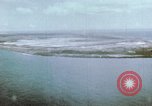
Aerial view of major U.S. airbase in the Pacific during World War II. B-25 on final approach for landing.
Aerial views of a sprawling U.S. Army Air Forces base in the Pacific Theater in World War 2. Various air strips and buildings. View of warships in the adjacent harbor. Vehicles drive on various roads on the ground. A B-25 Mitchell bomber with gear down on final approach to the airfield. Aerial views of the island and base.
CRITICALPAST.COM: About Us | Contact Us | FAQs - How to Order | License Agreement | My Account | My Lightboxes | Shopping Cart | Advanced Search | Featured Collections | Website Terms & Conditions | Privacy Policy ©2026 CriticalPast LLC.
License Agreement |
Terms & Conditions |
Privacy Policy
©2026 CriticalPast LLC.