


 Francais
 Deutsch
 Italiano
Refine Your Search
Sattahip Thailand 1969 stock footage and images
- Showing 283 to 288 of 1159 results more
more Hide
Hide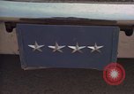
Major General Joseph J Nazzaro and part of his staff enter and leave several shops at U-Tapao Air Base in Thailand.
Four star ID plate on car and placard inside car with names of General Joseph J Nazzaro and Major General Crumm. A two star ID plate on another car with names of Major General John S Samuel and Major General Kenneth E Pletcher on the windshield. Major General Nazzaro and part of his staff entering and leaving several shops on the flight line.
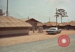
Major General Joseph J Nazzaro and part of his staff inspecting barracks at U-Tapao Air Base Thailand.
Major General Joseph J Nazzaro and part of his staff inspecting barracks. KC-135A's and camouflaged B-52's on flight line. Travel shot on flight line of Royal Thai Air Force UH-34 taxiing.
Men fueling B-52D at U-Tapao Air Base in Thailand.
Men fueling B-52D. Men fusing 750lb bombs on lowboy. Tractor truck loaded with 750 lb bombs pulling up to B-52D.
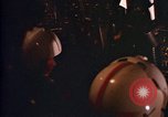
B-52D aircrew at stations during flight at U-Tapao Air Base in Thailand.
Scenes of B-52D aircraft aircrew at stations during flight. Pilot and copilot of B-52 inside cockpit. View from cockpit during final approach and touchdown at U-Tapao Air Base during Vietnam War period.
Dispatch of mobile unit, projectionof USIA film and communist campaign to get audience responses.
A man (implied by narrator to be a Communist) speaks to large crowd of men in an unidentified country. Narrator speaks of him as stirring up trouble and spreading the message of communism (during "red scare" timeframe in U.S.) Mobile unit truck of the United States Information Service (USIS) on the road to show (pro United States education and propaganda) USIA motion pictures. Citizens seated for watching USIA films on motion picture projector. Two local men work as projectionists. Faces of audience members as they watch the film on the screen. Man checks the reel of motion picture. Film of USIS starts. American and Thai officials riding on elephants cross a river in Thailand. American diplomatic officials talk with Thai officals seated around a table, planning anti-Communist information campaigns. They ride on horses in a rural area. They cross jungle areas on horse back. An American official wearing a suit and bow tie addresses a group of uniformed Thai officials. Maps on wall.
Second Sino-Japanese War
Opening scene shows formation of Japanese Mitsubishi G3M bombers in flight. View of bombardier at bomb sight inside a bomber. Bombs falling from the aircraft, upon the Chinese city of Shanghai, on a day in September, 1937. Ground level view of bomb exploding and Chinese civilians running for cover. A huge explosion throwing earth up. Aerial view of smoke rising from bomb strikes below. More ground views of bombs destroying structures. Chinese people fleeing across a bridge. Cluster of bombs falling from a Japanese airplane. More explosions and destruction. view from a G3M bomber, of others with bombs falling from them. View from above of civilians filling a street as they run for shelter. People on the ground rushing in all directions. Some are in horse-drawn carriages with luggage on top and other in rickshaws, apparently fleeing the city altogether. Bombing victims lying on the ground near destroyed structures. Heavy dark smoke rising from the attacks. Scene shifts to Japanese army officers entering the Yasukuni shrine in Tokyo. Behind them is A Shinto Tori (Gate) and behind that, the monument (statue) of Omura Masujiro. Scene shifts again, to view of the Temple of Heaven, an ancient Imperial Sacrificial Altar in Peking (Beijing) China. Chinese agriculture. Crowds of Chinese people. Stone statue of traditional Chinese lion. Picture of 1851 oil-on-canvas painting by the German American artist Emanuel Gottlieb Leutze, of Washington crossing the Delaware. Drawing of 15th century ship similar to one in Columbus'1492 voyage to America. Drawing of Roman Empire era building. Michelangelo’s statue of Moses. Drawing of ancient Egyptian pyramid and statue. Drawing of Chinese city and environs representing 4 thousand years ago. Extant ancient Chinese shrines and statues. Animated Relief map of China and surrounding countries of U.S.S.R., India,Burma,Thailand, Indo-China, Philippines, and Japan. Animation outlines China Proper. It also shows Manchuria and scenes from there of desolate mountainous land, with miners at work extracting raw materials. Mongolia and Sinkiang are outlined. The Gobi desert is seen with a long camel caravan crossing it. Closeup of nomads transporting animal skins by camel. The last region outlined is Tibet. The ice covered Himalayan mountains are shown. Buddhist monks praying in the courtyard of a shrine in Tibet. The Yellow, Si Kiang, and Yangtze Rivers are shown on the map. Views of Chinese sailing vessels.