


 Francais
 Deutsch
 Italiano
Refine Your Search
South Vietnam 1969 stock footage and images
- Showing 2227 to 2232 of 6014 results more
more Hide
Hide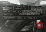
A U.S. military man and his family visits ancient ruins (Ctesiphon) near Salman Pak, Iraq.
Ancient ruins of Ctesiphon near Salman Pak, 30Km south of Baghdad, Iraq. The ruins known locally as Taq-i Kisra (arch of Kisra). A member of the U.S. Military Advisory Assistance Group, comes out of a house with his wife and children and gets into their 1949 Chevrolet automobile, parked in the driveway. The car leaves the house. View of the ruins of ancient Ctesiphon. The car arrives near the ruins. The family leaves their car and walks towards an Iraqi man who is waiting for them.
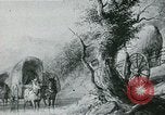
Construction of transport ways, cotton plantations and mechanized spinning and weaving industry in the United States.
A picturization of American people moving to the western territory of Louisiana which is bought by the United States under the Presidency of Thomas Jefferson. A map shows the path of construction of roads accessing farm lands. Farmers leading their herds of cattle to a market in the east. A great canal dug from the west. A map shows waterways linking rivers to the eastern states. The Erie Canal or the Big Ditch through which goods and people move to the farming land. Boats on the canal. People moving on a bridge. Trains moving on a rail road. Several ships at a harbor. Steam boats on rivers. Aug. 17, 1807: 'Fulton's Folly' Steams up the Hudson River. Cotton grown on plantation farm fields in the south. Workers at the cotton plantations. Horse carriages carrying cotton moving at a harbor. Mechanized spinning and weaving industry.
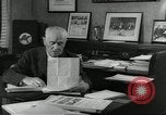
Carroll Dowens dictates to his secretary prior to a Southeastern Governors' conference in the United States.
Preparations underway for a Southeastern Governors' conference in the United States. Industrial consultant in headquarters of Southeastern Governors' conference Carroll Dowens dictates to his secretary. The secretary notes down as Dowens speaks. Various documents on a desk. A sign on a document reads 'southeastern Governors conference'. A frame on a wall with a sign that reads 'Economic opportunity number 1' followed by pictures of the Governors of the southeastern states. Another frame on the wall with a sign that reads 'with malice towards none'. A map of the south eastern states of the United States.
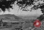
The Sangre de Cristo Range in the United States.
The Rocky Mountains in the United States. A view of the Sangre de Cristo Range, the southern ranges of the Rockies.
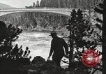
The historic Chittenden bridge across the Yellowstone River in Yellowstone National Park in the United States.
A man poses looking at the Chittenden bridge crossing the Yellowstone River, in 1917. (Note: The bridge, a few miles south of Canyon Junction, was built in 1903 under the supervision of Hiram Martin Chittenden, the Seattle district engineer for the Army Corps of Engineers, and originally referred to simply as the Melan arch bridge. It was later renamed in Chittenden's honor. It was replaced in 1962 with the Chittenden Memorial bridge.)
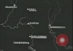
German infantry entering City of Bolgorad, Ukraine, during World War II
A map of the Eastern front in the area of Bolgorad (also Bjelgorod) on the Dnieper River, in Ukraine. Other points shown on map include Brjansk, Orel, Kursk, Woronesch, Charkow. Infantry of the German 11th Army entering the City of Bolgorad, Ukraine, south of Kursk, to take up defensive positions against Soviets during World War 2. The German soldiers are loaded in trucks. They wave and smile.
CRITICALPAST.COM: About Us | Contact Us | FAQs - How to Order | License Agreement | My Account | My Lightboxes | Shopping Cart | Advanced Search | Featured Collections | Website Terms & Conditions | Privacy Policy ©2026 CriticalPast LLC.
License Agreement |
Terms & Conditions |
Privacy Policy
©2026 CriticalPast LLC.